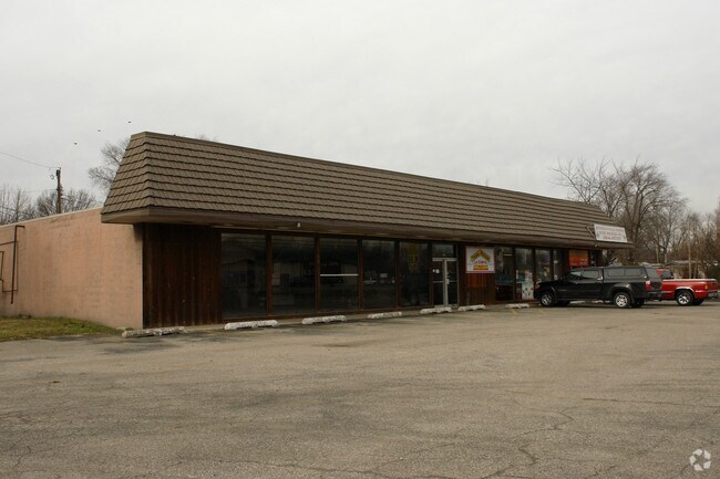
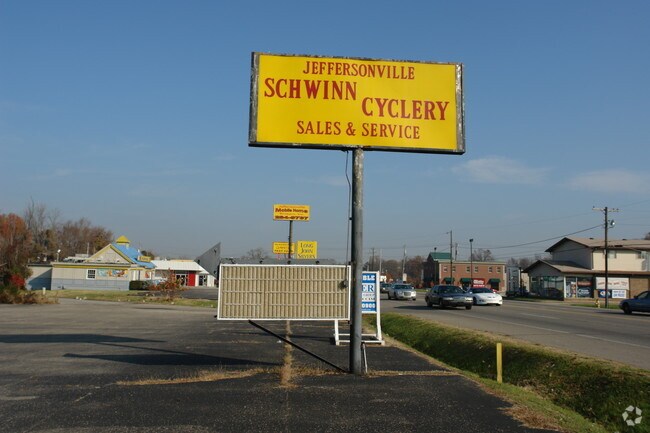
Property Record
1537 E 10Th St, Jeffersonville, IN 47130
NEARBY LISTINGS FOR SALE OR LEASE
Property Detail
1537 E 10Th St
Louisville-Jefferson County, KY-IN
Illinois Grant
10-19-00-200-473.000-010
RUSS ACRES GT 2 PT LOTS 9 & 10
Commercialacreage
Clark
X
Indiana
18019C0286E
9-10
2024
0.29 AC
2024
South Clark County
050303
Louisville
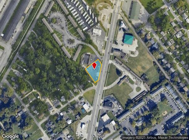
DEMOGRAPHICS near 1537 E 10Th St
1 Mile
3 Mile
5 Mile
2024 Total Population
11,020
65,119
196,047
2029 Population
11,720
68,472
200,955
Pop Growth 2024-2029
+ 6.35%
+ 5.15%
+ 2.50%
Average Age
40
40
40
2024 Total Households
4,800
29,368
89,695
HH Growth 2024-2029
+ 6.38%
+ 5.05%
+ 2.38%
Median Household Inc
$43,561
$53,099
$51,309
Avg Household Size
2.20
2.10
2.10
2024 Avg HH Vehicles
2.00
2.00
1.00
Median Home Value
$120,289
$167,580
$199,230
Median Year Built
1963
1971
1961
Nearby Places
Map Layers
Map Styles
 Street
 Aerial
- Restaurants
- Banks
- Shops
- Fitness
- Groceries
PUBLIC TRANSPORTATION
AIRPORT
Louisville Muhammad Ali International
DRIVE
WALK
Distance
Louisville Muhammad Ali International
20 min
11.1 mi
Freight Ports
Port of Toledo
DRIVE
WALK
Distance
Port of Toledo
353 min
305.1 mi
Nearby Properties
Address
Land Use
TOTAL SIZE
Lot Size
Zoning
Address
Land Use
TOTAL SIZE
Lot Size
Zoning
4.80 AC
M3-INDUSTR
Address
Land Use
TOTAL SIZE
Lot Size
Zoning
826,303 SF
2.90 AC
C3-CENTRAL
Address
Land Use
TOTAL SIZE
Lot Size
Zoning
130,724 SF
2.17 AC
Address
Land Use
TOTAL SIZE
Lot Size
Zoning
106,330 SF
9.44 AC
M3-INDUSTR
Address
Land Use
TOTAL SIZE
Lot Size
Zoning
0.56 AC
(C3)CENTRA
Address
Land Use
TOTAL SIZE
Lot Size
Zoning
23.42 AC
(W
Address
Land Use
TOTAL SIZE
Lot Size
Zoning
13,240 SF
20.84 AC
Address
Land Use
TOTAL SIZE
Lot Size
Zoning
2.07 AC
Address
Land Use
TOTAL SIZE
Lot Size
Zoning
21,767 SF
1.47 AC
EZ1-ENTERP
Address
Land Use
TOTAL SIZE
Lot Size
Zoning
50,946 SF
2.66 AC
(CM)COMMER
Address
Land Use
TOTAL SIZE
Lot Size
Zoning
699,568 SF
1.96 AC
(C3)CENTRA
Address
Land Use
TOTAL SIZE
Lot Size
Zoning
6,254 SF
1.48 AC
C2-COMMERC
Address
Land Use
TOTAL SIZE
Lot Size
Zoning
400 SF
13.92 AC
R6-RESIDEN
Address
Land Use
TOTAL SIZE
Lot Size
Zoning
20,729 SF
0.27 AC
(C3)CENTRA
Address
Land Use
TOTAL SIZE
Lot Size
Zoning
Address
Land Use
TOTAL SIZE
Lot Size
Zoning
1.54 AC
Address
Land Use
TOTAL SIZE
Lot Size
Zoning
15.29 AC
Address
Land Use
TOTAL SIZE
Lot Size
Zoning
4.58 AC
C3-CENTRAL
Address
Land Use
TOTAL SIZE
Lot Size
Zoning
2.81 AC
Address
Land Use
TOTAL SIZE
Lot Size
Zoning
7,026 SF
0.21 AC
C3-CENTRAL
Address
Land Use
TOTAL SIZE
Lot Size
Zoning
176,448 SF
2.45 AC
Address
Land Use
TOTAL SIZE
Lot Size
Zoning
109,470 SF
2.27 AC
Address
Land Use
TOTAL SIZE
Lot Size
Zoning
28,408 SF
1.55 AC
EZ1-ENTERP
Address
Land Use
TOTAL SIZE
Lot Size
Zoning
11,024 SF
0.32 AC
C3-CENTRAL
Address
Land Use
TOTAL SIZE
Lot Size
Zoning
2.09 AC
(C3)CENTRA
Address
Land Use
TOTAL SIZE
Lot Size
Zoning
4,178 SF
10.39 AC
Address
Land Use
TOTAL SIZE
Lot Size
Zoning
Address
Land Use
TOTAL SIZE
Lot Size
Zoning
Address
Land Use
TOTAL SIZE
Lot Size
Zoning
320,160 SF
1.15 AC
C3-CENTRAL
Address
Land Use
TOTAL SIZE
Lot Size
Zoning
24,302 SF
0.27 AC
CM-COMMERC
The World's #1 Commercial Real Estate Marketplace
Connect with us
© 2025 CoStar Group
The information above has been obtained from sources believed reliable. While we do not doubt its accuracy we have not verified it and make no guarantee, warranty or representation about it. It is your responsibility to independently confirm its accuracy and completeness. Any projections, opinions, assumptions, or estimates used are for example only and do not represent the current or future performance of the property. The value of this transaction to you depends on tax and other factors which should be evaluated by your tax, financial, and legal advisors. You and your advisors should conduct a careful, independent investigation of the property to determine to your satisfaction the suitability of the property for your needs.