Property Record
1537 Us Route 1, Cape Neddick, ME 03902


NEARBY LISTINGS FOR SALE OR LEASE
Property Detail
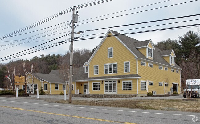
1537 Us Route 1
Gymhealthspa
York
X
Maine
23031C0678G
1.35 AC
2024
York County
2024
Portland/South Portland
036002
Portland-South Portland, ME
7,682 SF
YORK-000010-000000-000007B
DEMOGRAPHICS near 1537 Us Route 1
1 Mile
3 Mile
5 Mile
2024 Total Population
439
5,372
11,965
2029 Population
466
5,637
12,555
Pop Growth 2024-2029
+ 6.15%
+ 4.93%
+ 4.93%
Average Age
46
49
50
2024 Total Households
188
2,397
5,358
HH Growth 2024-2029
+ 5.85%
+ 4.63%
+ 4.74%
Median Household Inc
$119,444
$97,735
$94,316
Avg Household Size
2.30
2.20
2.20
2024 Avg HH Vehicles
2.00
2.00
2.00
Median Home Value
$587,838
$560,467
$514,838
Median Year Built
1975
1973
1978
Nearby Places
Map Layers
Map Styles
 Street
 Aerial
- Restaurants
- Banks
- Shops
- Fitness
- Groceries
PUBLIC TRANSPORTATION
COMMUTER RAIL
DRIVE
WALK
Distance
21 min
9.3 mi
AIRPORT
Portsmouth International at Pease
DRIVE
WALK
Distance
Portsmouth International at Pease
25 min
15.4 mi
Portland International Jetport
DRIVE
WALK
Distance
Portland International Jetport
55 min
37.6 mi
Freight Ports
Portland, ME
DRIVE
WALK
Distance
Portland, ME
56 min
40.1 mi
SALE & LEASE HISTORY
LISTING DATE
SALE/LEASE

Mar 11, 2019
For Sale
Aug 18, 2018
For Sale
Nearby Properties
Address
Land Use
TOTAL SIZE
Lot Size
Zoning
Address
Land Use
TOTAL SIZE
Lot Size
Zoning
64.25 AC
R2
Address
Land Use
TOTAL SIZE
Lot Size
Zoning
4.10 AC
LB/SLC
Address
Land Use
TOTAL SIZE
Lot Size
Zoning
4.64 AC
SLC/LB
Address
Land Use
TOTAL SIZE
Lot Size
Zoning
3.68 AC
SLC/GB
Address
Land Use
TOTAL SIZE
Lot Size
Zoning
2.63 AC
LBD/SL
Address
Land Use
TOTAL SIZE
Lot Size
Zoning
4,271 SF
4.10 AC
R2
Address
Land Use
TOTAL SIZE
Lot Size
Zoning
1.29 AC
SLR
Address
Land Use
TOTAL SIZE
Lot Size
Zoning
13.33 AC
R1-6
Address
Land Use
TOTAL SIZE
Lot Size
Zoning
2,232 SF
58.62 AC
RT1
Address
Land Use
TOTAL SIZE
Lot Size
Zoning
1.11 AC
LBD
Address
Land Use
TOTAL SIZE
Lot Size
Zoning
2.38 AC
SGD-2
Address
Land Use
TOTAL SIZE
Lot Size
Zoning
6,378 SF
2.46 AC
R2
Address
Land Use
TOTAL SIZE
Lot Size
Zoning
400 SF
0.36 AC
GB02
Address
Land Use
TOTAL SIZE
Lot Size
Zoning
2.07 AC
SLC
Address
Land Use
TOTAL SIZE
Lot Size
Zoning
4,718 SF
2.38 AC
SLR
Address
Land Use
TOTAL SIZE
Lot Size
Zoning
1.43 AC
SLC
Address
Land Use
TOTAL SIZE
Lot Size
Zoning
1.79 AC
SLC
Address
Land Use
TOTAL SIZE
Lot Size
Zoning
1.69 AC
R5
Address
Land Use
TOTAL SIZE
Lot Size
Zoning
1.83 AC
R2
Address
Land Use
TOTAL SIZE
Lot Size
Zoning
9,214 SF
2.15 AC
R5
Address
Land Use
TOTAL SIZE
Lot Size
Zoning
0.89 AC
SLR/OF
Address
Land Use
TOTAL SIZE
Lot Size
Zoning
25,061 SF
0.40 AC
B3
Address
Land Use
TOTAL SIZE
Lot Size
Zoning
1.02 AC
R5
Address
Land Use
TOTAL SIZE
Lot Size
Zoning
0.73 AC
R5
Address
Land Use
TOTAL SIZE
Lot Size
Zoning
7,728 SF
3 AC
SLC
Address
Land Use
TOTAL SIZE
Lot Size
Zoning
20,229 SF
0.64 AC
LBD
Address
Land Use
TOTAL SIZE
Lot Size
Zoning
1.30 AC
R2
Address
Land Use
TOTAL SIZE
Lot Size
Zoning
19,126 SF
0.24 AC
B3
Address
Land Use
TOTAL SIZE
Lot Size
Zoning
8.88 AC
R6
Address
Land Use
TOTAL SIZE
Lot Size
Zoning
1.88 AC
R2
The World's #1 Commercial Real Estate Marketplace
Connect with us
© 2025 CoStar Group
The information above has been obtained from sources believed reliable. While we do not doubt its accuracy we have not verified it and make no guarantee, warranty or representation about it. It is your responsibility to independently confirm its accuracy and completeness. Any projections, opinions, assumptions, or estimates used are for example only and do not represent the current or future performance of the property. The value of this transaction to you depends on tax and other factors which should be evaluated by your tax, financial, and legal advisors. You and your advisors should conduct a careful, independent investigation of the property to determine to your satisfaction the suitability of the property for your needs.