Property Record
1537 Us Route 1, Cape Neddick, ME 03902


Property Detail
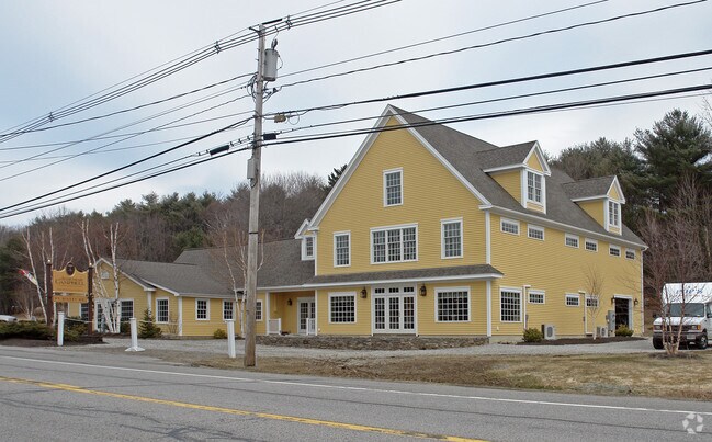
1537 Us Route 1
Gymhealthspa
York
R1-6
Maine
B and X Area of moderate flood hazard, usually the area between the limits of the 100-year and 500-year floods.
1.35 AC
2025
York County
2025
Portland/South Portland
036002
Portland-South Portland, ME
7,682 SF
YORK-000010-000000-000007B
NEARBY LISTINGS FOR SALE OR LEASE
DEMOGRAPHICS near 1537 Us Route 1
1 mile
3 mile
5 mile
2025 Total Population
565
5,701
12,803
2030 Population
595
5,887
13,185
Pop Growth 2025-2030
+ 5.31%
+ 3.26%
+ 2.98%
Average Age
47
50
50
2025 Total Households
242
2,548
5,746
HH Growth 2025-2030
+ 5.37%
+ 3.06%
+ 2.82%
Median Household Inc
$150,877
$127,224
$118,762
Avg Household Size
2.30
2.20
2.20
2025 Avg HH Vehicles
2.00
2.00
2.00
Median Home Value
$672,727
$735,356
$704,041
Median Year Built
1978
1975
1979
Nearby Places
Map Layers
Map Styles
 Street
 Aerial
Layers
 Traffic
 Biking
Places
Listings with unknown addresses are not visible on the map
- Restaurants
- Banks
- Shops
- Fitness
- Groceries
PUBLIC TRANSPORTATION
COMMUTER RAIL
Wells (Downeaster - Amtrak)
Drive
Walk
Distance
Wells (Downeaster - Amtrak)
20 min
9.3 mi
AIRPORT
Portsmouth International at Pease
Drive
Walk
Distance
Portsmouth International at Pease
25 min
15.4 mi
Freight Ports
Portland, ME
Drive
Walk
Distance
Portland, ME
55 min
40.1 mi
SALE & LEASE HISTORY
LISTING DATE
SALE/LEASE

Mar 11, 2019
For Sale
Aug 18, 2018
For Sale
Nearby Properties
Address
Land Use
TOTAL SIZE
Lot Size
Zoning
Address
Land Use
TOTAL SIZE
Lot Size
Zoning
64.25 AC
R2
Address
Land Use
TOTAL SIZE
Lot Size
Zoning
4.10 AC
LB/SLC
Address
Land Use
TOTAL SIZE
Lot Size
Zoning
4.64 AC
SLC/LB
Address
Land Use
TOTAL SIZE
Lot Size
Zoning
3.68 AC
SLC/GB
Address
Land Use
TOTAL SIZE
Lot Size
Zoning
2.63 AC
LBD/SL
Address
Land Use
TOTAL SIZE
Lot Size
Zoning
2,232 SF
25 AC
RT1
Address
Land Use
TOTAL SIZE
Lot Size
Zoning
13.33 AC
R1-6
Address
Land Use
TOTAL SIZE
Lot Size
Zoning
1.11 AC
LBD
Address
Land Use
TOTAL SIZE
Lot Size
Zoning
2.38 AC
SGD-2
Address
Land Use
TOTAL SIZE
Lot Size
Zoning
400 SF
0.36 AC
GB02
Address
Land Use
TOTAL SIZE
Lot Size
Zoning
2.07 AC
SLC
Address
Land Use
TOTAL SIZE
Lot Size
Zoning
1.79 AC
SLC
Address
Land Use
TOTAL SIZE
Lot Size
Zoning
4,718 SF
2.38 AC
SLR
Address
Land Use
TOTAL SIZE
Lot Size
Zoning
1.43 AC
SLC
Address
Land Use
TOTAL SIZE
Lot Size
Zoning
1.69 AC
R5
Address
Land Use
TOTAL SIZE
Lot Size
Zoning
9,214 SF
2.15 AC
R5
Address
Land Use
TOTAL SIZE
Lot Size
Zoning
1.02 AC
R5
Address
Land Use
TOTAL SIZE
Lot Size
Zoning
25,061 SF
0.40 AC
B3
Address
Land Use
TOTAL SIZE
Lot Size
Zoning
1.30 AC
R2
Address
Land Use
TOTAL SIZE
Lot Size
Zoning
0.89 AC
SLR/OF
Address
Land Use
TOTAL SIZE
Lot Size
Zoning
7,728 SF
3 AC
SLC
Address
Land Use
TOTAL SIZE
Lot Size
Zoning
1.88 AC
R2
Address
Land Use
TOTAL SIZE
Lot Size
Zoning
20,229 SF
0.64 AC
LBD
Address
Land Use
TOTAL SIZE
Lot Size
Zoning
19,126 SF
0.24 AC
B3
Address
Land Use
TOTAL SIZE
Lot Size
Zoning
8.88 AC
R6
Address
Land Use
TOTAL SIZE
Lot Size
Zoning
0.16 AC
RP
Address
Land Use
TOTAL SIZE
Lot Size
Zoning
0.87 AC
LBD
Address
Land Use
TOTAL SIZE
Lot Size
Zoning
16,968 SF
0.56 AC
B3
Address
Land Use
TOTAL SIZE
Lot Size
Zoning
0.81 AC
SLC
Address
Land Use
TOTAL SIZE
Lot Size
Zoning
4,167 SF
1.27 AC
R4
The World's #1 Commercial Real Estate Marketplace
Connect with us
© 2026 CoStar Group
The information above has been obtained from sources believed reliable. While we do not doubt its accuracy we have not verified it and make no guarantee, warranty or representation about it. It is your responsibility to independently confirm its accuracy and completeness. Any projections, opinions, assumptions, or estimates used are for example only and do not represent the current or future performance of the property. The value of this transaction to you depends on tax and other factors which should be evaluated by your tax, financial, and legal advisors. You and your advisors should conduct a careful, independent investigation of the property to determine to your satisfaction the suitability of the property for your needs.