Property Record
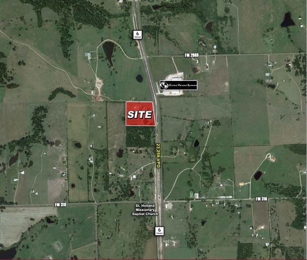
15384 Highway 6, Navasota, TX 77868

NEARBY LISTINGS FOR SALE OR LEASE
Property Detail
15384 Highway 6
R14807
James Wallace Surv A-59
Ranch
A0059 J WALLACE, TRACT 6, ACRES 18.3237
X
Grimes
48185C0450C
Texas
2024
6
2025
18.32 AC
180101
Central Texas Area
5,569 SF
Other Market Areas
DEMOGRAPHICS near 15384 Highway 6
1 Mile
3 Mile
5 Mile
2024 Total Population
117
2,186
4,730
2029 Population
133
2,394
5,244
Pop Growth 2024-2029
+ 13.68%
+ 9.52%
+ 10.87%
Average Age
44
46
44
2024 Total Households
37
331
935
HH Growth 2024-2029
+ 13.51%
+ 15.41%
+ 15.83%
Median Household Inc
$65,625
$58,648
$59,267
Avg Household Size
2.40
2.50
2.50
2024 Avg HH Vehicles
2.00
2.00
2.00
Median Home Value
$225,000
$222,727
$228,651
Median Year Built
2000
1999
1999
Nearby Places
Map Layers
Map Styles
 Street
 Aerial
- Restaurants
- Banks
- Shops
- Fitness
- Groceries
PUBLIC TRANSPORTATION
AIRPORT
Easterwood Field
DRIVE
WALK
Distance
Easterwood Field
44 min
33.1 mi
Freight Ports
Port of Houston
DRIVE
WALK
Distance
Port of Houston
93 min
74.6 mi
SALE & LEASE HISTORY
LISTING DATE
SALE/LEASE

Dec 05, 2018
For Sale
Nearby Properties
Address
Land Use
TOTAL SIZE
Lot Size
Zoning
Address
Land Use
TOTAL SIZE
Lot Size
Zoning
923.52 AC
1
Address
Land Use
TOTAL SIZE
Lot Size
Zoning
6,459 SF
349.57 AC
1
Address
Land Use
TOTAL SIZE
Lot Size
Zoning
292 AC
1
Address
Land Use
TOTAL SIZE
Lot Size
Zoning
78,330 SF
25 AC
1
Address
Land Use
TOTAL SIZE
Lot Size
Zoning
87,441 SF
536.10 AC
1
Address
Land Use
TOTAL SIZE
Lot Size
Zoning
70,512 SF
242.78 AC
1
Address
Land Use
TOTAL SIZE
Lot Size
Zoning
143.69 AC
1
Address
Land Use
TOTAL SIZE
Lot Size
Zoning
20,658 SF
47.46 AC
1
Address
Land Use
TOTAL SIZE
Lot Size
Zoning
118,862 SF
4.53 AC
1
Address
Land Use
TOTAL SIZE
Lot Size
Zoning
44,342 SF
54.65 AC
1
Address
Land Use
TOTAL SIZE
Lot Size
Zoning
23,044 SF
8.24 AC
Address
Land Use
TOTAL SIZE
Lot Size
Zoning
17,542 SF
18.07 AC
1
Address
Land Use
TOTAL SIZE
Lot Size
Zoning
8,156 SF
20.35 AC
Address
Land Use
TOTAL SIZE
Lot Size
Zoning
15,717 SF
11.76 AC
1
Address
Land Use
TOTAL SIZE
Lot Size
Zoning
100.48 AC
1
Address
Land Use
TOTAL SIZE
Lot Size
Zoning
4,530 SF
30.04 AC
1C
Address
Land Use
TOTAL SIZE
Lot Size
Zoning
43.51 AC
1
Address
Land Use
TOTAL SIZE
Lot Size
Zoning
9,523 SF
10.01 AC
Address
Land Use
TOTAL SIZE
Lot Size
Zoning
21,209 SF
77.06 AC
1
Address
Land Use
TOTAL SIZE
Lot Size
Zoning
12,650 SF
58.43 AC
1
Address
Land Use
TOTAL SIZE
Lot Size
Zoning
12,777 SF
29.99 AC
1
Address
Land Use
TOTAL SIZE
Lot Size
Zoning
19,570 SF
443.71 AC
1
Address
Land Use
TOTAL SIZE
Lot Size
Zoning
9,049 SF
36.06 AC
1
Address
Land Use
TOTAL SIZE
Lot Size
Zoning
15,520 SF
50 AC
1
Address
Land Use
TOTAL SIZE
Lot Size
Zoning
47,491 SF
101.43 AC
1
Address
Land Use
TOTAL SIZE
Lot Size
Zoning
8,971 SF
10.01 AC
Address
Land Use
TOTAL SIZE
Lot Size
Zoning
12,158 SF
10.01 AC
Address
Land Use
TOTAL SIZE
Lot Size
Zoning
19,319 SF
12.01 AC
1
Address
Land Use
TOTAL SIZE
Lot Size
Zoning
8,564 SF
12.32 AC
1
Address
Land Use
TOTAL SIZE
Lot Size
Zoning
8,533 SF
11.38 AC
1
The World's #1 Commercial Real Estate Marketplace
Connect with us
© 2026 CoStar Group
The information above has been obtained from sources believed reliable. While we do not doubt its accuracy we have not verified it and make no guarantee, warranty or representation about it. It is your responsibility to independently confirm its accuracy and completeness. Any projections, opinions, assumptions, or estimates used are for example only and do not represent the current or future performance of the property. The value of this transaction to you depends on tax and other factors which should be evaluated by your tax, financial, and legal advisors. You and your advisors should conduct a careful, independent investigation of the property to determine to your satisfaction the suitability of the property for your needs.