Property Record
1539 Blanding Blvd, Middleburg, FL 32068
NEARBY LISTINGS FOR SALE OR LEASE
Property Detail
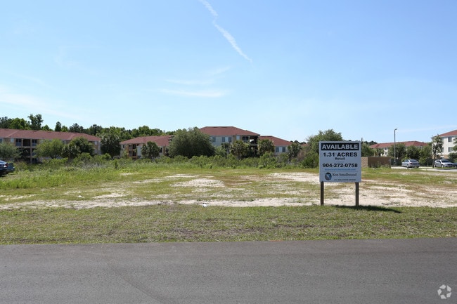
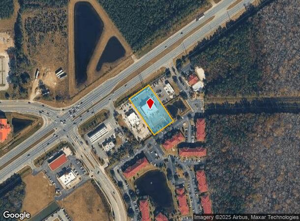
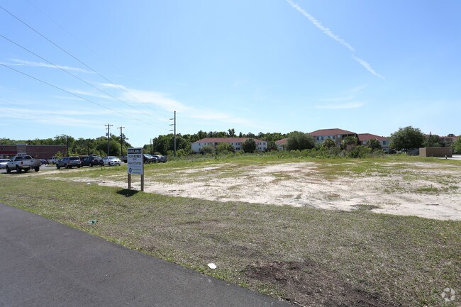
1539 Blanding Blvd
33-04-25-008123-005-00
(PT SUBJ TO CONSV ESMT AS REC OR 2291 PG 1291)PT OF NW1/4 S33T4R25 AS REC OR 4555 PG 287
Regionalshoppingcenterormallwithanchorstore
Clay
AE
Florida
12019C0160E
1.14 AC
2024
Orange Park/Clay County
2025
Jacksonville (Florida)
030209
Jacksonville, FL
5,983 SF
DEMOGRAPHICS near 1539 Blanding Blvd
1 Mile
3 Mile
5 Mile
2024 Total Population
6,346
33,183
101,567
2029 Population
6,991
36,230
111,089
Pop Growth 2024-2029
+ 10.16%
+ 9.18%
+ 9.38%
Average Age
36
39
39
2024 Total Households
2,156
11,904
35,018
HH Growth 2024-2029
+ 10.20%
+ 9.17%
+ 9.39%
Median Household Inc
$79,625
$80,891
$87,352
Avg Household Size
2.90
2.80
2.90
2024 Avg HH Vehicles
2.00
2.00
2.00
Median Home Value
$240,168
$234,542
$262,260
Median Year Built
2003
1992
1999
Nearby Places
- Restaurants
- Banks
- Shops
- Fitness
- Groceries
PUBLIC TRANSPORTATION
AIRPORT
Jacksonville International
DRIVE
WALK
Distance
Jacksonville International
50 min
33.7 mi
Gainesville Regional
DRIVE
WALK
Distance
Gainesville Regional
73 min
47.3 mi
Freight Ports
Jacksonville Port
DRIVE
WALK
Distance
Jacksonville Port
43 min
27.5 mi
Nearby Properties
Address
Land Use
TOTAL SIZE
Lot Size
Zoning
Address
Land Use
TOTAL SIZE
Lot Size
Zoning
340,385 SF
28.98 AC
Address
Land Use
TOTAL SIZE
Lot Size
Zoning
799,320 SF
150.55 AC
Address
Land Use
TOTAL SIZE
Lot Size
Zoning
241,396 SF
37.78 AC
Address
Land Use
TOTAL SIZE
Lot Size
Zoning
257,608 SF
27.17 AC
Address
Land Use
TOTAL SIZE
Lot Size
Zoning
233,551 SF
18.96 AC
PUD
Address
Land Use
TOTAL SIZE
Lot Size
Zoning
235,679 SF
53.26 AC
PO-1
Address
Land Use
TOTAL SIZE
Lot Size
Zoning
148,895 SF
35.72 AC
PO-1
Address
Land Use
TOTAL SIZE
Lot Size
Zoning
297,028 SF
16.78 AC
PUD
Address
Land Use
TOTAL SIZE
Lot Size
Zoning
83,621 SF
26.35 AC
Address
Land Use
TOTAL SIZE
Lot Size
Zoning
141,441 SF
82.05 AC
Address
Land Use
TOTAL SIZE
Lot Size
Zoning
105,657 SF
28.86 AC
Address
Land Use
TOTAL SIZE
Lot Size
Zoning
174,016 SF
8.12 AC
Address
Land Use
TOTAL SIZE
Lot Size
Zoning
106,486 SF
24.23 AC
PS-1
Address
Land Use
TOTAL SIZE
Lot Size
Zoning
67,490 SF
1.40 AC
Address
Land Use
TOTAL SIZE
Lot Size
Zoning
89,513 SF
19.76 AC
Address
Land Use
TOTAL SIZE
Lot Size
Zoning
221,247 SF
27.30 AC
Address
Land Use
TOTAL SIZE
Lot Size
Zoning
209,568 SF
24.51 AC
PCD
Address
Land Use
TOTAL SIZE
Lot Size
Zoning
70,640 SF
7.15 AC
Address
Land Use
TOTAL SIZE
Lot Size
Zoning
113,473 SF
14.90 AC
Address
Land Use
TOTAL SIZE
Lot Size
Zoning
59,700 SF
0.58 AC
Address
Land Use
TOTAL SIZE
Lot Size
Zoning
109,200 SF
3.89 AC
BB-3
Address
Land Use
TOTAL SIZE
Lot Size
Zoning
140,280 SF
10.74 AC
Address
Land Use
TOTAL SIZE
Lot Size
Zoning
83,680 SF
7.86 AC
Address
Land Use
TOTAL SIZE
Lot Size
Zoning
103,301 SF
2.94 AC
Address
Land Use
TOTAL SIZE
Lot Size
Zoning
60.13 AC
Address
Land Use
TOTAL SIZE
Lot Size
Zoning
110,457 SF
4.07 AC
BB
Address
Land Use
TOTAL SIZE
Lot Size
Zoning
101,582 SF
36.73 AC
Address
Land Use
TOTAL SIZE
Lot Size
Zoning
67,862 SF
58 AC
Address
Land Use
TOTAL SIZE
Lot Size
Zoning
105,513 SF
3.55 AC
Address
Land Use
TOTAL SIZE
Lot Size
Zoning
125,604 SF
23.77 AC
The World's #1 Commercial Real Estate Marketplace
Connect with us
© 2025 CoStar Group
The information above has been obtained from sources believed reliable. While we do not doubt its accuracy we have not verified it and make no guarantee, warranty or representation about it. It is your responsibility to independently confirm its accuracy and completeness. Any projections, opinions, assumptions, or estimates used are for example only and do not represent the current or future performance of the property. The value of this transaction to you depends on tax and other factors which should be evaluated by your tax, financial, and legal advisors. You and your advisors should conduct a careful, independent investigation of the property to determine to your satisfaction the suitability of the property for your needs.