Property Record
1539 W 81St St S, Tulsa, OK 74132

NEARBY LISTINGS FOR SALE OR LEASE
-
-
View all Tulsa listings for sale on LoopNet.com
Property Detail
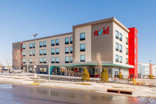
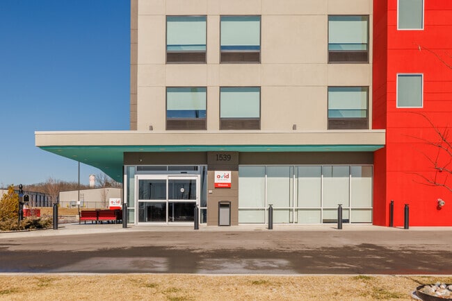
1539 W 81St St S
Tulsa, OK
Nickel Creek Phase Iv
71412-82-11-65605
PRT LT 1 BEG MOST ELY SECR LT 1 TH W333.37 CRV RT 39.27 NW32.13 N262.51 E116.10 SE53.18 SW20.25 SE352.94 POB BLK 1
Hotel
Tulsa
X
Oklahoma
40143C0342L
1
2025
1.69 AC
2025
Tulsa South/Broken Arrow
006713
Tulsa
42,590 SF
DEMOGRAPHICS near 1539 W 81St St S
1 Mile
3 Mile
5 Mile
2024 Total Population
2,953
39,131
115,640
2029 Population
2,967
40,406
119,711
Pop Growth 2024-2029
+ 0.47%
+ 3.26%
+ 3.52%
Average Age
38
36
39
2024 Total Households
1,456
16,945
49,090
HH Growth 2024-2029
(0.34%)
+ 3.21%
+ 3.52%
Median Household Inc
$71,249
$49,215
$58,834
Avg Household Size
2.00
2.20
2.30
2024 Avg HH Vehicles
2.00
2.00
2.00
Median Home Value
$388,625
$193,846
$235,310
Median Year Built
2010
1983
1978
Nearby Places
Map Layers
Map Styles
 Street
 Aerial
- Restaurants
- Banks
- Shops
- Fitness
- Groceries
PUBLIC TRANSPORTATION
AIRPORT
Tulsa International
DRIVE
WALK
Distance
Tulsa International
25 min
17.5 mi
Freight Ports
Tulsa Port Of Catoosa
DRIVE
WALK
Distance
Tulsa Port Of Catoosa
34 min
24.9 mi
Nearby Properties
Address
Land Use
TOTAL SIZE
Lot Size
Zoning
Address
Land Use
TOTAL SIZE
Lot Size
Zoning
1,584,609 SF
84.41 AC
AG
Address
Land Use
TOTAL SIZE
Lot Size
Zoning
49,344 SF
5.34 AC
CG
Address
Land Use
TOTAL SIZE
Lot Size
Zoning
358,576 SF
38.21 AC
RM1
Address
Land Use
TOTAL SIZE
Lot Size
Zoning
310,629 SF
19.19 AC
OM
Address
Land Use
TOTAL SIZE
Lot Size
Zoning
290,963 SF
10.77 AC
RM1
Address
Land Use
TOTAL SIZE
Lot Size
Zoning
325 SF
44.06 AC
RM2
Address
Land Use
TOTAL SIZE
Lot Size
Zoning
415.28 AC
IL
Address
Land Use
TOTAL SIZE
Lot Size
Zoning
119,056 SF
28.06 AC
CM
Address
Land Use
TOTAL SIZE
Lot Size
Zoning
147,881 SF
35.20 AC
RS2
Address
Land Use
TOTAL SIZE
Lot Size
Zoning
301,267 SF
25.06 AC
IL
Address
Land Use
TOTAL SIZE
Lot Size
Zoning
98,590 SF
6.41 AC
OM
Address
Land Use
TOTAL SIZE
Lot Size
Zoning
62,000 SF
7.20 AC
OM
Address
Land Use
TOTAL SIZE
Lot Size
Zoning
15.98 AC
OMH
Address
Land Use
TOTAL SIZE
Lot Size
Zoning
56,984 SF
5.54 AC
RS3
Address
Land Use
TOTAL SIZE
Lot Size
Zoning
62,792 SF
5.18 AC
RM1
Address
Land Use
TOTAL SIZE
Lot Size
Zoning
30,418 SF
7.86 AC
CM
Address
Land Use
TOTAL SIZE
Lot Size
Zoning
330,521 SF
22.04 AC
PUD
Address
Land Use
TOTAL SIZE
Lot Size
Zoning
31,313 SF
17.95 AC
IL
Address
Land Use
TOTAL SIZE
Lot Size
Zoning
1 SF
11.34 AC
CS
Address
Land Use
TOTAL SIZE
Lot Size
Zoning
2,178,542 SF
46.63 AC
OM
Address
Land Use
TOTAL SIZE
Lot Size
Zoning
35,845 SF
14.38 AC
CS
Address
Land Use
TOTAL SIZE
Lot Size
Zoning
13,691 SF
2.66 AC
CO
Address
Land Use
TOTAL SIZE
Lot Size
Zoning
198 SF
19.81 AC
RS3
Address
Land Use
TOTAL SIZE
Lot Size
Zoning
270,584 SF
28.85 AC
CO
Address
Land Use
TOTAL SIZE
Lot Size
Zoning
8.06 AC
RM2
Address
Land Use
TOTAL SIZE
Lot Size
Zoning
20,286 SF
21.68 AC
AG
Address
Land Use
TOTAL SIZE
Lot Size
Zoning
432 SF
72.60 AC
AG
Address
Land Use
TOTAL SIZE
Lot Size
Zoning
87,304 SF
3.29 AC
CN
Address
Land Use
TOTAL SIZE
Lot Size
Zoning
14,496 SF
100.21 AC
AG
Address
Land Use
TOTAL SIZE
Lot Size
Zoning
50,109 SF
28.71 AC
NCU
The World's #1 Commercial Real Estate Marketplace
Connect with us
© 2025 CoStar Group
The information above has been obtained from sources believed reliable. While we do not doubt its accuracy we have not verified it and make no guarantee, warranty or representation about it. It is your responsibility to independently confirm its accuracy and completeness. Any projections, opinions, assumptions, or estimates used are for example only and do not represent the current or future performance of the property. The value of this transaction to you depends on tax and other factors which should be evaluated by your tax, financial, and legal advisors. You and your advisors should conduct a careful, independent investigation of the property to determine to your satisfaction the suitability of the property for your needs.