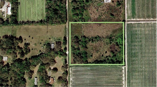
Property Record
154 Power Line Rd, East Palatka, FL 32131


NEARBY LISTINGS FOR SALE OR LEASE
Property Detail
154 Power Line Rd
04-10-27-0000-0020-0050
PT OF W1/2 OF NW1/4 OR588 P966 (SUB TO 170 WIDE FPL COORIDOR)
Miscellaneous
Putnam
X
Florida
12107C0212C
10.44 AC
2025
Florida Central North Area
2025
Other Market Areas
951000
Palatka, FL
DEMOGRAPHICS near 154 Power Line Rd
1 Mile
3 Mile
5 Mile
2024 Total Population
828
4,450
17,346
2029 Population
854
4,601
17,947
Pop Growth 2024-2029
+ 3.14%
+ 3.39%
+ 3.46%
Average Age
44
44
42
2024 Total Households
312
1,771
6,852
HH Growth 2024-2029
+ 2.88%
+ 3.39%
+ 3.40%
Median Household Inc
$47,500
$36,439
$33,188
Avg Household Size
2.40
2.40
2.40
2024 Avg HH Vehicles
2.00
2.00
2.00
Median Home Value
$373,912
$240,530
$142,515
Median Year Built
1981
1979
1973
Nearby Places
Map Layers
Map Styles
 Street
 Aerial
- Restaurants
- Banks
- Shops
- Fitness
- Groceries
PUBLIC TRANSPORTATION
COMMUTER RAIL
Palatka Amtrak (Silver Meteor - Amtrak, Silver Star - Amtrak)
DRIVE
WALK
Distance
Palatka Amtrak (Silver Meteor - Amtrak, Silver Star - Amtrak)
9 min
4.1 mi
Freight Ports
Jacksonville Port
DRIVE
WALK
Distance
Jacksonville Port
78 min
61.5 mi
SALE & LEASE HISTORY
LISTING DATE
SALE/LEASE

Jul 10, 2018
For Sale
Aug 30, 2022
For Sale
Nearby Properties
Address
Land Use
TOTAL SIZE
Lot Size
Zoning
Address
Land Use
TOTAL SIZE
Lot Size
Zoning
45,991 SF
1.69 AC
Address
Land Use
TOTAL SIZE
Lot Size
Zoning
19,096 SF
151.97 AC
Address
Land Use
TOTAL SIZE
Lot Size
Zoning
13,825 SF
4.13 AC
Address
Land Use
TOTAL SIZE
Lot Size
Zoning
6,892 SF
29 AC
Address
Land Use
TOTAL SIZE
Lot Size
Zoning
9,250 SF
96.36 AC
Address
Land Use
TOTAL SIZE
Lot Size
Zoning
13,054 SF
2.25 AC
Address
Land Use
TOTAL SIZE
Lot Size
Zoning
9,776 SF
3.87 AC
Address
Land Use
TOTAL SIZE
Lot Size
Zoning
18,434 SF
1.98 AC
Address
Land Use
TOTAL SIZE
Lot Size
Zoning
49,514 SF
9 AC
Address
Land Use
TOTAL SIZE
Lot Size
Zoning
1,712 SF
6.98 AC
Address
Land Use
TOTAL SIZE
Lot Size
Zoning
Address
Land Use
TOTAL SIZE
Lot Size
Zoning
13,060 SF
2.94 AC
Address
Land Use
TOTAL SIZE
Lot Size
Zoning
12,427 SF
16.63 AC
Address
Land Use
TOTAL SIZE
Lot Size
Zoning
6,150 SF
22.13 AC
Address
Land Use
TOTAL SIZE
Lot Size
Zoning
2,829 SF
1.31 AC
Address
Land Use
TOTAL SIZE
Lot Size
Zoning
4,805 SF
2.41 AC
Address
Land Use
TOTAL SIZE
Lot Size
Zoning
1,756 SF
5.34 AC
Address
Land Use
TOTAL SIZE
Lot Size
Zoning
10,007 SF
1.35 AC
Address
Land Use
TOTAL SIZE
Lot Size
Zoning
2,648 SF
4.18 AC
Address
Land Use
TOTAL SIZE
Lot Size
Zoning
Address
Land Use
TOTAL SIZE
Lot Size
Zoning
12,029 SF
1.58 AC
Address
Land Use
TOTAL SIZE
Lot Size
Zoning
3,571 SF
1.30 AC
Address
Land Use
TOTAL SIZE
Lot Size
Zoning
7,026 SF
3.02 AC
Address
Land Use
TOTAL SIZE
Lot Size
Zoning
4,194 SF
2.96 AC
Address
Land Use
TOTAL SIZE
Lot Size
Zoning
3,391 SF
8.55 AC
Address
Land Use
TOTAL SIZE
Lot Size
Zoning
Address
Land Use
TOTAL SIZE
Lot Size
Zoning
9,513 SF
2.23 AC
Address
Land Use
TOTAL SIZE
Lot Size
Zoning
12,320 SF
1.10 AC
Address
Land Use
TOTAL SIZE
Lot Size
Zoning
11,448 SF
2.31 AC
Address
Land Use
TOTAL SIZE
Lot Size
Zoning
12,624 SF
1.39 AC
The World's #1 Commercial Real Estate Marketplace
Connect with us
© 2025 CoStar Group
The information above has been obtained from sources believed reliable. While we do not doubt its accuracy we have not verified it and make no guarantee, warranty or representation about it. It is your responsibility to independently confirm its accuracy and completeness. Any projections, opinions, assumptions, or estimates used are for example only and do not represent the current or future performance of the property. The value of this transaction to you depends on tax and other factors which should be evaluated by your tax, financial, and legal advisors. You and your advisors should conduct a careful, independent investigation of the property to determine to your satisfaction the suitability of the property for your needs.