Property Record
154 Rand Rd, Portland, ME 04102

Property Detail
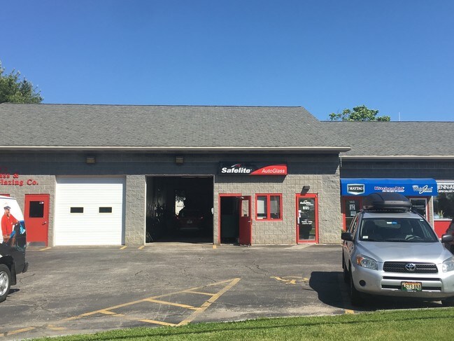
154 Rand Rd
Commercialcondominium
CUMBERLAND
B and X Area of moderate flood hazard, usually the area between the limits of the 100-year and 500-year floods.
Maine
2025
SW Cumberland County
2025
Portland/South Portland
002001
Portland-South Portland, ME
3,000 SF
PTLD-000262-000000-B037003
NEARBY LISTINGS FOR SALE OR LEASE
DEMOGRAPHICS near 154 Rand Rd
1 mile
3 mile
5 mile
2025 Total Population
4,940
59,643
115,841
2030 Population
4,971
60,092
116,845
Pop Growth 2025-2030
+ 0.63%
+ 0.75%
+ 0.87%
Average Age
44
41
41
2025 Total Households
2,027
26,806
52,844
HH Growth 2025-2030
+ 0.59%
+ 0.93%
+ 1.04%
Median Household Inc
$90,917
$88,285
$90,579
Avg Household Size
2.30
2.10
2.10
2025 Avg HH Vehicles
2.00
2.00
2.00
Median Home Value
$444,763
$444,873
$464,039
Median Year Built
1955
1954
1957
Nearby Places
Map Layers
Map Styles
 Street
 Aerial
Layers
 Traffic
 Biking
Places
Listings with unknown addresses are not visible on the map
- Restaurants
- Banks
- Shops
- Fitness
- Groceries
PUBLIC TRANSPORTATION
COMMUTER RAIL
Portland (Downeaster - Amtrak)
Drive
Walk
Distance
Portland (Downeaster - Amtrak)
6 min
3.1 mi
AIRPORT
Portland International Jetport
Drive
Walk
Distance
Portland International Jetport
10 min
4.0 mi
Freight Ports
Portland, ME
Drive
Walk
Distance
Portland, ME
9 min
5.0 mi
Nearby Properties
Address
Land Use
TOTAL SIZE
Lot Size
Zoning
Address
Land Use
TOTAL SIZE
Lot Size
Zoning
86.50 AC
Address
Land Use
TOTAL SIZE
Lot Size
Zoning
45.50 AC
Address
Land Use
TOTAL SIZE
Lot Size
Zoning
8.11 AC
Address
Land Use
TOTAL SIZE
Lot Size
Zoning
212.57 AC
Address
Land Use
TOTAL SIZE
Lot Size
Zoning
12.51 AC
Address
Land Use
TOTAL SIZE
Lot Size
Zoning
84,636 SF
31.70 AC
22
Address
Land Use
TOTAL SIZE
Lot Size
Zoning
408.26 AC
Address
Land Use
TOTAL SIZE
Lot Size
Zoning
133,492 SF
27.60 AC
Address
Land Use
TOTAL SIZE
Lot Size
Zoning
20.35 AC
Address
Land Use
TOTAL SIZE
Lot Size
Zoning
53.27 AC
22
Address
Land Use
TOTAL SIZE
Lot Size
Zoning
732,640 SF
Address
Land Use
TOTAL SIZE
Lot Size
Zoning
20.61 AC
TIFD
Address
Land Use
TOTAL SIZE
Lot Size
Zoning
Address
Land Use
TOTAL SIZE
Lot Size
Zoning
26,584 SF
2.79 AC
Address
Land Use
TOTAL SIZE
Lot Size
Zoning
5.13 AC
Address
Land Use
TOTAL SIZE
Lot Size
Zoning
238,150 SF
1.37 AC
Address
Land Use
TOTAL SIZE
Lot Size
Zoning
78,396 SF
8.60 AC
Address
Land Use
TOTAL SIZE
Lot Size
Zoning
285,570 SF
1.37 AC
Address
Land Use
TOTAL SIZE
Lot Size
Zoning
238,301 SF
1.33 AC
Address
Land Use
TOTAL SIZE
Lot Size
Zoning
176,100 SF
128 AC
Z
Address
Land Use
TOTAL SIZE
Lot Size
Zoning
135,968 SF
7.02 AC
Address
Land Use
TOTAL SIZE
Lot Size
Zoning
173,617 SF
15.28 AC
Address
Land Use
TOTAL SIZE
Lot Size
Zoning
125,719 SF
18.79 AC
Address
Land Use
TOTAL SIZE
Lot Size
Zoning
138,280 SF
0.59 AC
Address
Land Use
TOTAL SIZE
Lot Size
Zoning
120 AC
Z
Address
Land Use
TOTAL SIZE
Lot Size
Zoning
115,965 SF
123 AC
Z
Address
Land Use
TOTAL SIZE
Lot Size
Zoning
9.23 AC
Address
Land Use
TOTAL SIZE
Lot Size
Zoning
20.33 AC
Z
Address
Land Use
TOTAL SIZE
Lot Size
Zoning
139,588 SF
0.85 AC
16
Address
Land Use
TOTAL SIZE
Lot Size
Zoning
33.07 AC
The World's #1 Commercial Real Estate Marketplace
Connect with us
© 2026 CoStar Group
The information above has been obtained from sources believed reliable. While we do not doubt its accuracy we have not verified it and make no guarantee, warranty or representation about it. It is your responsibility to independently confirm its accuracy and completeness. Any projections, opinions, assumptions, or estimates used are for example only and do not represent the current or future performance of the property. The value of this transaction to you depends on tax and other factors which should be evaluated by your tax, financial, and legal advisors. You and your advisors should conduct a careful, independent investigation of the property to determine to your satisfaction the suitability of the property for your needs.