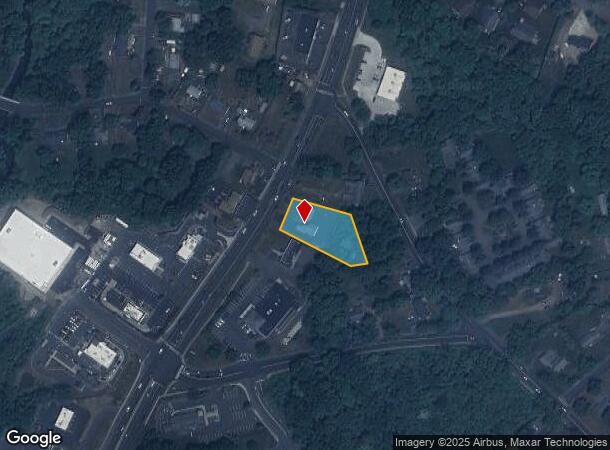
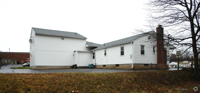
Property Record
154 Talcottville Rd, Vernon Rockville, CT 06066
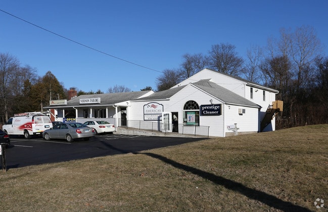
This Property Is For Sale
Current Lease Availabilities
NEARBY LISTINGS FOR SALE OR LEASE
Property Detail
154 Talcottville Rd
Hartford-West Hartford-East Hartford, CT
Tolland
VERN-000003-000012-000010
Connecticut
Commercialnec
10
2024
0.64 AC
2025
Tolland County
530302
Hartford
3,635 SF
DEMOGRAPHICS near 154 Talcottville Rd
1 Mile
3 Mile
5 Mile
2024 Total Population
5,723
47,803
112,587
2029 Population
5,720
47,535
112,073
Pop Growth 2024-2029
(0.05%)
(0.56%)
(0.46%)
Average Age
44
42
41
2024 Total Households
2,629
20,559
47,665
HH Growth 2024-2029
(0.08%)
(0.59%)
(0.47%)
Median Household Inc
$82,816
$84,951
$82,546
Avg Household Size
2.20
2.30
2.30
2024 Avg HH Vehicles
2.00
2.00
2.00
Median Home Value
$250,613
$257,438
$247,522
Median Year Built
1980
1975
1969
Nearby Places
Map Layers
Map Styles
 Street
 Aerial
- Restaurants
- Banks
- Shops
- Fitness
- Groceries
PUBLIC TRANSPORTATION
AIRPORT
Bradley International
DRIVE
WALK
Distance
Bradley International
40 min
20.2 mi
Nearby Properties
Address
Land Use
TOTAL SIZE
Lot Size
Zoning
Address
Land Use
TOTAL SIZE
Lot Size
Zoning
75.65 AC
PDZ GE
Address
Land Use
TOTAL SIZE
Lot Size
Zoning
3,200 SF
31.39 AC
INDUST
Address
Land Use
TOTAL SIZE
Lot Size
Zoning
29.87 AC
PDZ GE
Address
Land Use
TOTAL SIZE
Lot Size
Zoning
63.72 AC
R-22
Address
Land Use
TOTAL SIZE
Lot Size
Zoning
28,608 SF
25.37 AC
CUD
Address
Land Use
TOTAL SIZE
Lot Size
Zoning
12,068 SF
21.79 AC
CUD
Address
Land Use
TOTAL SIZE
Lot Size
Zoning
29,744 SF
29.50 AC
PRD
Address
Land Use
TOTAL SIZE
Lot Size
Zoning
24.02 AC
COMMER
Address
Land Use
TOTAL SIZE
Lot Size
Zoning
Address
Land Use
TOTAL SIZE
Lot Size
Zoning
188,775 SF
74.13 AC
R-27
Address
Land Use
TOTAL SIZE
Lot Size
Zoning
149,322 SF
16.76 AC
A30
Address
Land Use
TOTAL SIZE
Lot Size
Zoning
33.41 AC
MF
Address
Land Use
TOTAL SIZE
Lot Size
Zoning
68,988 SF
9.17 AC
GB
Address
Land Use
TOTAL SIZE
Lot Size
Zoning
85,470 SF
14.11 AC
R
Address
Land Use
TOTAL SIZE
Lot Size
Zoning
43,394 SF
35 AC
A30
Address
Land Use
TOTAL SIZE
Lot Size
Zoning
11 AC
R-27
Address
Land Use
TOTAL SIZE
Lot Size
Zoning
27.05 AC
COMMER
Address
Land Use
TOTAL SIZE
Lot Size
Zoning
81,412 SF
9.20 AC
GD
Address
Land Use
TOTAL SIZE
Lot Size
Zoning
7.11 AC
CUD
Address
Land Use
TOTAL SIZE
Lot Size
Zoning
144,679 SF
16.39 AC
CUD
Address
Land Use
TOTAL SIZE
Lot Size
Zoning
15.89 AC
PRD
Address
Land Use
TOTAL SIZE
Lot Size
Zoning
19.72 AC
GB
Address
Land Use
TOTAL SIZE
Lot Size
Zoning
16.18 AC
COMMER
Address
Land Use
TOTAL SIZE
Lot Size
Zoning
3,200 SF
9.09 AC
COMMER
Address
Land Use
TOTAL SIZE
Lot Size
Zoning
116,406 SF
10.64 AC
RA
Address
Land Use
TOTAL SIZE
Lot Size
Zoning
193 AC
R-40
Address
Land Use
TOTAL SIZE
Lot Size
Zoning
31.50 AC
PRD
Address
Land Use
TOTAL SIZE
Lot Size
Zoning
18.49 AC
PRD
Address
Land Use
TOTAL SIZE
Lot Size
Zoning
54,012 SF
16.64 AC
RA
Address
Land Use
TOTAL SIZE
Lot Size
Zoning
16.23 AC
CUD
The World's #1 Commercial Real Estate Marketplace
Connect with us
© 2025 CoStar Group
The information above has been obtained from sources believed reliable. While we do not doubt its accuracy we have not verified it and make no guarantee, warranty or representation about it. It is your responsibility to independently confirm its accuracy and completeness. Any projections, opinions, assumptions, or estimates used are for example only and do not represent the current or future performance of the property. The value of this transaction to you depends on tax and other factors which should be evaluated by your tax, financial, and legal advisors. You and your advisors should conduct a careful, independent investigation of the property to determine to your satisfaction the suitability of the property for your needs.