Property Record
154 Us Highway 54, Chaparral, NM 88081
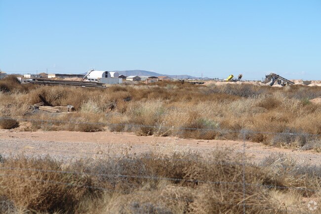

Property Detail
154 Us Highway 54
R056731
S: 27 T: 26 R: 6 TR IN N1/2 N1/2
Vacantlandnec
OTERO
B and X Area of moderate flood hazard, usually the area between the limits of the 100-year and 500-year floods.
New Mexico
2025
5 AC
2025
Las Cruces/Alamogordo
000903
Other Market Areas
1,196 SF
Alamogordo, NM
NEARBY LISTINGS FOR SALE OR LEASE
-
-
View all Chaparral listings for sale on LoopNet.com
DEMOGRAPHICS near 154 Us Highway 54
1 mile
3 mile
5 mile
2025 Total Population
1,090
8,354
16,356
2030 Population
1,171
8,700
16,878
Pop Growth 2025-2030
+ 7.43%
+ 4.14%
+ 3.19%
Average Age
37
35
35
2025 Total Households
202
1,970
4,464
HH Growth 2025-2030
+ 10.40%
+ 4.72%
+ 3.32%
Median Household Inc
$44,601
$43,918
$48,145
Avg Household Size
3.30
3.20
3.10
2025 Avg HH Vehicles
2.00
2.00
2.00
Median Home Value
$104,167
$103,488
$120,284
Median Year Built
2004
1993
1992
Nearby Places
Map Layers
Map Styles
 Street
 Aerial
Transit
 Traffic
 Biking
Places
Listings with unknown addresses are not visible on the map
- Restaurants
- Banks
- Shops
- Fitness
- Groceries
PUBLIC TRANSPORTATION
AIRPORT
El Paso International
Drive
Walk
Distance
El Paso International
35 min
23.8 mi
Freight Ports
Port of Corpus Christi
Drive
Walk
Distance
Port of Corpus Christi
701 min
710.7 mi
Nearby Properties
Address
Land Use
TOTAL SIZE
Lot Size
Zoning
Address
Land Use
TOTAL SIZE
Lot Size
Zoning
75,275 SF
19 AC
Address
Land Use
TOTAL SIZE
Lot Size
Zoning
5,488 SF
0.15 AC
C3
Address
Land Use
TOTAL SIZE
Lot Size
Zoning
27,500 SF
0.75 AC
Address
Land Use
TOTAL SIZE
Lot Size
Zoning
9,291 SF
1.53 AC
Address
Land Use
TOTAL SIZE
Lot Size
Zoning
8,073 SF
1.47 AC
Address
Land Use
TOTAL SIZE
Lot Size
Zoning
6,230 SF
1.26 AC
Address
Land Use
TOTAL SIZE
Lot Size
Zoning
12,080 SF
10.03 AC
Address
Land Use
TOTAL SIZE
Lot Size
Zoning
6,000 SF
0.84 AC
Address
Land Use
TOTAL SIZE
Lot Size
Zoning
4,379 SF
0.76 AC
Address
Land Use
TOTAL SIZE
Lot Size
Zoning
4,820 SF
1.06 AC
Address
Land Use
TOTAL SIZE
Lot Size
Zoning
4,170 SF
1.27 AC
Address
Land Use
TOTAL SIZE
Lot Size
Zoning
5,508 SF
1.27 AC
Address
Land Use
TOTAL SIZE
Lot Size
Zoning
2,025 SF
1.19 AC
Address
Land Use
TOTAL SIZE
Lot Size
Zoning
6,912 SF
2.18 AC
Address
Land Use
TOTAL SIZE
Lot Size
Zoning
2,000 SF
43.63 AC
Address
Land Use
TOTAL SIZE
Lot Size
Zoning
1,156 SF
0.15 AC
C3
Address
Land Use
TOTAL SIZE
Lot Size
Zoning
5,000 SF
14.70 AC
Address
Land Use
TOTAL SIZE
Lot Size
Zoning
3,738 SF
0.22 AC
C3
Address
Land Use
TOTAL SIZE
Lot Size
Zoning
2,230 SF
1.01 AC
Address
Land Use
TOTAL SIZE
Lot Size
Zoning
Address
Land Use
TOTAL SIZE
Lot Size
Zoning
2,500 SF
1.27 AC
Address
Land Use
TOTAL SIZE
Lot Size
Zoning
1,620 SF
1.01 AC
Address
Land Use
TOTAL SIZE
Lot Size
Zoning
1,984 SF
2.11 AC
C-3
Address
Land Use
TOTAL SIZE
Lot Size
Zoning
1,100 SF
0.52 AC
C3
Address
Land Use
TOTAL SIZE
Lot Size
Zoning
3,173 SF
5 AC
Address
Land Use
TOTAL SIZE
Lot Size
Zoning
5,000 SF
1.97 AC
Address
Land Use
TOTAL SIZE
Lot Size
Zoning
328 SF
5 AC
Address
Land Use
TOTAL SIZE
Lot Size
Zoning
3,858 SF
0.83 AC
Address
Land Use
TOTAL SIZE
Lot Size
Zoning
2,174 SF
1.01 AC
Address
Land Use
TOTAL SIZE
Lot Size
Zoning
1,344 SF
3.50 AC
The World's #1 Commercial Real Estate Marketplace
Connect with us
© 2026 CoStar Group
The information above has been obtained from sources believed reliable. While we do not doubt its accuracy we have not verified it and make no guarantee, warranty or representation about it. It is your responsibility to independently confirm its accuracy and completeness. Any projections, opinions, assumptions, or estimates used are for example only and do not represent the current or future performance of the property. The value of this transaction to you depends on tax and other factors which should be evaluated by your tax, financial, and legal advisors. You and your advisors should conduct a careful, independent investigation of the property to determine to your satisfaction the suitability of the property for your needs.