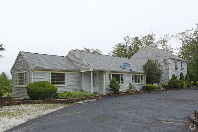
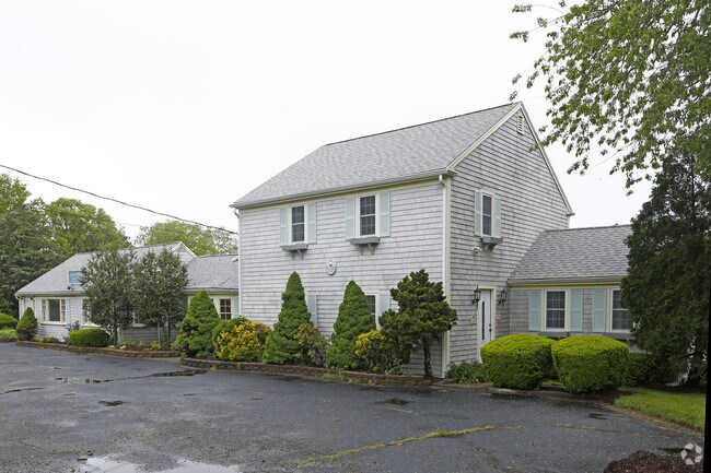
Property Record
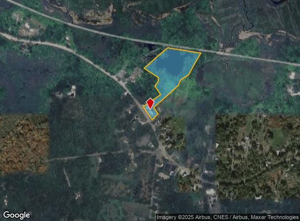
1540 Main St, West Barnstable, MA 02668
NEARBY LISTINGS FOR SALE OR LEASE
-
-
View all West Barnstable listings for sale on LoopNet.com
Property Detail
1540 Main St
BARN-000197-000000-000015
Barnstable
Taxexempt
Massachusetts
AE
15
25001C0553J
5.36 AC
0
Cape Cod
2025
Other Market Areas
012200
Barnstable Town, MA
3,068 SF
DEMOGRAPHICS near 1540 Main St
1 Mile
3 Mile
5 Mile
2024 Total Population
544
11,837
40,298
2029 Population
534
11,770
40,553
Pop Growth 2024-2029
(1.84%)
(0.57%)
+ 0.63%
Average Age
48
47
46
2024 Total Households
216
4,814
16,474
HH Growth 2024-2029
(2.31%)
(0.87%)
+ 0.42%
Median Household Inc
$112,790
$107,071
$90,204
Avg Household Size
2.30
2.40
2.30
2024 Avg HH Vehicles
2.00
2.00
2.00
Median Home Value
$633,721
$471,298
$472,762
Median Year Built
1984
1979
1978
Nearby Places
Map Layers
Map Styles
 Street
 Aerial
- Restaurants
- Banks
- Shops
- Fitness
- Groceries
PUBLIC TRANSPORTATION
COMMUTER RAIL
DRIVE
WALK
Distance
10 min
5.1 mi
AIRPORT
Martha's Vineyard
DRIVE
WALK
Distance
Martha's Vineyard
103 min
37.8 mi
Freight Ports
Port of New Bedford Harbor
DRIVE
WALK
Distance
Port of New Bedford Harbor
61 min
43.9 mi
Nearby Properties
Address
Land Use
TOTAL SIZE
Lot Size
Zoning
Address
Land Use
TOTAL SIZE
Lot Size
Zoning
44 AC
RG;RF
Address
Land Use
TOTAL SIZE
Lot Size
Zoning
10.68 AC
Address
Land Use
TOTAL SIZE
Lot Size
Zoning
17.95 AC
VB-A;R
Address
Land Use
TOTAL SIZE
Lot Size
Zoning
1,114.30 AC
Address
Land Use
TOTAL SIZE
Lot Size
Zoning
30,000 SF
8.48 AC
HB;RF-
Address
Land Use
TOTAL SIZE
Lot Size
Zoning
253,562 SF
12.54 AC
RC-1;H
Address
Land Use
TOTAL SIZE
Lot Size
Zoning
37,169 SF
8.71 AC
RC-1;H
Address
Land Use
TOTAL SIZE
Lot Size
Zoning
90,837 SF
11.66 AC
IN
Address
Land Use
TOTAL SIZE
Lot Size
Zoning
73,621 SF
9.91 AC
RC;HB
Address
Land Use
TOTAL SIZE
Lot Size
Zoning
54,688 SF
10.02 AC
B;RG;R
Address
Land Use
TOTAL SIZE
Lot Size
Zoning
36,536 SF
36.91 AC
RG;RF-
Address
Land Use
TOTAL SIZE
Lot Size
Zoning
39,689 SF
9.12 AC
Address
Land Use
TOTAL SIZE
Lot Size
Zoning
126.31 AC
RG;RF-
Address
Land Use
TOTAL SIZE
Lot Size
Zoning
4.60 AC
RC;HB
Address
Land Use
TOTAL SIZE
Lot Size
Zoning
800 SF
7.30 AC
MB
Address
Land Use
TOTAL SIZE
Lot Size
Zoning
1,188.31 AC
RF;RF-
Address
Land Use
TOTAL SIZE
Lot Size
Zoning
143.68 AC
R
Address
Land Use
TOTAL SIZE
Lot Size
Zoning
58,488 SF
4.35 AC
B;HB
Address
Land Use
TOTAL SIZE
Lot Size
Zoning
7.06 AC
RD-1;R
Address
Land Use
TOTAL SIZE
Lot Size
Zoning
8.18 AC
HB;B;R
Address
Land Use
TOTAL SIZE
Lot Size
Zoning
1.91 AC
RF
Address
Land Use
TOTAL SIZE
Lot Size
Zoning
5.32 AC
RF
Address
Land Use
TOTAL SIZE
Lot Size
Zoning
27,168 SF
4.12 AC
B;RG
Address
Land Use
TOTAL SIZE
Lot Size
Zoning
18,870 SF
2.34 AC
RD-1;H
Address
Land Use
TOTAL SIZE
Lot Size
Zoning
332.06 AC
INDLTD
Address
Land Use
TOTAL SIZE
Lot Size
Zoning
7.13 AC
1
Address
Land Use
TOTAL SIZE
Lot Size
Zoning
61 AC
1
Address
Land Use
TOTAL SIZE
Lot Size
Zoning
2.47 AC
0
Address
Land Use
TOTAL SIZE
Lot Size
Zoning
22,400 SF
4.44 AC
RD-1;H
Address
Land Use
TOTAL SIZE
Lot Size
Zoning
1.32 AC
The World's #1 Commercial Real Estate Marketplace
Connect with us
© 2025 CoStar Group
The information above has been obtained from sources believed reliable. While we do not doubt its accuracy we have not verified it and make no guarantee, warranty or representation about it. It is your responsibility to independently confirm its accuracy and completeness. Any projections, opinions, assumptions, or estimates used are for example only and do not represent the current or future performance of the property. The value of this transaction to you depends on tax and other factors which should be evaluated by your tax, financial, and legal advisors. You and your advisors should conduct a careful, independent investigation of the property to determine to your satisfaction the suitability of the property for your needs.