Property Record
1540 Silo Rd, Bonham, TX 75418
Property Detail
1540 Silo Rd
Bonham, TX
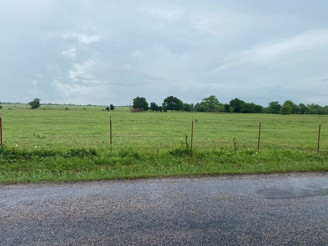
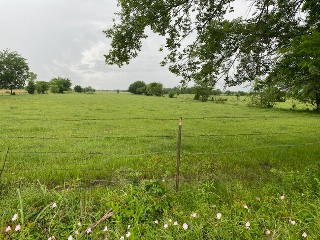
A1194 O H P WOOD, ACRES 17.
86030
FANNIN
Agriculturalland
Texas
B and X Area of moderate flood hazard, usually the area between the limits of the 100-year and 500-year floods.
17 AC
2024
Texas North Area
2025
Other Market Areas
950402
NEARBY LISTINGS FOR SALE OR LEASE
DEMOGRAPHICS near 1540 Silo Rd
1 mile
3 mile
5 mile
2025 Total Population
2,629
12,410
15,367
2030 Population
2,646
13,004
16,109
Pop Growth 2025-2030
+ 0.65%
+ 4.79%
+ 4.83%
Average Age
40
41
42
2025 Total Households
149
3,665
4,852
HH Growth 2025-2030
+ 4.70%
+ 5.84%
+ 5.69%
Median Household Inc
$31,250
$50,970
$55,620
Avg Household Size
2.10
2.40
2.40
2025 Avg HH Vehicles
1.00
2.00
2.00
Median Home Value
$146,666
$187,226
$204,435
Median Year Built
1985
1977
1979
Nearby Places
Map Layers
Map Styles
 Street
 Aerial
Transit
 Traffic
 Biking
Places
Listings with unknown addresses are not visible on the map
- Restaurants
- Banks
- Shops
- Fitness
- Groceries
SALE & LEASE HISTORY
LISTING DATE
SALE/LEASE

May 21, 2023
For Sale
Nearby Properties
Address
Land Use
TOTAL SIZE
Lot Size
Zoning
Address
Land Use
TOTAL SIZE
Lot Size
Zoning
547,252 SF
79.10 AC
Address
Land Use
TOTAL SIZE
Lot Size
Zoning
249,422 SF
66.19 AC
Address
Land Use
TOTAL SIZE
Lot Size
Zoning
11,627 SF
54.02 AC
Address
Land Use
TOTAL SIZE
Lot Size
Zoning
76,317 SF
18.34 AC
Address
Land Use
TOTAL SIZE
Lot Size
Zoning
16,335 SF
106.30 AC
Address
Land Use
TOTAL SIZE
Lot Size
Zoning
3,164 SF
7.92 AC
Address
Land Use
TOTAL SIZE
Lot Size
Zoning
482.51 AC
Address
Land Use
TOTAL SIZE
Lot Size
Zoning
596,495 SF
35 AC
Address
Land Use
TOTAL SIZE
Lot Size
Zoning
111,650 SF
15.17 AC
Address
Land Use
TOTAL SIZE
Lot Size
Zoning
83,105 SF
11.92 AC
Address
Land Use
TOTAL SIZE
Lot Size
Zoning
8,420 SF
496.52 AC
Address
Land Use
TOTAL SIZE
Lot Size
Zoning
66,559 SF
5.68 AC
Address
Land Use
TOTAL SIZE
Lot Size
Zoning
81,491 SF
15.44 AC
Address
Land Use
TOTAL SIZE
Lot Size
Zoning
77.44 AC
Address
Land Use
TOTAL SIZE
Lot Size
Zoning
31,944 SF
1.38 AC
Address
Land Use
TOTAL SIZE
Lot Size
Zoning
60,188 SF
7.85 AC
Address
Land Use
TOTAL SIZE
Lot Size
Zoning
94,842 SF
3.09 AC
Address
Land Use
TOTAL SIZE
Lot Size
Zoning
60,143 SF
7.18 AC
Address
Land Use
TOTAL SIZE
Lot Size
Zoning
31.27 AC
Address
Land Use
TOTAL SIZE
Lot Size
Zoning
40,920 SF
6.74 AC
Address
Land Use
TOTAL SIZE
Lot Size
Zoning
33,961 SF
3.12 AC
Address
Land Use
TOTAL SIZE
Lot Size
Zoning
137,365 SF
37.75 AC
Address
Land Use
TOTAL SIZE
Lot Size
Zoning
32,178 SF
16.44 AC
Address
Land Use
TOTAL SIZE
Lot Size
Zoning
31,300 SF
25.04 AC
Address
Land Use
TOTAL SIZE
Lot Size
Zoning
21,000 SF
2.76 AC
Address
Land Use
TOTAL SIZE
Lot Size
Zoning
7,876 SF
4 AC
Address
Land Use
TOTAL SIZE
Lot Size
Zoning
49,583 SF
3.53 AC
Address
Land Use
TOTAL SIZE
Lot Size
Zoning
123,655 SF
11.51 AC
Address
Land Use
TOTAL SIZE
Lot Size
Zoning
59,442 SF
129.25 AC
Address
Land Use
TOTAL SIZE
Lot Size
Zoning
45,769 SF
20.34 AC
The World's #1 Commercial Real Estate Marketplace
Connect with us
© 2026 CoStar Group
The information above has been obtained from sources believed reliable. While we do not doubt its accuracy we have not verified it and make no guarantee, warranty or representation about it. It is your responsibility to independently confirm its accuracy and completeness. Any projections, opinions, assumptions, or estimates used are for example only and do not represent the current or future performance of the property. The value of this transaction to you depends on tax and other factors which should be evaluated by your tax, financial, and legal advisors. You and your advisors should conduct a careful, independent investigation of the property to determine to your satisfaction the suitability of the property for your needs.