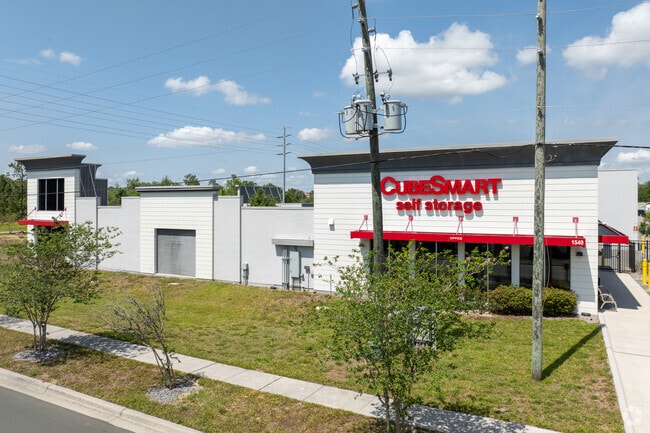
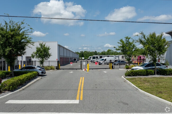
Property Record
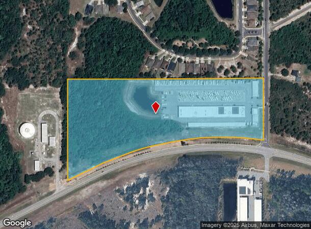
1540 Sullivan Rd, Davenport, FL 33896
NEARBY LISTINGS FOR SALE OR LEASE
Property Detail
1540 Sullivan Rd
Orlando-Kissimmee-Sanford, FL
Acreage & Unrec
35-25-27-0000-0090-0000
SE1/4 OF SE1/4 N OF SR 532 LESS RD R/W HWY 532
Publicstorage
Osceola
A
Florida
12105C0125H
90
2024
14.44 AC
2025
Osceola Outlying
040801
Orlando
88,515 SF
DEMOGRAPHICS near 1540 Sullivan Rd
1 Mile
3 Mile
5 Mile
2024 Total Population
2,453
37,473
79,796
2029 Population
3,069
46,922
99,904
Pop Growth 2024-2029
+ 25.11%
+ 25.22%
+ 25.20%
Average Age
38
38
39
2024 Total Households
888
13,917
29,741
HH Growth 2024-2029
+ 25.34%
+ 25.10%
+ 25.09%
Median Household Inc
$70,105
$66,966
$70,905
Avg Household Size
2.70
2.60
2.60
2024 Avg HH Vehicles
2.00
2.00
2.00
Median Home Value
$268,420
$285,861
$307,372
Median Year Built
2005
2007
2007
Nearby Places
Map Layers
Map Styles
 Street
 Aerial
- Restaurants
- Banks
- Shops
- Fitness
- Groceries
PUBLIC TRANSPORTATION
COMMUTER RAIL
Poinciana (SunRail - Florida Department of Transportation)
DRIVE
WALK
Distance
Poinciana (SunRail - Florida Department of Transportation)
10 min
6.1 mi
AIRPORT
Orlando International
DRIVE
WALK
Distance
Orlando International
39 min
28.5 mi
Freight Ports
Port of Tampa Bay
DRIVE
WALK
Distance
Port of Tampa Bay
75 min
62.2 mi
Nearby Properties
Address
Land Use
TOTAL SIZE
Lot Size
Zoning
Address
Land Use
TOTAL SIZE
Lot Size
Zoning
533,192 SF
70.52 AC
OPUD
Address
Land Use
TOTAL SIZE
Lot Size
Zoning
417,544 SF
62.60 AC
Address
Land Use
TOTAL SIZE
Lot Size
Zoning
434,491 SF
27.48 AC
Address
Land Use
TOTAL SIZE
Lot Size
Zoning
295,034 SF
14.25 AC
Address
Land Use
TOTAL SIZE
Lot Size
Zoning
597,078 SF
51.33 AC
Address
Land Use
TOTAL SIZE
Lot Size
Zoning
422,457 SF
17.46 AC
Address
Land Use
TOTAL SIZE
Lot Size
Zoning
425,752 SF
19.52 AC
Address
Land Use
TOTAL SIZE
Lot Size
Zoning
355,791 SF
28.19 AC
OPD
Address
Land Use
TOTAL SIZE
Lot Size
Zoning
436,302 SF
27.87 AC
Address
Land Use
TOTAL SIZE
Lot Size
Zoning
480,104 SF
12.37 AC
Address
Land Use
TOTAL SIZE
Lot Size
Zoning
358,576 SF
27.34 AC
OPD
Address
Land Use
TOTAL SIZE
Lot Size
Zoning
302,226 SF
135.83 AC
Address
Land Use
TOTAL SIZE
Lot Size
Zoning
412,886 SF
10.72 AC
Address
Land Use
TOTAL SIZE
Lot Size
Zoning
335,536 SF
11.97 AC
Address
Land Use
TOTAL SIZE
Lot Size
Zoning
333,554 SF
19.22 AC
Address
Land Use
TOTAL SIZE
Lot Size
Zoning
329,700 SF
12.09 AC
Address
Land Use
TOTAL SIZE
Lot Size
Zoning
307,953 SF
16.20 AC
Address
Land Use
TOTAL SIZE
Lot Size
Zoning
360,801 SF
8.24 AC
Address
Land Use
TOTAL SIZE
Lot Size
Zoning
352,892 SF
19.23 AC
Address
Land Use
TOTAL SIZE
Lot Size
Zoning
336,042 SF
20.77 AC
Address
Land Use
TOTAL SIZE
Lot Size
Zoning
256,589 SF
15.37 AC
OPD
Address
Land Use
TOTAL SIZE
Lot Size
Zoning
216,296 SF
16.37 AC
Address
Land Use
TOTAL SIZE
Lot Size
Zoning
338,315 SF
59.58 AC
Address
Land Use
TOTAL SIZE
Lot Size
Zoning
236,745 SF
26.56 AC
Address
Land Use
TOTAL SIZE
Lot Size
Zoning
164,106 SF
7.13 AC
Address
Land Use
TOTAL SIZE
Lot Size
Zoning
210,404 SF
45.84 AC
OPUD
Address
Land Use
TOTAL SIZE
Lot Size
Zoning
41,812 SF
162.70 AC
OAC
Address
Land Use
TOTAL SIZE
Lot Size
Zoning
88,884 SF
3.34 AC
Address
Land Use
TOTAL SIZE
Lot Size
Zoning
148,436 SF
10.27 AC
Address
Land Use
TOTAL SIZE
Lot Size
Zoning
62,808 SF
7.09 AC
OPD
The World's #1 Commercial Real Estate Marketplace
Connect with us
© 2026 CoStar Group
The information above has been obtained from sources believed reliable. While we do not doubt its accuracy we have not verified it and make no guarantee, warranty or representation about it. It is your responsibility to independently confirm its accuracy and completeness. Any projections, opinions, assumptions, or estimates used are for example only and do not represent the current or future performance of the property. The value of this transaction to you depends on tax and other factors which should be evaluated by your tax, financial, and legal advisors. You and your advisors should conduct a careful, independent investigation of the property to determine to your satisfaction the suitability of the property for your needs.