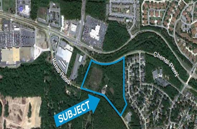
Property Record
15401 Chenal Pky, Little Rock, AR 72211

NEARBY LISTINGS FOR SALE OR LEASE
-
-
-
-
-
-
Rahling Road and Chenal Valley Drive
Little Rock, AR 72223
Rent Upon Request
2.01 - 2.76 AC Lot
Land
-
-
-
-
-
-
View all Little Rock listings for sale on LoopNet.com
Property Detail
15401 Chenal Pky
44L-075-00-013-00
Kanis
Apartment
PT NW COM SE COR N208.3' N40*1'20"W582.15' TO POB N27*9'20"W147.9' N0*59'18"E659.5' TO SR/W LN W MARKHAM PKWY TH AL SD R/W S65*W55.3' S72*31'W150.23' N86*W587.4' TH LEAVING R/W S65*55'10"E20.4' TO ELN ROCK CRK S28*W AL SD CRK 545.17' TO N R/W LN KANI
AE
Pulaski
05119C0314H
Arkansas
2025
13.50 AC
2025
West
004218
Little Rock/N Little Rock
333,636 SF
Little Rock-North Little Rock-Conway, AR
DEMOGRAPHICS near 15401 Chenal Pky
1 Mile
3 Mile
5 Mile
2024 Total Population
7,010
45,075
93,739
2029 Population
7,002
44,893
93,367
Pop Growth 2024-2029
(0.11%)
(0.40%)
(0.40%)
Average Age
38
39
40
2024 Total Households
3,197
19,706
41,229
HH Growth 2024-2029
(0.22%)
(0.45%)
(0.45%)
Median Household Inc
$62,167
$85,979
$71,900
Avg Household Size
2.20
2.20
2.20
2024 Avg HH Vehicles
2.00
2.00
2.00
Median Home Value
$271,077
$285,450
$257,216
Median Year Built
1995
1991
1986
Nearby Places
Map Layers
Map Styles
 Street
 Aerial
- Restaurants
- Banks
- Shops
- Fitness
- Groceries
PUBLIC TRANSPORTATION
AIRPORT
Bill and Hillary Clinton Ntl/Adams Field
DRIVE
WALK
Distance
Bill and Hillary Clinton Ntl/Adams Field
23 min
14.9 mi
Freight Ports
Port of Shreveport
DRIVE
WALK
Distance
Port of Shreveport
251 min
232.1 mi
SALE & LEASE HISTORY
LISTING DATE
SALE/LEASE

Sep 24, 2016
For Sale
Nearby Properties
Address
Land Use
TOTAL SIZE
Lot Size
Zoning
Address
Land Use
TOTAL SIZE
Lot Size
Zoning
286,440 SF
10.79 AC
Address
Land Use
TOTAL SIZE
Lot Size
Zoning
115,378 SF
30.50 AC
Address
Land Use
TOTAL SIZE
Lot Size
Zoning
201,059 SF
49.76 AC
Address
Land Use
TOTAL SIZE
Lot Size
Zoning
145,580 SF
19.89 AC
Address
Land Use
TOTAL SIZE
Lot Size
Zoning
39,635 SF
15.76 AC
Address
Land Use
TOTAL SIZE
Lot Size
Zoning
220,563 SF
12.36 AC
Address
Land Use
TOTAL SIZE
Lot Size
Zoning
54,594 SF
16.79 AC
Address
Land Use
TOTAL SIZE
Lot Size
Zoning
48,982 SF
9.06 AC
Address
Land Use
TOTAL SIZE
Lot Size
Zoning
216,869 SF
20.84 AC
Address
Land Use
TOTAL SIZE
Lot Size
Zoning
130,800 SF
7.78 AC
Address
Land Use
TOTAL SIZE
Lot Size
Zoning
172,261 SF
5.48 AC
Address
Land Use
TOTAL SIZE
Lot Size
Zoning
221,911 SF
10.31 AC
Address
Land Use
TOTAL SIZE
Lot Size
Zoning
127,020 SF
13.56 AC
Address
Land Use
TOTAL SIZE
Lot Size
Zoning
57,494 SF
9.53 AC
Address
Land Use
TOTAL SIZE
Lot Size
Zoning
102,600 SF
17.29 AC
Address
Land Use
TOTAL SIZE
Lot Size
Zoning
168,221 SF
12.02 AC
Address
Land Use
TOTAL SIZE
Lot Size
Zoning
221,204 SF
4.54 AC
Address
Land Use
TOTAL SIZE
Lot Size
Zoning
32,562 SF
13.40 AC
Address
Land Use
TOTAL SIZE
Lot Size
Zoning
210,924 SF
22.66 AC
Address
Land Use
TOTAL SIZE
Lot Size
Zoning
91,384 SF
8.34 AC
Address
Land Use
TOTAL SIZE
Lot Size
Zoning
54,284 SF
11.33 AC
Address
Land Use
TOTAL SIZE
Lot Size
Zoning
86,186 SF
13.24 AC
Address
Land Use
TOTAL SIZE
Lot Size
Zoning
74,220 SF
15.49 AC
Address
Land Use
TOTAL SIZE
Lot Size
Zoning
238,164 SF
34.25 AC
Address
Land Use
TOTAL SIZE
Lot Size
Zoning
122,775 SF
9.96 AC
Address
Land Use
TOTAL SIZE
Lot Size
Zoning
155,943 SF
10.59 AC
Address
Land Use
TOTAL SIZE
Lot Size
Zoning
21,640 SF
20 AC
Address
Land Use
TOTAL SIZE
Lot Size
Zoning
40,803 SF
18.48 AC
Address
Land Use
TOTAL SIZE
Lot Size
Zoning
33,992 SF
13.15 AC
The World's #1 Commercial Real Estate Marketplace
Connect with us
© 2026 CoStar Group
The information above has been obtained from sources believed reliable. While we do not doubt its accuracy we have not verified it and make no guarantee, warranty or representation about it. It is your responsibility to independently confirm its accuracy and completeness. Any projections, opinions, assumptions, or estimates used are for example only and do not represent the current or future performance of the property. The value of this transaction to you depends on tax and other factors which should be evaluated by your tax, financial, and legal advisors. You and your advisors should conduct a careful, independent investigation of the property to determine to your satisfaction the suitability of the property for your needs.