Property Record
15401 Roosevelt Blvd, Clearwater, FL 33760


NEARBY LISTINGS FOR SALE OR LEASE
-
-
View all Clearwater listings for sale on LoopNet.com
Property Detail
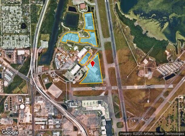
15401 Roosevelt Blvd
34-29-16-00110-000-0005
Airport Sub (Unrecorded)
Transportationcommunicationsgeneral
AIRPORT SUB (UNRECORDED) (SHELTAIR ST PETERSBURG LEASE) PART OF NW 1/4 & SW 1/4 OF SEC 34-29-16 DESC AS FROM SW COR OF SEC TH N01D1557W 2440FT(S) FOR POB TH N75D3710W 9.05FT TH N20D35E 69.48FT TH CUR RT RAD 1341.07FT ARC 124.8FT CB N23D1128E 122.03FT
AE
Pinellas
12103C0137H
Florida
2024
41.78 AC
2025
Gateway
024510
Tampa/St Petersburg
329,931 SF
Tampa-St. Petersburg-Clearwater, FL
DEMOGRAPHICS near 15401 Roosevelt Blvd
1 Mile
3 Mile
5 Mile
2024 Total Population
2,149
35,154
153,675
2029 Population
2,114
36,051
154,910
Pop Growth 2024-2029
(1.63%)
+ 2.55%
+ 0.80%
Average Age
42
44
44
2024 Total Households
954
16,854
72,794
HH Growth 2024-2029
(1.89%)
+ 2.58%
+ 0.71%
Median Household Inc
$46,024
$59,298
$57,680
Avg Household Size
2.20
2.00
2.00
2024 Avg HH Vehicles
1.00
1.00
1.00
Median Home Value
$326,804
$219,919
$216,686
Median Year Built
1983
1984
1979
Nearby Places
Map Layers
Map Styles
 Street
 Aerial
- Restaurants
- Banks
- Shops
- Fitness
- Groceries
PUBLIC TRANSPORTATION
AIRPORT
St Pete-Clearwater International
DRIVE
WALK
Distance
St Pete-Clearwater International
16 min
5.0 mi
Tampa International
DRIVE
WALK
Distance
Tampa International
27 min
16.5 mi
Freight Ports
Port of Tampa Bay
DRIVE
WALK
Distance
Port of Tampa Bay
37 min
21.8 mi
Nearby Properties
Address
Land Use
TOTAL SIZE
Lot Size
Zoning
Address
Land Use
TOTAL SIZE
Lot Size
Zoning
795,890 SF
69.11 AC
M1
Address
Land Use
TOTAL SIZE
Lot Size
Zoning
130,544 SF
1,313.50 AC
PCAIRPOR
Address
Land Use
TOTAL SIZE
Lot Size
Zoning
1,160,631 SF
28.08 AC
Address
Land Use
TOTAL SIZE
Lot Size
Zoning
1,232,878 SF
12.64 AC
Address
Land Use
TOTAL SIZE
Lot Size
Zoning
498,319 SF
15.52 AC
Address
Land Use
TOTAL SIZE
Lot Size
Zoning
428,587 SF
14.35 AC
Address
Land Use
TOTAL SIZE
Lot Size
Zoning
466,420 SF
2.60 AC
Address
Land Use
TOTAL SIZE
Lot Size
Zoning
171,420 SF
300.24 AC
M1
Address
Land Use
TOTAL SIZE
Lot Size
Zoning
350,604 SF
13.21 AC
Address
Land Use
TOTAL SIZE
Lot Size
Zoning
429,226 SF
0.85 AC
Address
Land Use
TOTAL SIZE
Lot Size
Zoning
416,482 SF
14.93 AC
Address
Land Use
TOTAL SIZE
Lot Size
Zoning
367,411 SF
16.12 AC
Address
Land Use
TOTAL SIZE
Lot Size
Zoning
382,389 SF
13.62 AC
Address
Land Use
TOTAL SIZE
Lot Size
Zoning
401,627 SF
0.66 AC
Address
Land Use
TOTAL SIZE
Lot Size
Zoning
337,954 SF
21 AC
R3
Address
Land Use
TOTAL SIZE
Lot Size
Zoning
402,681 SF
18.40 AC
Address
Land Use
TOTAL SIZE
Lot Size
Zoning
255,548 SF
21.69 AC
RPD10
Address
Land Use
TOTAL SIZE
Lot Size
Zoning
364,675 SF
66.40 AC
AE
Address
Land Use
TOTAL SIZE
Lot Size
Zoning
311,000 SF
15.50 AC
Address
Land Use
TOTAL SIZE
Lot Size
Zoning
446,556 SF
14.95 AC
M1
Address
Land Use
TOTAL SIZE
Lot Size
Zoning
396,822 SF
36.20 AC
RPD5
Address
Land Use
TOTAL SIZE
Lot Size
Zoning
362,618 SF
40.19 AC
R6
Address
Land Use
TOTAL SIZE
Lot Size
Zoning
266,396 SF
23.18 AC
Address
Land Use
TOTAL SIZE
Lot Size
Zoning
294,478 SF
44.79 AC
M1
Address
Land Use
TOTAL SIZE
Lot Size
Zoning
352,158 SF
47.45 AC
Address
Land Use
TOTAL SIZE
Lot Size
Zoning
250,000 SF
21.44 AC
Address
Land Use
TOTAL SIZE
Lot Size
Zoning
160,014 SF
7.77 AC
Address
Land Use
TOTAL SIZE
Lot Size
Zoning
62,948 SF
12.11 AC
Address
Land Use
TOTAL SIZE
Lot Size
Zoning
244,655 SF
16.84 AC
AE
Address
Land Use
TOTAL SIZE
Lot Size
Zoning
225,515 SF
26.82 AC
The World's #1 Commercial Real Estate Marketplace
Connect with us
© 2025 CoStar Group
The information above has been obtained from sources believed reliable. While we do not doubt its accuracy we have not verified it and make no guarantee, warranty or representation about it. It is your responsibility to independently confirm its accuracy and completeness. Any projections, opinions, assumptions, or estimates used are for example only and do not represent the current or future performance of the property. The value of this transaction to you depends on tax and other factors which should be evaluated by your tax, financial, and legal advisors. You and your advisors should conduct a careful, independent investigation of the property to determine to your satisfaction the suitability of the property for your needs.