Property Record
15403 Westminster Way N, Shoreline, WA 98133


NEARBY LISTINGS FOR SALE OR LEASE
Property Detail
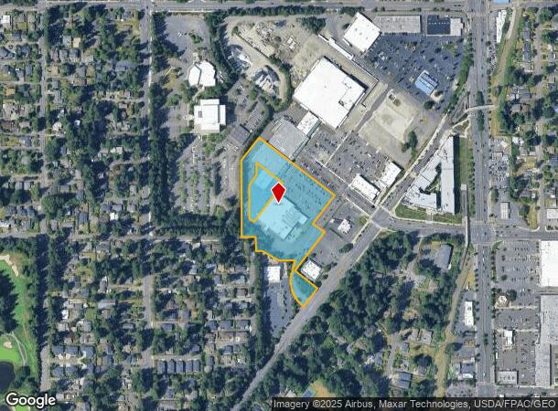
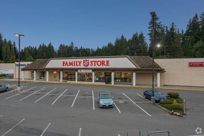
15403 Westminster Way N
Seattle-Tacoma-Bellevue, WA
Aurora Square
030650-0040
AURORA SQUARE LESS POR DAF - BEG NW COR LOT 2 SD PLAT TH N 1-05-49 W ALG W LN LOT 4 63.04 FT TH N 88-54-11 E 35 FT TH S 57-56-52 E 115.29 FT TO N LN SD LOT 2 TH S 88-54-11 W 131.53 FT & LESS BEG NE COR SD LOT 2 TH S 1-05-49 E ALG E LN THOF 191.32 FT
Storebuilding
King
X
Washington
53033C0330G
4
2025
5.45 AC
2024
Edmonds/Lynnwood
020900
Seattle/Puget Sound
59,750 SF
DEMOGRAPHICS near 15403 Westminster Way N
1 Mile
3 Mile
5 Mile
2024 Total Population
16,240
131,751
327,544
2029 Population
16,433
133,237
332,799
Pop Growth 2024-2029
+ 1.19%
+ 1.13%
+ 1.60%
Average Age
41
41
41
2024 Total Households
6,835
56,902
140,469
HH Growth 2024-2029
+ 1.20%
+ 1.16%
+ 1.62%
Median Household Inc
$90,964
$92,867
$108,944
Avg Household Size
2.20
2.20
2.20
2024 Avg HH Vehicles
2.00
2.00
2.00
Median Home Value
$731,906
$761,046
$806,282
Median Year Built
1975
1972
1970
Nearby Places
Map Layers
Map Styles
 Street
 Aerial
- Restaurants
- Banks
- Shops
- Fitness
- Groceries
PUBLIC TRANSPORTATION
COMMUTER RAIL
Edmonds Station (Sounder South Line - Central Puget Sound Regional Transit Authority Rail (Link Light Rail/Sounder))
DRIVE
WALK
Distance
Edmonds Station (Sounder South Line - Central Puget Sound Regional Transit Authority Rail (Link Light Rail/Sounder))
15 min
6.5 mi
AIRPORT
Seattle Paine Field International
DRIVE
WALK
Distance
Seattle Paine Field International
26 min
13.5 mi
Seattle-Tacoma International
DRIVE
WALK
Distance
Seattle-Tacoma International
38 min
24.8 mi
Freight Ports
Port of Seattle
DRIVE
WALK
Distance
Port of Seattle
26 min
15.4 mi
SALE & LEASE HISTORY
LISTING DATE
SALE/LEASE

Sep 25, 2016
For Lease
Feb 27, 2023
For Lease
Nearby Properties
Address
Land Use
TOTAL SIZE
Lot Size
Zoning
Address
Land Use
TOTAL SIZE
Lot Size
Zoning
400,610 SF
77.69 AC
R6
Address
Land Use
TOTAL SIZE
Lot Size
Zoning
172,297 SF
4.21 AC
NC3-95 (M)
Address
Land Use
TOTAL SIZE
Lot Size
Zoning
10,090 SF
11.73 AC
NC3-95 (M)
Address
Land Use
TOTAL SIZE
Lot Size
Zoning
325,905 SF
22.50 AC
RM-1.5
Address
Land Use
TOTAL SIZE
Lot Size
Zoning
207,576 SF
5.98 AC
MR (M)
Address
Land Use
TOTAL SIZE
Lot Size
Zoning
183,056 SF
1.95 AC
C1-55 (M)
Address
Land Use
TOTAL SIZE
Lot Size
Zoning
168,619 SF
7.79 AC
NC3-145 (M
Address
Land Use
TOTAL SIZE
Lot Size
Zoning
54,224 SF
2.22 AC
NC3-55 (M)
Address
Land Use
TOTAL SIZE
Lot Size
Zoning
170,408 SF
1.85 AC
NC3-75 (M)
Address
Land Use
TOTAL SIZE
Lot Size
Zoning
131,236 SF
19.14 AC
R6
Address
Land Use
TOTAL SIZE
Lot Size
Zoning
69,799 SF
40.77 AC
RS-8
Address
Land Use
TOTAL SIZE
Lot Size
Zoning
288,283 SF
3.94 AC
NC3-75 (M)
Address
Land Use
TOTAL SIZE
Lot Size
Zoning
46,513 SF
5.90 AC
SM-NG 145
Address
Land Use
TOTAL SIZE
Lot Size
Zoning
220,000 SF
25.47 AC
R6
Address
Land Use
TOTAL SIZE
Lot Size
Zoning
234,128 SF
1.57 AC
NC3-145 (M
Address
Land Use
TOTAL SIZE
Lot Size
Zoning
179,340 SF
6.27 AC
LR2 (M)
Address
Land Use
TOTAL SIZE
Lot Size
Zoning
152,168 SF
3.02 AC
CZ
Address
Land Use
TOTAL SIZE
Lot Size
Zoning
172,514 SF
15.34 AC
MB
Address
Land Use
TOTAL SIZE
Lot Size
Zoning
3,284 SF
72.10 AC
R6
Address
Land Use
TOTAL SIZE
Lot Size
Zoning
115,440 SF
1.07 AC
MB
Address
Land Use
TOTAL SIZE
Lot Size
Zoning
236,309 SF
43.88 AC
R6
Address
Land Use
TOTAL SIZE
Lot Size
Zoning
181,168 SF
4.72 AC
MR (M)
Address
Land Use
TOTAL SIZE
Lot Size
Zoning
402,321 SF
32.47 AC
C
Address
Land Use
TOTAL SIZE
Lot Size
Zoning
36,975 SF
4.96 AC
NR2
Address
Land Use
TOTAL SIZE
Lot Size
Zoning
108,040 SF
28.20 AC
R6
Address
Land Use
TOTAL SIZE
Lot Size
Zoning
32,009 SF
1.60 AC
NC3-55 (M)
Address
Land Use
TOTAL SIZE
Lot Size
Zoning
130,572 SF
2 AC
C1-75 (M)
Address
Land Use
TOTAL SIZE
Lot Size
Zoning
17,853 SF
6.50 AC
NR2
Address
Land Use
TOTAL SIZE
Lot Size
Zoning
133,298 SF
11.12 AC
NC3-95 (M)
Address
Land Use
TOTAL SIZE
Lot Size
Zoning
152,658 SF
2.81 AC
R18
The World's #1 Commercial Real Estate Marketplace
Connect with us
© 2025 CoStar Group
The information above has been obtained from sources believed reliable. While we do not doubt its accuracy we have not verified it and make no guarantee, warranty or representation about it. It is your responsibility to independently confirm its accuracy and completeness. Any projections, opinions, assumptions, or estimates used are for example only and do not represent the current or future performance of the property. The value of this transaction to you depends on tax and other factors which should be evaluated by your tax, financial, and legal advisors. You and your advisors should conduct a careful, independent investigation of the property to determine to your satisfaction the suitability of the property for your needs.