Property Record
1541 Northside Dr, Memphis, TN 38127


NEARBY LISTINGS FOR SALE OR LEASE
-
-
View all Memphis listings for sale on LoopNet.com
Property Detail
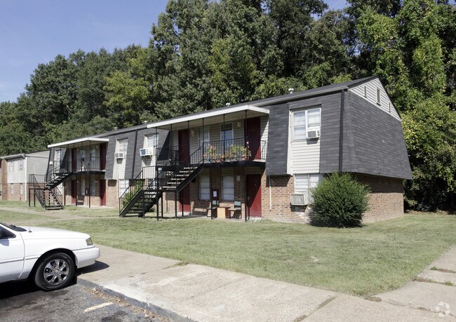
1541 Northside Dr
06-9065-0-0083
Overton
Apartment
Shelby
AE
Tennessee
05035C0375E
1
0
12.57 AC
2025
Frayser
009901
Memphis
53,176 SF
Memphis, TN-MS-AR
DEMOGRAPHICS near 1541 Northside Dr
1 Mile
3 Mile
5 Mile
2024 Total Population
6,443
41,343
87,878
2029 Population
6,431
41,437
88,296
Pop Growth 2024-2029
(0.19%)
+ 0.23%
+ 0.48%
Average Age
34
35
36
2024 Total Households
2,308
14,624
33,759
HH Growth 2024-2029
(0.30%)
+ 0.13%
+ 0.36%
Median Household Inc
$30,543
$36,661
$37,102
Avg Household Size
2.80
2.70
2.50
2024 Avg HH Vehicles
2.00
2.00
1.00
Median Home Value
$63,748
$69,729
$84,946
Median Year Built
1963
1966
1968
Nearby Places
Map Layers
Map Styles
 Street
 Aerial
- Restaurants
- Banks
- Shops
- Fitness
- Groceries
PUBLIC TRANSPORTATION
COMMUTER RAIL
Central Station (Riverfront Loop - Memphis Area Transit Authority Trolley (MataTrolley))
DRIVE
WALK
Distance
Central Station (Riverfront Loop - Memphis Area Transit Authority Trolley (MataTrolley))
14 min
8.7 mi
AIRPORT
Memphis International
DRIVE
WALK
Distance
Memphis International
25 min
16.3 mi
Freight Ports
Port of Shreveport
DRIVE
WALK
Distance
Port of Shreveport
407 min
374.9 mi
Nearby Properties
Address
Land Use
TOTAL SIZE
Lot Size
Zoning
Address
Land Use
TOTAL SIZE
Lot Size
Zoning
1,709,372 SF
28.70 AC
EMP
Address
Land Use
TOTAL SIZE
Lot Size
Zoning
1,146,617 SF
62.32 AC
EMP
Address
Land Use
TOTAL SIZE
Lot Size
Zoning
111,016 SF
6.90 AC
CMU-1
Address
Land Use
TOTAL SIZE
Lot Size
Zoning
201,722 SF
64.13 AC
EMP
Address
Land Use
TOTAL SIZE
Lot Size
Zoning
92,798 SF
12.66 AC
RU-3
Address
Land Use
TOTAL SIZE
Lot Size
Zoning
56,620 SF
25.08 AC
R-6
Address
Land Use
TOTAL SIZE
Lot Size
Zoning
32,116 SF
7.61 AC
R-6
Address
Land Use
TOTAL SIZE
Lot Size
Zoning
19,013 SF
3.51 AC
RU-3
Address
Land Use
TOTAL SIZE
Lot Size
Zoning
18,492 SF
8.35 AC
R-6
Address
Land Use
TOTAL SIZE
Lot Size
Zoning
47,756 SF
9.94 AC
RU-3
Address
Land Use
TOTAL SIZE
Lot Size
Zoning
35,890 SF
10.53 AC
RU-3
Address
Land Use
TOTAL SIZE
Lot Size
Zoning
10.26 AC
R-10
Address
Land Use
TOTAL SIZE
Lot Size
Zoning
39,628 SF
8.81 AC
RU-3
Address
Land Use
TOTAL SIZE
Lot Size
Zoning
22,925 SF
13.53 AC
RU-3
Address
Land Use
TOTAL SIZE
Lot Size
Zoning
48,194 SF
5.49 AC
R-6
Address
Land Use
TOTAL SIZE
Lot Size
Zoning
51,253 SF
17.50 AC
RU-3
Address
Land Use
TOTAL SIZE
Lot Size
Zoning
37,092 SF
4.30 AC
RU-3
Address
Land Use
TOTAL SIZE
Lot Size
Zoning
236,244 SF
11.24 AC
EMP
Address
Land Use
TOTAL SIZE
Lot Size
Zoning
84,851 SF
11.25 AC
CMU-2
Address
Land Use
TOTAL SIZE
Lot Size
Zoning
62,008 SF
6.45 AC
RU-3
Address
Land Use
TOTAL SIZE
Lot Size
Zoning
49,200 SF
3.38 AC
CMU-2
Address
Land Use
TOTAL SIZE
Lot Size
Zoning
12,231 SF
4.10 AC
CMU-2
Address
Land Use
TOTAL SIZE
Lot Size
Zoning
35,562 SF
1.45 AC
CMU-1
Address
Land Use
TOTAL SIZE
Lot Size
Zoning
56,185 SF
3.53 AC
CMU-3
Address
Land Use
TOTAL SIZE
Lot Size
Zoning
33,590 SF
10.46 AC
RU-3
Address
Land Use
TOTAL SIZE
Lot Size
Zoning
16,545 SF
3.25 AC
CMU-2
Address
Land Use
TOTAL SIZE
Lot Size
Zoning
64,810 SF
6.68 AC
CMU-2
Address
Land Use
TOTAL SIZE
Lot Size
Zoning
34.67 AC
EMP
Address
Land Use
TOTAL SIZE
Lot Size
Zoning
40,320 SF
6.83 AC
RU-3
The World's #1 Commercial Real Estate Marketplace
Connect with us
© 2026 CoStar Group
The information above has been obtained from sources believed reliable. While we do not doubt its accuracy we have not verified it and make no guarantee, warranty or representation about it. It is your responsibility to independently confirm its accuracy and completeness. Any projections, opinions, assumptions, or estimates used are for example only and do not represent the current or future performance of the property. The value of this transaction to you depends on tax and other factors which should be evaluated by your tax, financial, and legal advisors. You and your advisors should conduct a careful, independent investigation of the property to determine to your satisfaction the suitability of the property for your needs.