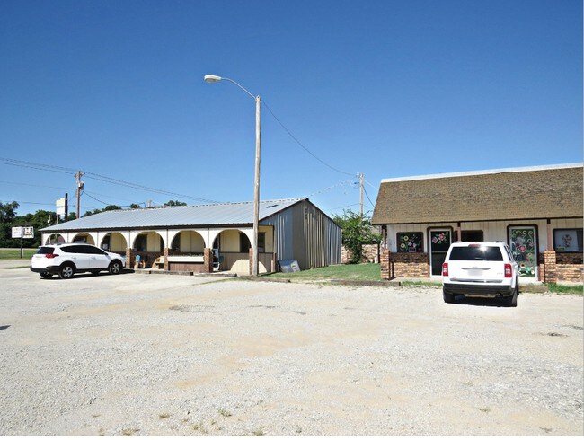
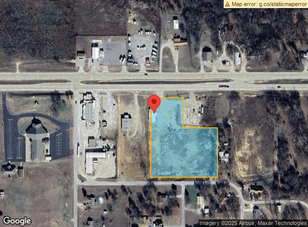
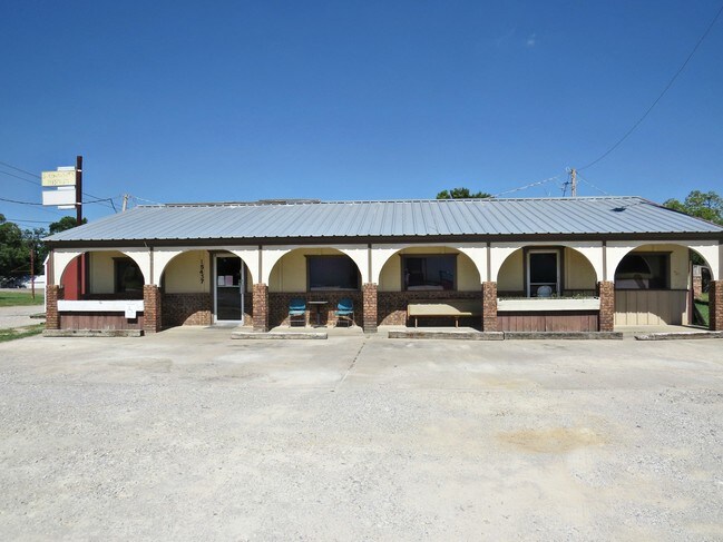
Property Record
15437 Us Highway 70, Ardmore, OK 73401
NEARBY LISTINGS FOR SALE OR LEASE
-
-
No Photo
-
View all Ardmore listings for lease on LoopNet.com
Property Detail
15437 Us Highway 70
2990-31-04S-01E-1-001-00
Lone Grove City Tracts
Farmsupplyequipmentretail
PT NE DESC AS BEG AT A POINT 452.29 E & 136.49 S NW/C NE; S 524.51; E 429.21; N 330; W 220.50; N 194.25; W 208.71 TO POB-31 04S 01E
X
Carter
40019C0440C
Oklahoma
2024
1e
2025
4.18 AC
892501
Other Market Areas
520 SF
Ardmore, OK
DEMOGRAPHICS near 15437 Us Highway 70
1 Mile
3 Mile
5 Mile
2024 Total Population
1,398
5,359
11,500
2029 Population
1,415
5,400
11,615
Pop Growth 2024-2029
+ 1.22%
+ 0.77%
+ 1.00%
Average Age
39
39
40
2024 Total Households
496
1,948
4,398
HH Growth 2024-2029
+ 1.01%
+ 0.72%
+ 0.95%
Median Household Inc
$71,010
$70,910
$71,788
Avg Household Size
2.70
2.70
2.50
2024 Avg HH Vehicles
2.00
2.00
2.00
Median Home Value
$174,489
$180,642
$193,381
Median Year Built
1984
1987
1984
Nearby Places
Map Layers
Map Styles
 Street
 Aerial
- Restaurants
- Banks
- Shops
- Fitness
- Groceries
SALE & LEASE HISTORY
LISTING DATE
SALE/LEASE

Sep 06, 2017
For Lease
Sep 05, 2018
For Lease
May 14, 2018
For Sale
Nearby Properties
Address
Land Use
TOTAL SIZE
Lot Size
Zoning
Address
Land Use
TOTAL SIZE
Lot Size
Zoning
1,134 SF
4.03 AC
C1
Address
Land Use
TOTAL SIZE
Lot Size
Zoning
264 SF
5.38 AC
C1
Address
Land Use
TOTAL SIZE
Lot Size
Zoning
3,000 SF
58.77 AC
NP
Address
Land Use
TOTAL SIZE
Lot Size
Zoning
6,622 SF
2.98 AC
R1
Address
Land Use
TOTAL SIZE
Lot Size
Zoning
224 SF
2.03 AC
C1
Address
Land Use
TOTAL SIZE
Lot Size
Zoning
16,000 SF
2.98 AC
C1
Address
Land Use
TOTAL SIZE
Lot Size
Zoning
579 SF
3.01 AC
C1
Address
Land Use
TOTAL SIZE
Lot Size
Zoning
1,204 SF
7.73 AC
C1
Address
Land Use
TOTAL SIZE
Lot Size
Zoning
2,548 SF
0.77 AC
C1
Address
Land Use
TOTAL SIZE
Lot Size
Zoning
2,560 SF
5.12 AC
C1
Address
Land Use
TOTAL SIZE
Lot Size
Zoning
160 SF
5.27 AC
C1
Address
Land Use
TOTAL SIZE
Lot Size
Zoning
1,728 SF
53.89 AC
NP
Address
Land Use
TOTAL SIZE
Lot Size
Zoning
4,550 SF
11.72 AC
C1
Address
Land Use
TOTAL SIZE
Lot Size
Zoning
4,695 SF
3 AC
R1
Address
Land Use
TOTAL SIZE
Lot Size
Zoning
1,006 SF
1.93 AC
C1
Address
Land Use
TOTAL SIZE
Lot Size
Zoning
864 SF
0.58 AC
C1
Address
Land Use
TOTAL SIZE
Lot Size
Zoning
1,362 SF
5 AC
C1
Address
Land Use
TOTAL SIZE
Lot Size
Zoning
7,286 SF
20.76 AC
C1
Address
Land Use
TOTAL SIZE
Lot Size
Zoning
3,444 SF
30 AC
NP
Address
Land Use
TOTAL SIZE
Lot Size
Zoning
210 SF
1.07 AC
C1
Address
Land Use
TOTAL SIZE
Lot Size
Zoning
20 AC
NP
Address
Land Use
TOTAL SIZE
Lot Size
Zoning
3,500 SF
7.07 AC
C1
Address
Land Use
TOTAL SIZE
Lot Size
Zoning
374 SF
0.57 AC
C1
Address
Land Use
TOTAL SIZE
Lot Size
Zoning
432 SF
3 AC
R1
Address
Land Use
TOTAL SIZE
Lot Size
Zoning
1,512 SF
1.01 AC
C1
Address
Land Use
TOTAL SIZE
Lot Size
Zoning
4,000 SF
13.78 AC
C1
Address
Land Use
TOTAL SIZE
Lot Size
Zoning
9,600 SF
1.18 AC
C1
Address
Land Use
TOTAL SIZE
Lot Size
Zoning
375 SF
0.28 AC
C1
Address
Land Use
TOTAL SIZE
Lot Size
Zoning
3,200 SF
2.63 AC
C1
The World's #1 Commercial Real Estate Marketplace
Connect with us
© 2025 CoStar Group
The information above has been obtained from sources believed reliable. While we do not doubt its accuracy we have not verified it and make no guarantee, warranty or representation about it. It is your responsibility to independently confirm its accuracy and completeness. Any projections, opinions, assumptions, or estimates used are for example only and do not represent the current or future performance of the property. The value of this transaction to you depends on tax and other factors which should be evaluated by your tax, financial, and legal advisors. You and your advisors should conduct a careful, independent investigation of the property to determine to your satisfaction the suitability of the property for your needs.