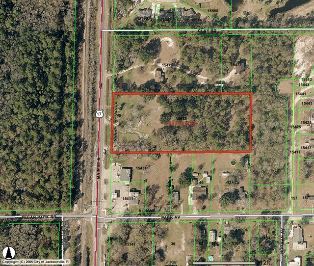
Property Record
15453 N Main St, Jacksonville, FL 32218


NEARBY LISTINGS FOR SALE OR LEASE
Property Detail
15453 N Main St
Jacksonville, FL
Pleasant Park
108295-0000
9-31 40-1N-27E PLEASANT PARK LOT 8
Commercialacreage
Duval
X
Florida
12031C0065J
8
2025
4.69 AC
2026
Northeast Jacksonville
010101
Jacksonville (Florida)
DEMOGRAPHICS near 15453 N Main St
1 Mile
3 Mile
5 Mile
2024 Total Population
2,947
16,105
41,190
2029 Population
3,118
17,015
43,736
Pop Growth 2024-2029
+ 5.80%
+ 5.65%
+ 6.18%
Average Age
35
38
38
2024 Total Households
991
5,664
15,193
HH Growth 2024-2029
+ 5.95%
+ 5.84%
+ 6.59%
Median Household Inc
$102,638
$83,990
$76,801
Avg Household Size
2.90
2.70
2.60
2024 Avg HH Vehicles
2.00
2.00
2.00
Median Home Value
$263,513
$269,251
$267,140
Median Year Built
2010
2006
2005
Nearby Places
Map Layers
Map Styles
 Street
 Aerial
- Restaurants
- Banks
- Shops
- Fitness
- Groceries
PUBLIC TRANSPORTATION
AIRPORT
Jacksonville International
DRIVE
WALK
Distance
Jacksonville International
17 min
7.4 mi
Freight Ports
Jacksonville Port
DRIVE
WALK
Distance
Jacksonville Port
27 min
17.8 mi
SALE & LEASE HISTORY
LISTING DATE
SALE/LEASE

Sep 24, 2016
For Sale
Nearby Properties
Address
Land Use
TOTAL SIZE
Lot Size
Zoning
Address
Land Use
TOTAL SIZE
Lot Size
Zoning
344,800 SF
35.11 AC
PUD
Address
Land Use
TOTAL SIZE
Lot Size
Zoning
226,421 SF
1.89 AC
PUD
Address
Land Use
TOTAL SIZE
Lot Size
Zoning
201,630 SF
21.59 AC
PUD
Address
Land Use
TOTAL SIZE
Lot Size
Zoning
240,988 SF
18.11 AC
PUD
Address
Land Use
TOTAL SIZE
Lot Size
Zoning
210,341 SF
8.84 AC
PUD
Address
Land Use
TOTAL SIZE
Lot Size
Zoning
317,815 SF
17.56 AC
PUD
Address
Land Use
TOTAL SIZE
Lot Size
Zoning
163,276 SF
8.39 AC
PUD
Address
Land Use
TOTAL SIZE
Lot Size
Zoning
197,526 SF
11.98 AC
PUD
Address
Land Use
TOTAL SIZE
Lot Size
Zoning
226,572 SF
9.24 AC
PUD
Address
Land Use
TOTAL SIZE
Lot Size
Zoning
86,637 SF
8.09 AC
CCG-1
Address
Land Use
TOTAL SIZE
Lot Size
Zoning
90,363 SF
11.12 AC
PUD
Address
Land Use
TOTAL SIZE
Lot Size
Zoning
110,968 SF
5.75 AC
PUD
Address
Land Use
TOTAL SIZE
Lot Size
Zoning
28,653 SF
2.89 AC
PUD
Address
Land Use
TOTAL SIZE
Lot Size
Zoning
81,802 SF
9.34 AC
PUD
Address
Land Use
TOTAL SIZE
Lot Size
Zoning
93.72 AC
PUD
Address
Land Use
TOTAL SIZE
Lot Size
Zoning
9,750 SF
71.20 AC
IL
Address
Land Use
TOTAL SIZE
Lot Size
Zoning
50,034 SF
8.72 AC
PUD
Address
Land Use
TOTAL SIZE
Lot Size
Zoning
24.37 AC
PUD
Address
Land Use
TOTAL SIZE
Lot Size
Zoning
56,488 SF
4.18 AC
PUD
Address
Land Use
TOTAL SIZE
Lot Size
Zoning
322,359 SF
14.85 AC
CCG-1
Address
Land Use
TOTAL SIZE
Lot Size
Zoning
283,827 SF
98.64 AC
IL
Address
Land Use
TOTAL SIZE
Lot Size
Zoning
26,910 SF
2.14 AC
PUD
Address
Land Use
TOTAL SIZE
Lot Size
Zoning
22,607 SF
1.95 AC
PUD
Address
Land Use
TOTAL SIZE
Lot Size
Zoning
8,916 SF
26.61 AC
PUD
Address
Land Use
TOTAL SIZE
Lot Size
Zoning
602.71 AC
PUD
Address
Land Use
TOTAL SIZE
Lot Size
Zoning
97,130 SF
6 AC
CCG-1
Address
Land Use
TOTAL SIZE
Lot Size
Zoning
53,506 SF
7.16 AC
RLD-70
Address
Land Use
TOTAL SIZE
Lot Size
Zoning
41,467 SF
13.91 AC
RLD-60
Address
Land Use
TOTAL SIZE
Lot Size
Zoning
30,727 SF
13.71 AC
CCG-1
Address
Land Use
TOTAL SIZE
Lot Size
Zoning
35,256 SF
34.79 AC
PUD
The World's #1 Commercial Real Estate Marketplace
Connect with us
© 2026 CoStar Group
The information above has been obtained from sources believed reliable. While we do not doubt its accuracy we have not verified it and make no guarantee, warranty or representation about it. It is your responsibility to independently confirm its accuracy and completeness. Any projections, opinions, assumptions, or estimates used are for example only and do not represent the current or future performance of the property. The value of this transaction to you depends on tax and other factors which should be evaluated by your tax, financial, and legal advisors. You and your advisors should conduct a careful, independent investigation of the property to determine to your satisfaction the suitability of the property for your needs.