Property Record
1546 Tempest Ct, Bozeman, MT 59718

Property Detail
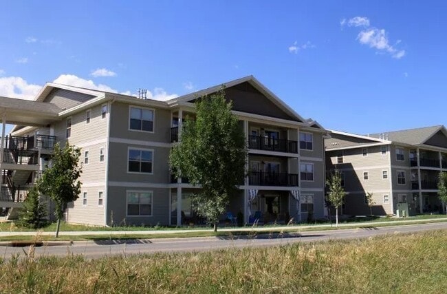
1546 Tempest Ct
Bozeman, MT
WEST WINDS SUB PH 1A &1B, S02, T02 S, R05 E, BLOCK 4, LOT 1, PLUS OPEN SPACE PLAT J-411
06-0798-02-2-04-01-0000
Gallatin
Gardenaptcourtapt5plusunits
Montana
B and X Area of moderate flood hazard, usually the area between the limits of the 100-year and 500-year floods.
1
2025
1.33 AC
2025
Bozeman/Yellowstone Country
000506
Other Market Areas
30,801 SF
NEARBY LISTINGS FOR SALE OR LEASE
DEMOGRAPHICS near 1546 Tempest Ct
1 mile
3 mile
5 mile
2025 Total Population
13,044
58,218
76,749
2030 Population
13,747
61,271
80,431
Pop Growth 2025-2030
+ 5.39%
+ 5.24%
+ 4.80%
Average Age
36
35
37
2025 Total Households
5,531
24,203
31,346
HH Growth 2025-2030
+ 5.68%
+ 5.70%
+ 5.25%
Median Household Inc
$85,891
$87,610
$94,113
Avg Household Size
2.30
2.20
2.30
2025 Avg HH Vehicles
2.00
2.00
2.00
Median Home Value
$665,237
$727,588
$765,191
Median Year Built
2009
2005
2004
Nearby Places
Map Layers
Map Styles
 Street
 Aerial
Layers
 Traffic
 Biking
Places
Listings with unknown addresses are not visible on the map
- Restaurants
- Banks
- Shops
- Fitness
- Groceries
PUBLIC TRANSPORTATION
AIRPORT
Bozeman Yellowstone International
Drive
Walk
Distance
Bozeman Yellowstone International
15 min
8.9 mi
Freight Ports
Port of Everett
Drive
Walk
Distance
Port of Everett
746 min
699.3 mi
Nearby Properties
Address
Land Use
TOTAL SIZE
Lot Size
Zoning
Address
Land Use
TOTAL SIZE
Lot Size
Zoning
15,099 SF
16.05 AC
Address
Land Use
TOTAL SIZE
Lot Size
Zoning
138,308 SF
58.03 AC
Address
Land Use
TOTAL SIZE
Lot Size
Zoning
33,109 SF
9.89 AC
Address
Land Use
TOTAL SIZE
Lot Size
Zoning
89,441 SF
0.46 AC
6
Address
Land Use
TOTAL SIZE
Lot Size
Zoning
214,283 SF
5.20 AC
Address
Land Use
TOTAL SIZE
Lot Size
Zoning
6,317 SF
9.14 AC
Address
Land Use
TOTAL SIZE
Lot Size
Zoning
23,325 SF
9.82 AC
Address
Land Use
TOTAL SIZE
Lot Size
Zoning
69,093 SF
8.96 AC
BP
Address
Land Use
TOTAL SIZE
Lot Size
Zoning
129,579 SF
9.74 AC
Address
Land Use
TOTAL SIZE
Lot Size
Zoning
10,368 SF
6.75 AC
Address
Land Use
TOTAL SIZE
Lot Size
Zoning
8,100 SF
64.73 AC
Address
Land Use
TOTAL SIZE
Lot Size
Zoning
33,771 SF
7.10 AC
Address
Land Use
TOTAL SIZE
Lot Size
Zoning
85,290 SF
7.82 AC
Address
Land Use
TOTAL SIZE
Lot Size
Zoning
20,118 SF
7.95 AC
Address
Land Use
TOTAL SIZE
Lot Size
Zoning
81,620 SF
10.65 AC
1
Address
Land Use
TOTAL SIZE
Lot Size
Zoning
85,052 SF
1.26 AC
6
Address
Land Use
TOTAL SIZE
Lot Size
Zoning
69,917 SF
0.68 AC
6
Address
Land Use
TOTAL SIZE
Lot Size
Zoning
259,349 SF
B2
Address
Land Use
TOTAL SIZE
Lot Size
Zoning
20,106 SF
8.23 AC
Address
Land Use
TOTAL SIZE
Lot Size
Zoning
96,944 SF
0.44 AC
1
Address
Land Use
TOTAL SIZE
Lot Size
Zoning
149,599 SF
18.41 AC
Address
Land Use
TOTAL SIZE
Lot Size
Zoning
119,732 SF
7.32 AC
Address
Land Use
TOTAL SIZE
Lot Size
Zoning
7,552 SF
8.60 AC
Address
Land Use
TOTAL SIZE
Lot Size
Zoning
90,003 SF
17.01 AC
Address
Land Use
TOTAL SIZE
Lot Size
Zoning
162,081 SF
4.95 AC
Address
Land Use
TOTAL SIZE
Lot Size
Zoning
19,938 SF
Address
Land Use
TOTAL SIZE
Lot Size
Zoning
90,347 SF
1.74 AC
5
Address
Land Use
TOTAL SIZE
Lot Size
Zoning
27,219 SF
10.11 AC
R3
Address
Land Use
TOTAL SIZE
Lot Size
Zoning
128,745 SF
4.24 AC
Address
Land Use
TOTAL SIZE
Lot Size
Zoning
162.22 AC
The World's #1 Commercial Real Estate Marketplace
Connect with us
© 2026 CoStar Group
The information above has been obtained from sources believed reliable. While we do not doubt its accuracy we have not verified it and make no guarantee, warranty or representation about it. It is your responsibility to independently confirm its accuracy and completeness. Any projections, opinions, assumptions, or estimates used are for example only and do not represent the current or future performance of the property. The value of this transaction to you depends on tax and other factors which should be evaluated by your tax, financial, and legal advisors. You and your advisors should conduct a careful, independent investigation of the property to determine to your satisfaction the suitability of the property for your needs.