Property Record
1547 Military Rd, Buffalo, NY 14217
NEARBY LISTINGS FOR SALE OR LEASE
Property Detail
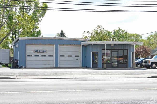
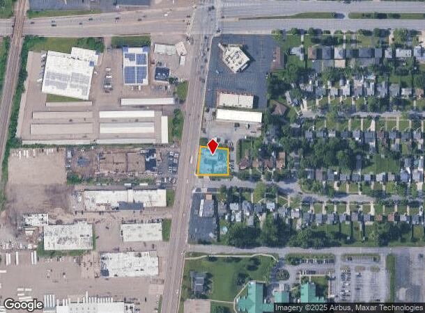
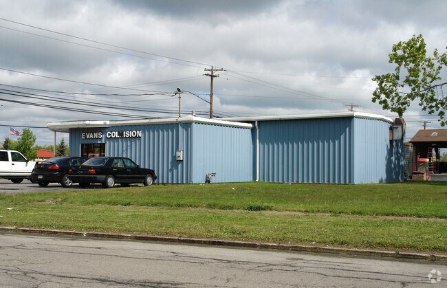
1547 Military Rd
Buffalo-Cheektowaga-Niagara Falls, NY
The Holland Land Companys Survey
146489-065-440-0001-029-000
COR N LOWELL RD 1199 253 254PT 252 114.9X 127
Autorepair
Erie
X
New York
36029C0182H
29.000
2025
0.34 AC
2024
North
008202
Buffalo/Niagara Falls
740 SF
DEMOGRAPHICS near 1547 Military Rd
1 Mile
3 Mile
5 Mile
2024 Total Population
14,221
115,782
280,531
2029 Population
14,012
113,532
275,661
Pop Growth 2024-2029
(1.47%)
(1.94%)
(1.74%)
Average Age
42
41
39
2024 Total Households
6,499
52,100
119,788
HH Growth 2024-2029
(1.66%)
(1.99%)
(1.81%)
Median Household Inc
$57,106
$58,976
$57,875
Avg Household Size
2.10
2.20
2.20
2024 Avg HH Vehicles
1.00
1.00
1.00
Median Home Value
$155,137
$164,677
$175,363
Median Year Built
1951
1949
1949
Nearby Places
- Restaurants
- Banks
- Shops
- Fitness
- Groceries
PUBLIC TRANSPORTATION
AIRPORT
Buffalo Niagara International
DRIVE
WALK
Distance
Buffalo Niagara International
20 min
9.8 mi
Niagara Falls International
DRIVE
WALK
Distance
Niagara Falls International
20 min
10.2 mi
Freight Ports
Port of Toledo
DRIVE
WALK
Distance
Port of Toledo
372 min
312.7 mi
SALE & LEASE HISTORY
LISTING DATE
SALE/LEASE

Jul 06, 2017
For Sale
Nearby Properties
Address
Land Use
TOTAL SIZE
Lot Size
Zoning
Address
Land Use
TOTAL SIZE
Lot Size
Zoning
139,224 SF
13.72 AC
WID
Address
Land Use
TOTAL SIZE
Lot Size
Zoning
80,927 SF
28.20 AC
WID
Address
Land Use
TOTAL SIZE
Lot Size
Zoning
239,735 SF
17.73 AC
TND
Address
Land Use
TOTAL SIZE
Lot Size
Zoning
650,000 SF
42.15 AC
G-1
Address
Land Use
TOTAL SIZE
Lot Size
Zoning
67,666 SF
17.43 AC
G-1
Address
Land Use
TOTAL SIZE
Lot Size
Zoning
3.20 AC
G-1
Address
Land Use
TOTAL SIZE
Lot Size
Zoning
11,808 SF
11.93 AC
N-3R
Address
Land Use
TOTAL SIZE
Lot Size
Zoning
2,474 SF
24.84 AC
Address
Land Use
TOTAL SIZE
Lot Size
Zoning
67,000 SF
6.50 AC
Address
Land Use
TOTAL SIZE
Lot Size
Zoning
120,954 SF
9.74 AC
D-S
Address
Land Use
TOTAL SIZE
Lot Size
Zoning
356,891 SF
21.33 AC
B
Address
Land Use
TOTAL SIZE
Lot Size
Zoning
16 AC
G-1
Address
Land Use
TOTAL SIZE
Lot Size
Zoning
151,641 SF
1.53 AC
N-1S
Address
Land Use
TOTAL SIZE
Lot Size
Zoning
107,490 SF
3.55 AC
Address
Land Use
TOTAL SIZE
Lot Size
Zoning
81,224 SF
0.45 AC
Address
Land Use
TOTAL SIZE
Lot Size
Zoning
33,970 SF
9.70 AC
Address
Land Use
TOTAL SIZE
Lot Size
Zoning
135,140 SF
25.60 AC
Address
Land Use
TOTAL SIZE
Lot Size
Zoning
138,000 SF
7.30 AC
P-S
Address
Land Use
TOTAL SIZE
Lot Size
Zoning
97,298 SF
15.28 AC
D-S
Address
Land Use
TOTAL SIZE
Lot Size
Zoning
Address
Land Use
TOTAL SIZE
Lot Size
Zoning
3,840 SF
11.80 AC
D-R
Address
Land Use
TOTAL SIZE
Lot Size
Zoning
13,836 SF
7.70 AC
D-R
Address
Land Use
TOTAL SIZE
Lot Size
Zoning
62,169 SF
29.44 AC
N-3R
Address
Land Use
TOTAL SIZE
Lot Size
Zoning
265,850 SF
19.35 AC
Address
Land Use
TOTAL SIZE
Lot Size
Zoning
Address
Land Use
TOTAL SIZE
Lot Size
Zoning
259,454 SF
7.66 AC
N-3R
Address
Land Use
TOTAL SIZE
Lot Size
Zoning
Address
Land Use
TOTAL SIZE
Lot Size
Zoning
260,199 SF
16.25 AC
Address
Land Use
TOTAL SIZE
Lot Size
Zoning
122,248 SF
9.15 AC
D-S
Address
Land Use
TOTAL SIZE
Lot Size
Zoning
2,797 SF
0.16 AC
N-1S
The World's #1 Commercial Real Estate Marketplace
Connect with us
© 2025 CoStar Group
The information above has been obtained from sources believed reliable. While we do not doubt its accuracy we have not verified it and make no guarantee, warranty or representation about it. It is your responsibility to independently confirm its accuracy and completeness. Any projections, opinions, assumptions, or estimates used are for example only and do not represent the current or future performance of the property. The value of this transaction to you depends on tax and other factors which should be evaluated by your tax, financial, and legal advisors. You and your advisors should conduct a careful, independent investigation of the property to determine to your satisfaction the suitability of the property for your needs.