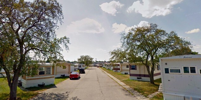
Property Record
1549 E Atherton Rd, Flint, MI 48507

Property Detail
1549 E Atherton Rd
41-21-351-021
PART OF S 1/2 OF SW 1/4 OF SEC 21, T7N, R7E. COM AT SWLY COR OF SD SEC; TH S 89 DEG 45 MIN 30 SEC E ALG SLY LINE OF SD SEC,
Commercialnec
Genesee
GN-1
Michigan
B and X Area of moderate flood hazard, usually the area between the limits of the 100-year and 500-year floods.
0.25 AC
2024
South Flint/Grand Blanc
2025
Detroit
003400
Flint, MI
939 SF
NEARBY LISTINGS FOR SALE OR LEASE
DEMOGRAPHICS near 1549 E Atherton Rd
1 mile
3 mile
5 mile
2025 Total Population
8,283
56,339
137,245
2030 Population
8,385
56,424
137,478
Pop Growth 2025-2030
+ 1.23%
+ 0.15%
+ 0.17%
Average Age
35
39
40
2025 Total Households
3,305
23,585
56,920
HH Growth 2025-2030
+ 1.15%
+ 0.17%
+ 0.17%
Median Household Inc
$32,275
$44,759
$50,287
Avg Household Size
2.40
2.30
2.30
2025 Avg HH Vehicles
1.00
1.00
2.00
Median Home Value
$83,775
$98,957
$123,640
Median Year Built
1962
1958
1960
Nearby Places
Map Layers
Map Styles
 Street
 Aerial
Layers
 Traffic
 Biking
Places
Listings with unknown addresses are not visible on the map
- Restaurants
- Banks
- Shops
- Fitness
- Groceries
PUBLIC TRANSPORTATION
COMMUTER RAIL
Drive
Walk
Distance
5 min
2.1 mi
AIRPORT
Bishop International
Drive
Walk
Distance
Bishop International
23 min
11.8 mi
Nearby Properties
Address
Land Use
TOTAL SIZE
Lot Size
Zoning
Address
Land Use
TOTAL SIZE
Lot Size
Zoning
Address
Land Use
TOTAL SIZE
Lot Size
Zoning
290,267 SF
79 AC
PC
Address
Land Use
TOTAL SIZE
Lot Size
Zoning
130,291 SF
Address
Land Use
TOTAL SIZE
Lot Size
Zoning
227,755 SF
32.27 AC
C-2
Address
Land Use
TOTAL SIZE
Lot Size
Zoning
354,079 SF
48.41 AC
C-4
Address
Land Use
TOTAL SIZE
Lot Size
Zoning
144,896 SF
0.23 AC
DC
Address
Land Use
TOTAL SIZE
Lot Size
Zoning
115,556 SF
2.50 AC
DE
Address
Land Use
TOTAL SIZE
Lot Size
Zoning
371,636 SF
12.50 AC
M-1
Address
Land Use
TOTAL SIZE
Lot Size
Zoning
100,000 SF
Address
Land Use
TOTAL SIZE
Lot Size
Zoning
60,613 SF
12.91 AC
RO
Address
Land Use
TOTAL SIZE
Lot Size
Zoning
68,571 SF
0.81 AC
DC
Address
Land Use
TOTAL SIZE
Lot Size
Zoning
246,759 SF
19.03 AC
CC
Address
Land Use
TOTAL SIZE
Lot Size
Zoning
24.38 AC
RM
Address
Land Use
TOTAL SIZE
Lot Size
Zoning
91,726 SF
7.28 AC
HDM
Address
Land Use
TOTAL SIZE
Lot Size
Zoning
111,882 SF
5.36 AC
C-4
Address
Land Use
TOTAL SIZE
Lot Size
Zoning
419,038 SF
57.18 AC
M-2
Address
Land Use
TOTAL SIZE
Lot Size
Zoning
49,582 SF
25.15 AC
HRM
Address
Land Use
TOTAL SIZE
Lot Size
Zoning
364,289 SF
24.80 AC
GN-1
Address
Land Use
TOTAL SIZE
Lot Size
Zoning
136,506 SF
16.54 AC
C-4
Address
Land Use
TOTAL SIZE
Lot Size
Zoning
236,340 SF
25.17 AC
CE
Address
Land Use
TOTAL SIZE
Lot Size
Zoning
11.22 AC
RM
Address
Land Use
TOTAL SIZE
Lot Size
Zoning
2,321 SF
18.59 AC
M-1
Address
Land Use
TOTAL SIZE
Lot Size
Zoning
2,829 SF
75.78 AC
RMH
Address
Land Use
TOTAL SIZE
Lot Size
Zoning
85,697 SF
0.30 AC
DC
Address
Land Use
TOTAL SIZE
Lot Size
Zoning
62.08 AC
MHP
Address
Land Use
TOTAL SIZE
Lot Size
Zoning
65,488 SF
0.30 AC
DC
Address
Land Use
TOTAL SIZE
Lot Size
Zoning
320,622 SF
14.93 AC
M-2
Address
Land Use
TOTAL SIZE
Lot Size
Zoning
74,816 SF
Address
Land Use
TOTAL SIZE
Lot Size
Zoning
98,932 SF
6.09 AC
GI-2
Address
Land Use
TOTAL SIZE
Lot Size
Zoning
149,982 SF
20.30 AC
TN-2
The World's #1 Commercial Real Estate Marketplace
Connect with us
© 2026 CoStar Group
The information above has been obtained from sources believed reliable. While we do not doubt its accuracy we have not verified it and make no guarantee, warranty or representation about it. It is your responsibility to independently confirm its accuracy and completeness. Any projections, opinions, assumptions, or estimates used are for example only and do not represent the current or future performance of the property. The value of this transaction to you depends on tax and other factors which should be evaluated by your tax, financial, and legal advisors. You and your advisors should conduct a careful, independent investigation of the property to determine to your satisfaction the suitability of the property for your needs.