Property Record
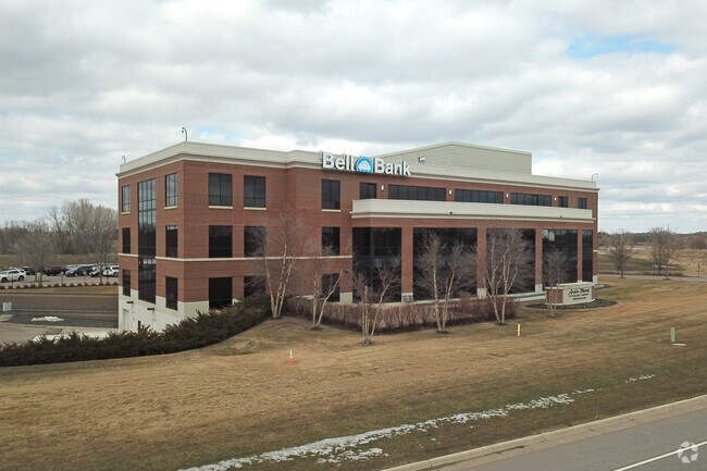
15490 101St Ave N, Maple Grove, MN 55369

NEARBY LISTINGS FOR SALE OR LEASE
Property Detail
15490 101St Ave N
Minneapolis-St. Paul-Bloomington, MN-WI
Austin Mutual 2Nd Addn
04-119-22-34-0011
LOT 001 BLOCK 001 T AUSTIN MUTUAL 2ND ADDN IRREGULAR
Commercialnec
Hennepin
X
Minnesota
27053C0063F
1
2024
6.88 AC
2024
Northwest
026708
Minneapolis/St Paul
78,147 SF
DEMOGRAPHICS near 15490 101St Ave N
1 Mile
3 Mile
5 Mile
2024 Total Population
2,274
34,014
89,773
2029 Population
2,337
33,538
88,766
Pop Growth 2024-2029
+ 2.77%
(1.40%)
(1.12%)
Average Age
39
40
40
2024 Total Households
871
12,664
33,815
HH Growth 2024-2029
+ 2.64%
(1.60%)
(1.30%)
Median Household Inc
$87,943
$120,534
$119,121
Avg Household Size
2.50
2.60
2.60
2024 Avg HH Vehicles
2.00
2.00
2.00
Median Home Value
$303,953
$365,513
$369,649
Median Year Built
1986
1991
1992
Nearby Places
Map Layers
Map Styles
 Street
 Aerial
- Restaurants
- Banks
- Shops
- Fitness
- Groceries
PUBLIC TRANSPORTATION
COMMUTER RAIL
Anoka Station (Northstar Corridor - Northstar Commuter Rail)
DRIVE
WALK
Distance
Anoka Station (Northstar Corridor - Northstar Commuter Rail)
18 min
9.4 mi
AIRPORT
Minneapolis-St Paul International/Wold-Chamberlain
DRIVE
WALK
Distance
Minneapolis-St Paul International/Wold-Chamberlain
46 min
32.7 mi
Freight Ports
Port Milwaukee
DRIVE
WALK
Distance
Port Milwaukee
396 min
358.5 mi
Nearby Properties
Address
Land Use
TOTAL SIZE
Lot Size
Zoning
Address
Land Use
TOTAL SIZE
Lot Size
Zoning
4.33 AC
Address
Land Use
TOTAL SIZE
Lot Size
Zoning
68.12 AC
Address
Land Use
TOTAL SIZE
Lot Size
Zoning
42.21 AC
Address
Land Use
TOTAL SIZE
Lot Size
Zoning
297,060 SF
19.17 AC
Address
Land Use
TOTAL SIZE
Lot Size
Zoning
25.06 AC
Address
Land Use
TOTAL SIZE
Lot Size
Zoning
Address
Land Use
TOTAL SIZE
Lot Size
Zoning
Address
Land Use
TOTAL SIZE
Lot Size
Zoning
Address
Land Use
TOTAL SIZE
Lot Size
Zoning
228,208 SF
24.92 AC
Address
Land Use
TOTAL SIZE
Lot Size
Zoning
10.44 AC
Address
Land Use
TOTAL SIZE
Lot Size
Zoning
132,200 SF
28.23 AC
Address
Land Use
TOTAL SIZE
Lot Size
Zoning
17.09 AC
Address
Land Use
TOTAL SIZE
Lot Size
Zoning
Address
Land Use
TOTAL SIZE
Lot Size
Zoning
Address
Land Use
TOTAL SIZE
Lot Size
Zoning
20.09 AC
Address
Land Use
TOTAL SIZE
Lot Size
Zoning
Address
Land Use
TOTAL SIZE
Lot Size
Zoning
11.45 AC
Address
Land Use
TOTAL SIZE
Lot Size
Zoning
218,144 SF
3.71 AC
Address
Land Use
TOTAL SIZE
Lot Size
Zoning
11.61 AC
Address
Land Use
TOTAL SIZE
Lot Size
Zoning
10.26 AC
Address
Land Use
TOTAL SIZE
Lot Size
Zoning
219,980 SF
18.09 AC
Address
Land Use
TOTAL SIZE
Lot Size
Zoning
168,961 SF
15.61 AC
Address
Land Use
TOTAL SIZE
Lot Size
Zoning
175,096 SF
18.91 AC
Address
Land Use
TOTAL SIZE
Lot Size
Zoning
178,023 SF
14.24 AC
Address
Land Use
TOTAL SIZE
Lot Size
Zoning
144,927 SF
28.23 AC
Address
Land Use
TOTAL SIZE
Lot Size
Zoning
78,300 SF
4.20 AC
Address
Land Use
TOTAL SIZE
Lot Size
Zoning
Address
Land Use
TOTAL SIZE
Lot Size
Zoning
160,680 SF
14.17 AC
Address
Land Use
TOTAL SIZE
Lot Size
Zoning
Address
Land Use
TOTAL SIZE
Lot Size
Zoning
42,498 SF
2.94 AC
The World's #1 Commercial Real Estate Marketplace
Connect with us
© 2025 CoStar Group
The information above has been obtained from sources believed reliable. While we do not doubt its accuracy we have not verified it and make no guarantee, warranty or representation about it. It is your responsibility to independently confirm its accuracy and completeness. Any projections, opinions, assumptions, or estimates used are for example only and do not represent the current or future performance of the property. The value of this transaction to you depends on tax and other factors which should be evaluated by your tax, financial, and legal advisors. You and your advisors should conduct a careful, independent investigation of the property to determine to your satisfaction the suitability of the property for your needs.