Property Record
155 Blake Ave, Fort Walton Beach, FL 32548


Current Lease Availabilities
NEARBY LISTINGS FOR SALE OR LEASE
Property Detail
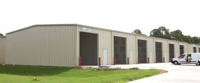
155 Blake Ave
Crestview-Fort Walton Beach-Destin, FL
Fort Walton Beach Industrial Park
09-2S-24-0000-0093-0090
COM SW COR OF NW1/4 OF SW1/4 S 66FT TO S R/W LOVEJOY RD AND POB E ALG R/W 400FT S2 DEG W 321.98FT N87 DEG W 392.23FT TO SAID W SEC LINE N 322.07FT TO POB AKA PARCEL #1 AND COM SW COR OF NW1/4 OF SW1/4 S 388.07FT TO POB S87 DEG E 392.23FT S2 DEG W 321
Warehouse
Okaloosa
X
Florida
12091C0441J
90
2023
5.80 AC
2024
Fort Walton Beach
022900
Other Market Areas
57,620 SF
DEMOGRAPHICS near 155 Blake Ave
1 Mile
3 Mile
5 Mile
2024 Total Population
5,798
40,684
67,826
2029 Population
6,089
42,562
71,335
Pop Growth 2024-2029
+ 5.02%
+ 4.62%
+ 5.17%
Average Age
39
39
40
2024 Total Households
2,258
16,904
28,991
HH Growth 2024-2029
+ 4.96%
+ 4.60%
+ 5.37%
Median Household Inc
$61,042
$59,134
$58,754
Avg Household Size
2.50
2.30
2.20
2024 Avg HH Vehicles
2.00
2.00
2.00
Median Home Value
$232,676
$246,842
$269,985
Median Year Built
1984
1981
1981
Nearby Places
Map Layers
Map Styles
 Street
 Aerial
- Restaurants
- Banks
- Shops
- Fitness
- Groceries
PUBLIC TRANSPORTATION
AIRPORT
Eglin AFB/Destin-Ft Walton Beach
DRIVE
WALK
Distance
Eglin AFB/Destin-Ft Walton Beach
32 min
13.7 mi
Freight Ports
Port of Panama City
DRIVE
WALK
Distance
Port of Panama City
101 min
62.2 mi
Nearby Properties
Address
Land Use
TOTAL SIZE
Lot Size
Zoning
Address
Land Use
TOTAL SIZE
Lot Size
Zoning
1,954.92 AC
Address
Land Use
TOTAL SIZE
Lot Size
Zoning
173,879 SF
9 AC
Address
Land Use
TOTAL SIZE
Lot Size
Zoning
342,628 SF
14.83 AC
Address
Land Use
TOTAL SIZE
Lot Size
Zoning
120,159 SF
14.82 AC
Address
Land Use
TOTAL SIZE
Lot Size
Zoning
216,839 SF
9.63 AC
Address
Land Use
TOTAL SIZE
Lot Size
Zoning
8,066.36 AC
Address
Land Use
TOTAL SIZE
Lot Size
Zoning
Address
Land Use
TOTAL SIZE
Lot Size
Zoning
55,566 SF
5.40 AC
Address
Land Use
TOTAL SIZE
Lot Size
Zoning
282,804 SF
78.70 AC
Address
Land Use
TOTAL SIZE
Lot Size
Zoning
Address
Land Use
TOTAL SIZE
Lot Size
Zoning
128,844 SF
4.86 AC
Address
Land Use
TOTAL SIZE
Lot Size
Zoning
182,844 SF
20.62 AC
Address
Land Use
TOTAL SIZE
Lot Size
Zoning
68,966 SF
6.03 AC
Address
Land Use
TOTAL SIZE
Lot Size
Zoning
140,945 SF
80.64 AC
Address
Land Use
TOTAL SIZE
Lot Size
Zoning
159,550 SF
31.10 AC
Address
Land Use
TOTAL SIZE
Lot Size
Zoning
108,284 SF
5.47 AC
Address
Land Use
TOTAL SIZE
Lot Size
Zoning
118,773 SF
26 AC
Address
Land Use
TOTAL SIZE
Lot Size
Zoning
75,892 SF
1.72 AC
Address
Land Use
TOTAL SIZE
Lot Size
Zoning
3,894 SF
315.07 AC
Address
Land Use
TOTAL SIZE
Lot Size
Zoning
121,164 SF
5.78 AC
Address
Land Use
TOTAL SIZE
Lot Size
Zoning
51,195 SF
6.10 AC
Address
Land Use
TOTAL SIZE
Lot Size
Zoning
287,257 SF
13.86 AC
Address
Land Use
TOTAL SIZE
Lot Size
Zoning
Address
Land Use
TOTAL SIZE
Lot Size
Zoning
78,958 SF
7.88 AC
Address
Land Use
TOTAL SIZE
Lot Size
Zoning
71,050 SF
2.52 AC
Address
Land Use
TOTAL SIZE
Lot Size
Zoning
16,204 SF
254.05 AC
Address
Land Use
TOTAL SIZE
Lot Size
Zoning
229,805 SF
19.31 AC
Address
Land Use
TOTAL SIZE
Lot Size
Zoning
146,143 SF
19.39 AC
Address
Land Use
TOTAL SIZE
Lot Size
Zoning
61,445 SF
3.47 AC
Address
Land Use
TOTAL SIZE
Lot Size
Zoning
65,995 SF
6.53 AC
The World's #1 Commercial Real Estate Marketplace
Connect with us
© 2025 CoStar Group
The information above has been obtained from sources believed reliable. While we do not doubt its accuracy we have not verified it and make no guarantee, warranty or representation about it. It is your responsibility to independently confirm its accuracy and completeness. Any projections, opinions, assumptions, or estimates used are for example only and do not represent the current or future performance of the property. The value of this transaction to you depends on tax and other factors which should be evaluated by your tax, financial, and legal advisors. You and your advisors should conduct a careful, independent investigation of the property to determine to your satisfaction the suitability of the property for your needs.