Property Record
155 E Galleria Dr, Henderson, NV 89011
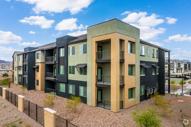

Property Detail
155 E Galleria Dr
Las Vegas-Henderson-North Las Vegas, NV
CADENCE NEIGHBORHOOD 5 PARCEL R2 AMD PLAT BOOK 165 PAGE 51 LOT 5R2-1B
179-06-513-007
CLARK
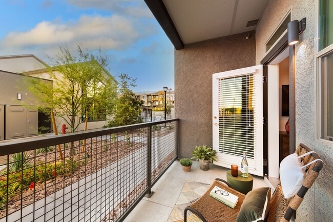
Apartment
Nevada
2026
5
2026
15.37 AC
005442
Valley View
9,493 SF
Las Vegas
NEARBY LISTINGS FOR SALE OR LEASE
-
-
View all Henderson listings for sale on LoopNet.com
DEMOGRAPHICS near 155 E Galleria Dr
1 mile
3 mile
5 mile
2025 Total Population
14,868
65,383
194,730
2030 Population
16,595
69,968
206,171
Pop Growth 2025-2030
+ 11.62%
+ 7.01%
+ 5.88%
Average Age
42
41
41
2025 Total Households
5,669
24,640
74,981
HH Growth 2025-2030
+ 11.71%
+ 7.16%
+ 5.97%
Median Household Inc
$120,611
$85,720
$83,364
Avg Household Size
2.60
2.60
2.50
2025 Avg HH Vehicles
2.00
2.00
2.00
Median Home Value
$591,642
$450,290
$434,050
Median Year Built
2011
2003
1999
Nearby Places
Map Layers
Map Styles
 Street
 Aerial
Layers
 Traffic
 Biking
Places
Listings with unknown addresses are not visible on the map
- Restaurants
- Banks
- Shops
- Fitness
- Groceries
PUBLIC TRANSPORTATION
AIRPORT
Boulder City Municipal
Drive
Walk
Distance
Boulder City Municipal
25 min
14.2 mi
Harry Reid International
Drive
Walk
Distance
Harry Reid International
52 min
15.9 mi
Nearby Properties
Address
Land Use
TOTAL SIZE
Lot Size
Zoning
Address
Land Use
TOTAL SIZE
Lot Size
Zoning
62,258 SF
59.95 AC
Address
Land Use
TOTAL SIZE
Lot Size
Zoning
251,075 SF
24.28 AC
Address
Land Use
TOTAL SIZE
Lot Size
Zoning
Address
Land Use
TOTAL SIZE
Lot Size
Zoning
31,463 SF
191.46 AC
PS
Address
Land Use
TOTAL SIZE
Lot Size
Zoning
502,625 SF
45.92 AC
Address
Land Use
TOTAL SIZE
Lot Size
Zoning
350.47 AC
PS
Address
Land Use
TOTAL SIZE
Lot Size
Zoning
10.50 AC
Address
Land Use
TOTAL SIZE
Lot Size
Zoning
81,485 SF
160.06 AC
PS
Address
Land Use
TOTAL SIZE
Lot Size
Zoning
387,990 SF
22.04 AC
Address
Land Use
TOTAL SIZE
Lot Size
Zoning
12.48 AC
Address
Land Use
TOTAL SIZE
Lot Size
Zoning
9,000 SF
96.81 AC
RE
Address
Land Use
TOTAL SIZE
Lot Size
Zoning
3,289 SF
22.36 AC
R3
Address
Land Use
TOTAL SIZE
Lot Size
Zoning
4,141 SF
9.15 AC
C2
Address
Land Use
TOTAL SIZE
Lot Size
Zoning
40,031 SF
21.25 AC
Address
Land Use
TOTAL SIZE
Lot Size
Zoning
78,760 SF
1.23 AC
Address
Land Use
TOTAL SIZE
Lot Size
Zoning
239,288 SF
14.10 AC
Address
Land Use
TOTAL SIZE
Lot Size
Zoning
250,076 SF
24.61 AC
Address
Land Use
TOTAL SIZE
Lot Size
Zoning
71,133 SF
7.56 AC
DP
Address
Land Use
TOTAL SIZE
Lot Size
Zoning
19,753 SF
10.21 AC
DP
Address
Land Use
TOTAL SIZE
Lot Size
Zoning
213,472 SF
7.46 AC
Address
Land Use
TOTAL SIZE
Lot Size
Zoning
3,664 SF
16.09 AC
RH20
Address
Land Use
TOTAL SIZE
Lot Size
Zoning
14,463 SF
19.48 AC
Address
Land Use
TOTAL SIZE
Lot Size
Zoning
3,293 SF
17.37 AC
H:RM-16-MP
Address
Land Use
TOTAL SIZE
Lot Size
Zoning
186,000 SF
13.63 AC
H:IG-MP
Address
Land Use
TOTAL SIZE
Lot Size
Zoning
1,254 SF
72.23 AC
PF
Address
Land Use
TOTAL SIZE
Lot Size
Zoning
136,465 SF
34.67 AC
Address
Land Use
TOTAL SIZE
Lot Size
Zoning
58.14 AC
PF
Address
Land Use
TOTAL SIZE
Lot Size
Zoning
168,361 SF
10.84 AC
The World's #1 Commercial Real Estate Marketplace
Connect with us
© 2026 CoStar Group
The information above has been obtained from sources believed reliable. While we do not doubt its accuracy we have not verified it and make no guarantee, warranty or representation about it. It is your responsibility to independently confirm its accuracy and completeness. Any projections, opinions, assumptions, or estimates used are for example only and do not represent the current or future performance of the property. The value of this transaction to you depends on tax and other factors which should be evaluated by your tax, financial, and legal advisors. You and your advisors should conduct a careful, independent investigation of the property to determine to your satisfaction the suitability of the property for your needs.