Property Record
155 E Steels Corners Rd, Stow, OH 44224
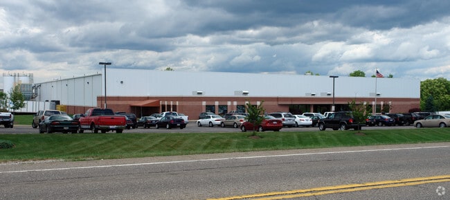


Property Detail
155 E Steels Corners Rd
Akron, OH
LOT 13 N OF STEELS COR RD 11.8179A 100% ABMT - PH I (98 NC)
35-05523
Summit
Lightindustrial
Ohio
B and X Area of moderate flood hazard, usually the area between the limits of the 100-year and 500-year floods.
13
2023
11.82 AC
2025
Akron
532902
Cleveland
78,214 SF
NEARBY LISTINGS FOR SALE OR LEASE
DEMOGRAPHICS near 155 E Steels Corners Rd
1 mile
3 mile
5 mile
2025 Total Population
4,178
37,588
114,169
2030 Population
4,280
37,609
114,124
Pop Growth 2025-2030
+ 2.44%
+ 0.06%
(0.04%)
Average Age
39
42
42
2025 Total Households
1,801
16,420
50,113
HH Growth 2025-2030
+ 2.50%
+ 0.01%
(0.04%)
Median Household Inc
$95,071
$85,328
$77,798
Avg Household Size
2.20
2.20
2.20
2025 Avg HH Vehicles
2.00
2.00
2.00
Median Home Value
$349,687
$231,419
$221,905
Median Year Built
1995
1971
1970
Nearby Places
Map Layers
Map Styles
 Street
 Aerial
Layers
 Traffic
 Biking
Places
Listings with unknown addresses are not visible on the map
- Restaurants
- Banks
- Shops
- Fitness
- Groceries
PUBLIC TRANSPORTATION
COMMUTER RAIL
Botzum (National Park Scenic Railway - Cuyahoga Valley Scenic Railroad)
Drive
Walk
Distance
Botzum (National Park Scenic Railway - Cuyahoga Valley Scenic Railroad)
10 min
5.3 mi
Indigo Lake (National Park Scenic Railway - Cuyahoga Valley Scenic Railroad)
Drive
Walk
Distance
Indigo Lake (National Park Scenic Railway - Cuyahoga Valley Scenic Railroad)
13 min
6.3 mi
AIRPORT
Akron-Canton Regional
Drive
Walk
Distance
Akron-Canton Regional
31 min
22.3 mi
Cleveland-Hopkins International
Drive
Walk
Distance
Cleveland-Hopkins International
49 min
34.9 mi
Freight Ports
Port of Toledo
Drive
Walk
Distance
Port of Toledo
152 min
129.4 mi
Nearby Properties
Address
Land Use
TOTAL SIZE
Lot Size
Zoning
Address
Land Use
TOTAL SIZE
Lot Size
Zoning
188,042 SF
45.24 AC
Address
Land Use
TOTAL SIZE
Lot Size
Zoning
246,181 SF
54.04 AC
Address
Land Use
TOTAL SIZE
Lot Size
Zoning
297,758 SF
23.28 AC
Address
Land Use
TOTAL SIZE
Lot Size
Zoning
115,224 SF
10.30 AC
Address
Land Use
TOTAL SIZE
Lot Size
Zoning
131,124 SF
29.45 AC
Address
Land Use
TOTAL SIZE
Lot Size
Zoning
52,646 SF
69.69 AC
Address
Land Use
TOTAL SIZE
Lot Size
Zoning
396,660 SF
31.89 AC
Address
Land Use
TOTAL SIZE
Lot Size
Zoning
15.41 AC
Address
Land Use
TOTAL SIZE
Lot Size
Zoning
118,740 SF
15.25 AC
Address
Land Use
TOTAL SIZE
Lot Size
Zoning
145,844 SF
9.80 AC
Address
Land Use
TOTAL SIZE
Lot Size
Zoning
Address
Land Use
TOTAL SIZE
Lot Size
Zoning
165,600 SF
11.21 AC
Address
Land Use
TOTAL SIZE
Lot Size
Zoning
136,220 SF
33 AC
Address
Land Use
TOTAL SIZE
Lot Size
Zoning
31,128 SF
1.48 AC
Address
Land Use
TOTAL SIZE
Lot Size
Zoning
280,603 SF
19.19 AC
Address
Land Use
TOTAL SIZE
Lot Size
Zoning
118,516 SF
22.07 AC
Address
Land Use
TOTAL SIZE
Lot Size
Zoning
21.80 AC
Address
Land Use
TOTAL SIZE
Lot Size
Zoning
12.94 AC
Address
Land Use
TOTAL SIZE
Lot Size
Zoning
Address
Land Use
TOTAL SIZE
Lot Size
Zoning
31,442 SF
6.51 AC
Address
Land Use
TOTAL SIZE
Lot Size
Zoning
16,057 SF
107.44 AC
Address
Land Use
TOTAL SIZE
Lot Size
Zoning
81,202 SF
7.56 AC
Address
Land Use
TOTAL SIZE
Lot Size
Zoning
Address
Land Use
TOTAL SIZE
Lot Size
Zoning
6.52 AC
Address
Land Use
TOTAL SIZE
Lot Size
Zoning
7.20 AC
Address
Land Use
TOTAL SIZE
Lot Size
Zoning
121,950 SF
9.19 AC
Address
Land Use
TOTAL SIZE
Lot Size
Zoning
Address
Land Use
TOTAL SIZE
Lot Size
Zoning
62,100 SF
31.76 AC
Address
Land Use
TOTAL SIZE
Lot Size
Zoning
71,219 SF
10.31 AC
Address
Land Use
TOTAL SIZE
Lot Size
Zoning
149,465 SF
13.60 AC
The World's #1 Commercial Real Estate Marketplace
Connect with us
© 2026 CoStar Group
The information above has been obtained from sources believed reliable. While we do not doubt its accuracy we have not verified it and make no guarantee, warranty or representation about it. It is your responsibility to independently confirm its accuracy and completeness. Any projections, opinions, assumptions, or estimates used are for example only and do not represent the current or future performance of the property. The value of this transaction to you depends on tax and other factors which should be evaluated by your tax, financial, and legal advisors. You and your advisors should conduct a careful, independent investigation of the property to determine to your satisfaction the suitability of the property for your needs.