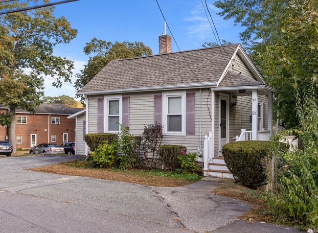
Property Record
155 King Ave, Weymouth, MA 02188
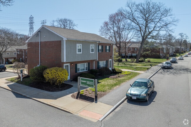

NEARBY LISTINGS FOR SALE OR LEASE
-
-
View all Weymouth listings for sale on LoopNet.com
Property Detail
155 King Ave
WEYM-000020-000283-000001
Norfolk
Apartment
Massachusetts
A
1
25021C0229F
5.58 AC
2025
Weymouth Landing
2025
Boston
422401
Boston-Cambridge-Newton, MA-NH
DEMOGRAPHICS near 155 King Ave
1 Mile
3 Mile
5 Mile
2024 Total Population
13,586
101,856
203,985
2029 Population
13,537
101,040
203,314
Pop Growth 2024-2029
(0.36%)
(0.80%)
(0.33%)
Average Age
43
42
42
2024 Total Households
5,692
42,700
84,752
HH Growth 2024-2029
(0.39%)
(0.83%)
(0.30%)
Median Household Inc
$100,560
$95,036
$98,415
Avg Household Size
2.30
2.30
2.30
2024 Avg HH Vehicles
2.00
2.00
2.00
Median Home Value
$472,080
$507,189
$580,247
Median Year Built
1958
1959
1962
Nearby Places
Map Layers
Map Styles
 Street
 Aerial
- Restaurants
- Banks
- Shops
- Fitness
- Groceries
PUBLIC TRANSPORTATION
COMMUTER RAIL
Weymouth Landing/East Braintree (Greenbush Line - MBTA)
DRIVE
WALK
Distance
Weymouth Landing/East Braintree (Greenbush Line - MBTA)
2 min
20 min
1.1 mi
East Weymouth (Greenbush Line - Massachusetts Bay Transportation Authority Commuter Rail (Purple Line))
DRIVE
WALK
Distance
East Weymouth (Greenbush Line - Massachusetts Bay Transportation Authority Commuter Rail (Purple Line))
5 min
2.4 mi
AIRPORT
General Edward Lawrence Logan International
DRIVE
WALK
Distance
General Edward Lawrence Logan International
28 min
17.2 mi
Freight Ports
Port of Boston
DRIVE
WALK
Distance
Port of Boston
25 min
15.0 mi
SALE & LEASE HISTORY
LISTING DATE
SALE/LEASE

Dec 05, 2023
For Sale
Nearby Properties
Address
Land Use
TOTAL SIZE
Lot Size
Zoning
Address
Land Use
TOTAL SIZE
Lot Size
Zoning
50.61 AC
IND
Address
Land Use
TOTAL SIZE
Lot Size
Zoning
31.29 AC
100
Address
Land Use
TOTAL SIZE
Lot Size
Zoning
3.65 AC
100
Address
Land Use
TOTAL SIZE
Lot Size
Zoning
33.81 AC
A3
Address
Land Use
TOTAL SIZE
Lot Size
Zoning
9.10 AC
RESC
Address
Land Use
TOTAL SIZE
Lot Size
Zoning
202,858 SF
2.30 AC
Address
Land Use
TOTAL SIZE
Lot Size
Zoning
233,488 SF
9.82 AC
Address
Land Use
TOTAL SIZE
Lot Size
Zoning
11.90 AC
PUD
Address
Land Use
TOTAL SIZE
Lot Size
Zoning
7.62 AC
A2
Address
Land Use
TOTAL SIZE
Lot Size
Zoning
240,481 SF
25.23 AC
CL2
Address
Land Use
TOTAL SIZE
Lot Size
Zoning
233,530 SF
6.70 AC
PUD
Address
Land Use
TOTAL SIZE
Lot Size
Zoning
172,027 SF
3.73 AC
100
Address
Land Use
TOTAL SIZE
Lot Size
Zoning
617,116 SF
79.59 AC
INDB
Address
Land Use
TOTAL SIZE
Lot Size
Zoning
204,944 SF
3.83 AC
Address
Land Use
TOTAL SIZE
Lot Size
Zoning
3,375 SF
12.03 AC
PUD
Address
Land Use
TOTAL SIZE
Lot Size
Zoning
10.04 AC
PUD
Address
Land Use
TOTAL SIZE
Lot Size
Zoning
395,130 SF
6.50 AC
IND
Address
Land Use
TOTAL SIZE
Lot Size
Zoning
18.76 AC
GBD
Address
Land Use
TOTAL SIZE
Lot Size
Zoning
11.39 AC
100
Address
Land Use
TOTAL SIZE
Lot Size
Zoning
111,871 SF
4.72 AC
RESC
Address
Land Use
TOTAL SIZE
Lot Size
Zoning
9.78 AC
M-1
Address
Land Use
TOTAL SIZE
Lot Size
Zoning
0.23 AC
A2
Address
Land Use
TOTAL SIZE
Lot Size
Zoning
80,226 SF
6.60 AC
RES
Address
Land Use
TOTAL SIZE
Lot Size
Zoning
122,808 SF
3.41 AC
Address
Land Use
TOTAL SIZE
Lot Size
Zoning
0.16 AC
Address
Land Use
TOTAL SIZE
Lot Size
Zoning
5.03 AC
Address
Land Use
TOTAL SIZE
Lot Size
Zoning
5.59 AC
PUD
Address
Land Use
TOTAL SIZE
Lot Size
Zoning
3.92 AC
R-4
Address
Land Use
TOTAL SIZE
Lot Size
Zoning
132,194 SF
4 AC
RESC
Address
Land Use
TOTAL SIZE
Lot Size
Zoning
231,358 SF
40.22 AC
The World's #1 Commercial Real Estate Marketplace
Connect with us
© 2025 CoStar Group
The information above has been obtained from sources believed reliable. While we do not doubt its accuracy we have not verified it and make no guarantee, warranty or representation about it. It is your responsibility to independently confirm its accuracy and completeness. Any projections, opinions, assumptions, or estimates used are for example only and do not represent the current or future performance of the property. The value of this transaction to you depends on tax and other factors which should be evaluated by your tax, financial, and legal advisors. You and your advisors should conduct a careful, independent investigation of the property to determine to your satisfaction the suitability of the property for your needs.