Property Record
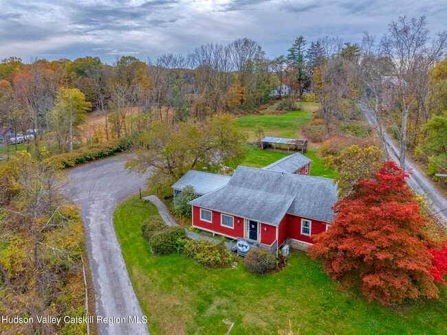
155 Old State Route 213, High Falls, NY 12440

This Property Is For Sale
NEARBY LISTINGS FOR SALE OR LEASE
Property Detail
155 Old State Route 213
3400-070.009-0002-027.000-0000
Ulster
Restaurantbuilding
New York
X
27.000
36111C0585E
2.35 AC
2025
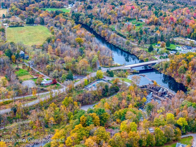
Hudson Valley Area
2024
Other Market Areas
952901
Kingston, NY
2,575 SF
DEMOGRAPHICS near 155 Old State Route 213
1 Mile
3 Mile
5 Mile
2024 Total Population
654
5,297
11,947
2029 Population
656
5,253
11,781
Pop Growth 2024-2029
+ 0.31%
(0.83%)
(1.39%)
Average Age
47
47
46
2024 Total Households
293
2,343
5,134
HH Growth 2024-2029
+ 0.34%
(0.81%)
(1.38%)
Median Household Inc
$106,250
$92,365
$92,038
Avg Household Size
2.10
2.20
2.30
2024 Avg HH Vehicles
2.00
2.00
2.00
Median Home Value
$443,038
$433,978
$430,022
Median Year Built
1961
1963
1965
Nearby Places
Map Layers
Map Styles
 Street
 Aerial
- Restaurants
- Banks
- Shops
- Fitness
- Groceries
PUBLIC TRANSPORTATION
AIRPORT
New York Stewart International
DRIVE
WALK
Distance
New York Stewart International
53 min
34.9 mi
Freight Ports
Albany, NY Port
DRIVE
WALK
Distance
Albany, NY Port
77 min
63.0 mi
Nearby Properties
Address
Land Use
TOTAL SIZE
Lot Size
Zoning
Address
Land Use
TOTAL SIZE
Lot Size
Zoning
23,140 SF
87.30 AC
R1
Address
Land Use
TOTAL SIZE
Lot Size
Zoning
Address
Land Use
TOTAL SIZE
Lot Size
Zoning
Address
Land Use
TOTAL SIZE
Lot Size
Zoning
1,709 SF
27.40 AC
A2
Address
Land Use
TOTAL SIZE
Lot Size
Zoning
10,007 SF
235.70 AC
I-1
Address
Land Use
TOTAL SIZE
Lot Size
Zoning
42,975 SF
35 AC
R-1
Address
Land Use
TOTAL SIZE
Lot Size
Zoning
12,000 SF
95.80 AC
A
Address
Land Use
TOTAL SIZE
Lot Size
Zoning
47,809 SF
23.80 AC
R3
Address
Land Use
TOTAL SIZE
Lot Size
Zoning
34,323 SF
6.40 AC
R-1
Address
Land Use
TOTAL SIZE
Lot Size
Zoning
Address
Land Use
TOTAL SIZE
Lot Size
Zoning
6,950 SF
82.86 AC
R1
Address
Land Use
TOTAL SIZE
Lot Size
Zoning
36,492 SF
6.25 AC
B1
Address
Land Use
TOTAL SIZE
Lot Size
Zoning
9,080 SF
42.70 AC
R1
Address
Land Use
TOTAL SIZE
Lot Size
Zoning
17,081 SF
6.94 AC
R-1
Address
Land Use
TOTAL SIZE
Lot Size
Zoning
7,615 SF
35.20 AC
B1
Address
Land Use
TOTAL SIZE
Lot Size
Zoning
Address
Land Use
TOTAL SIZE
Lot Size
Zoning
23.70 AC
I1
Address
Land Use
TOTAL SIZE
Lot Size
Zoning
3,824 SF
140.90 AC
R1
Address
Land Use
TOTAL SIZE
Lot Size
Zoning
3,463 SF
72.43 AC
R1
Address
Land Use
TOTAL SIZE
Lot Size
Zoning
960 SF
95.50 AC
AR3
Address
Land Use
TOTAL SIZE
Lot Size
Zoning
21,170 SF
18.67 AC
R-1
Address
Land Use
TOTAL SIZE
Lot Size
Zoning
924 SF
10.14 AC
R-2
Address
Land Use
TOTAL SIZE
Lot Size
Zoning
864 SF
45.80 AC
A4
Address
Land Use
TOTAL SIZE
Lot Size
Zoning
2,353 SF
10 AC
R1
Address
Land Use
TOTAL SIZE
Lot Size
Zoning
2,202 SF
6.70 AC
R1
Address
Land Use
TOTAL SIZE
Lot Size
Zoning
3,479 SF
102.80 AC
R1
Address
Land Use
TOTAL SIZE
Lot Size
Zoning
33,270 SF
11 AC
I1
Address
Land Use
TOTAL SIZE
Lot Size
Zoning
752.60 AC
A4
Address
Land Use
TOTAL SIZE
Lot Size
Zoning
6,820 SF
6.25 AC
SR
Address
Land Use
TOTAL SIZE
Lot Size
Zoning
2,160 SF
23 AC
R1
The World's #1 Commercial Real Estate Marketplace
Connect with us
© 2025 CoStar Group
The information above has been obtained from sources believed reliable. While we do not doubt its accuracy we have not verified it and make no guarantee, warranty or representation about it. It is your responsibility to independently confirm its accuracy and completeness. Any projections, opinions, assumptions, or estimates used are for example only and do not represent the current or future performance of the property. The value of this transaction to you depends on tax and other factors which should be evaluated by your tax, financial, and legal advisors. You and your advisors should conduct a careful, independent investigation of the property to determine to your satisfaction the suitability of the property for your needs.