Property Record
155 Middle Rd, Southampton, MA 01073

Property Detail
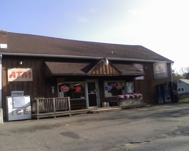
155 Middle Rd
SHAM-000044-000163
Hampshire
Storebuilding
Massachusetts
B and X Area of moderate flood hazard, usually the area between the limits of the 100-year and 500-year floods.
0.65 AC
2025
Hampshire County
2025
Hartford
822500
Amherst Town-Northampton, MA
2,116 SF
NEARBY LISTINGS FOR SALE OR LEASE
-
-
View all Southampton listings for sale on LoopNet.com
DEMOGRAPHICS near 155 Middle Rd
1 mile
3 mile
5 mile
2025 Total Population
1,682
10,280
72,671
2030 Population
1,684
10,322
72,676
Pop Growth 2025-2030
+ 0.12%
+ 0.41%
+ 0.01%
Average Age
43
45
42
2025 Total Households
635
4,033
29,401
HH Growth 2025-2030
+ 0.16%
+ 0.45%
+ 0.02%
Median Household Inc
$89,144
$92,849
$68,265
Avg Household Size
2.50
2.40
2.40
2025 Avg HH Vehicles
2.00
2.00
2.00
Median Home Value
$367,897
$343,636
$326,885
Median Year Built
1974
1975
1961
Nearby Places
Map Layers
Map Styles
 Street
 Aerial
Layers
 Traffic
 Biking
Places
Listings with unknown addresses are not visible on the map
- Restaurants
- Banks
- Shops
- Fitness
- Groceries
PUBLIC TRANSPORTATION
COMMUTER RAIL
Holyoke Amtrak (Valley Flyer - Amtrak, Vermonter - Amtrak)
Drive
Walk
Distance
Holyoke Amtrak (Valley Flyer - Amtrak, Vermonter - Amtrak)
14 min
7.1 mi
AIRPORT
Bradley International
Drive
Walk
Distance
Bradley International
48 min
23.2 mi
Freight Ports
Albany, NY Port
Drive
Walk
Distance
Albany, NY Port
97 min
78.3 mi
SALE & LEASE HISTORY
LISTING DATE
SALE/LEASE

Sep 24, 2016
For Sale
Jan 29, 2019
For Sale
Feb 12, 2018
For Sale
Nearby Properties
Address
Land Use
TOTAL SIZE
Lot Size
Zoning
Address
Land Use
TOTAL SIZE
Lot Size
Zoning
71.67 AC
Address
Land Use
TOTAL SIZE
Lot Size
Zoning
133.29 AC
Address
Land Use
TOTAL SIZE
Lot Size
Zoning
Address
Land Use
TOTAL SIZE
Lot Size
Zoning
3.80 AC
Address
Land Use
TOTAL SIZE
Lot Size
Zoning
Address
Land Use
TOTAL SIZE
Lot Size
Zoning
74.25 AC
Address
Land Use
TOTAL SIZE
Lot Size
Zoning
143,568 SF
14.69 AC
Address
Land Use
TOTAL SIZE
Lot Size
Zoning
908.80 AC
RA
Address
Land Use
TOTAL SIZE
Lot Size
Zoning
99,230 SF
10.94 AC
Address
Land Use
TOTAL SIZE
Lot Size
Zoning
138,289 SF
22.79 AC
IG
Address
Land Use
TOTAL SIZE
Lot Size
Zoning
Address
Land Use
TOTAL SIZE
Lot Size
Zoning
242,152 SF
18.76 AC
Address
Land Use
TOTAL SIZE
Lot Size
Zoning
105,408 SF
41.06 AC
Address
Land Use
TOTAL SIZE
Lot Size
Zoning
21,405 SF
0.01 AC
Address
Land Use
TOTAL SIZE
Lot Size
Zoning
6.35 AC
RA
Address
Land Use
TOTAL SIZE
Lot Size
Zoning
86,524 SF
12.40 AC
Address
Land Use
TOTAL SIZE
Lot Size
Zoning
56,102 SF
11.90 AC
R-1A
Address
Land Use
TOTAL SIZE
Lot Size
Zoning
26.09 AC
Address
Land Use
TOTAL SIZE
Lot Size
Zoning
Address
Land Use
TOTAL SIZE
Lot Size
Zoning
126.15 AC
Address
Land Use
TOTAL SIZE
Lot Size
Zoning
Address
Land Use
TOTAL SIZE
Lot Size
Zoning
34,815 SF
9.29 AC
Address
Land Use
TOTAL SIZE
Lot Size
Zoning
538.50 AC
RA
Address
Land Use
TOTAL SIZE
Lot Size
Zoning
100,000 SF
10.51 AC
Address
Land Use
TOTAL SIZE
Lot Size
Zoning
127,500 SF
20 AC
Address
Land Use
TOTAL SIZE
Lot Size
Zoning
22,706 SF
7.02 AC
IP
Address
Land Use
TOTAL SIZE
Lot Size
Zoning
62,648 SF
18.75 AC
Address
Land Use
TOTAL SIZE
Lot Size
Zoning
93,664 SF
4.79 AC
Address
Land Use
TOTAL SIZE
Lot Size
Zoning
550 AC
RA
Address
Land Use
TOTAL SIZE
Lot Size
Zoning
788.74 AC
The World's #1 Commercial Real Estate Marketplace
Connect with us
© 2026 CoStar Group
The information above has been obtained from sources believed reliable. While we do not doubt its accuracy we have not verified it and make no guarantee, warranty or representation about it. It is your responsibility to independently confirm its accuracy and completeness. Any projections, opinions, assumptions, or estimates used are for example only and do not represent the current or future performance of the property. The value of this transaction to you depends on tax and other factors which should be evaluated by your tax, financial, and legal advisors. You and your advisors should conduct a careful, independent investigation of the property to determine to your satisfaction the suitability of the property for your needs.