Property Record
155 Union Ave, Paterson, NJ 07502


Save to a Folder
{{folder.Name}}
{{folder.ListingIds.length}} Properties
{{folder.ListingIds.length}} Property
Create a New Folder
Property Detail
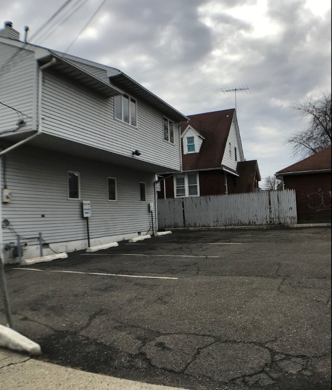
155 Union Ave
08-01611-0000-00016
Passaic
Commercialnec
New Jersey
R-1
16
AE The base floodplain where base flood elevations are provided. AE Zones are now used on new format FIRMs instead of A1-A30 Zones.
0.11 AC
2025
Passaic Urban Region
2026
Northern New Jersey
180101
New York-Jersey City-White Plains, NY-NJ
2,330 SF
NEARBY LISTINGS FOR SALE OR LEASE
DEMOGRAPHICS near 155 Union Ave
1 mile
3 mile
5 mile
2025 Total Population
38,694
232,064
487,518
2030 Population
39,246
234,507
495,859
Pop Growth 2025-2030
+ 1.43%
+ 1.05%
+ 1.71%
Average Age
38
38
40
2025 Total Households
12,188
75,750
164,353
HH Growth 2025-2030
+ 1.90%
+ 1.14%
+ 1.81%
Median Household Inc
$69,016
$67,560
$88,578
Avg Household Size
3.10
2.90
2.80
2025 Avg HH Vehicles
1.00
1.00
2.00
Median Home Value
$387,073
$467,131
$511,147
Median Year Built
1956
1956
1955
Nearby Places
Map Layers
Map Styles
 Street
 Aerial
Layers
 Traffic
 Biking
Places
Listings with unknown addresses are not visible on the map
- Restaurants
- Banks
- Shops
- Fitness
- Groceries
PUBLIC TRANSPORTATION
COMMUTER RAIL
Paterson (Main/Bergen County Line - NJ TRANSIT RAIL, Port Jervis Line - NJ TRANSIT RAIL)
Drive
Walk
Distance
Paterson (Main/Bergen County Line - NJ TRANSIT RAIL, Port Jervis Line - NJ TRANSIT RAIL)
3 min
2.1 mi
Hawthorne (Main/Bergen County Line - NJ TRANSIT RAIL, Port Jervis Line - NJ TRANSIT RAIL)
Drive
Walk
Distance
Hawthorne (Main/Bergen County Line - NJ TRANSIT RAIL, Port Jervis Line - NJ TRANSIT RAIL)
6 min
3.4 mi
AIRPORT
Newark Liberty International
Drive
Walk
Distance
Newark Liberty International
26 min
22.4 mi
LaGuardia
Drive
Walk
Distance
LaGuardia
39 min
26.5 mi
Westchester County
Drive
Walk
Distance
Westchester County
59 min
42.2 mi
Freight Ports
Port Newark Container Terminal
Drive
Walk
Distance
Port Newark Container Terminal
32 min
21.7 mi
SALE & LEASE HISTORY
LISTING DATE
SALE/LEASE

Nov 26, 2018
For Lease
Feb 22, 2018
For Lease
Nearby Properties
Address
Land Use
TOTAL SIZE
Lot Size
Zoning
Address
Land Use
TOTAL SIZE
Lot Size
Zoning
8.75 AC
Address
Land Use
TOTAL SIZE
Lot Size
Zoning
12,506 SF
130 AC
B-2
Address
Land Use
TOTAL SIZE
Lot Size
Zoning
79,310 SF
2 AC
B-2
Address
Land Use
TOTAL SIZE
Lot Size
Zoning
152,050 SF
1.96 AC
B-1
Address
Land Use
TOTAL SIZE
Lot Size
Zoning
7.83 AC
Address
Land Use
TOTAL SIZE
Lot Size
Zoning
1.80 AC
Address
Land Use
TOTAL SIZE
Lot Size
Zoning
0.69 AC
I-1
Address
Land Use
TOTAL SIZE
Lot Size
Zoning
45,000 SF
124.04 AC
R-A
Address
Land Use
TOTAL SIZE
Lot Size
Zoning
56.67 AC
Address
Land Use
TOTAL SIZE
Lot Size
Zoning
764,364 SF
16.60 AC
I-2
Address
Land Use
TOTAL SIZE
Lot Size
Zoning
260,609 SF
35.39 AC
Address
Land Use
TOTAL SIZE
Lot Size
Zoning
0.12 AC
Address
Land Use
TOTAL SIZE
Lot Size
Zoning
20.43 AC
Address
Land Use
TOTAL SIZE
Lot Size
Zoning
183,072 SF
5.50 AC
Address
Land Use
TOTAL SIZE
Lot Size
Zoning
192,252 SF
5 AC
Address
Land Use
TOTAL SIZE
Lot Size
Zoning
140,626 SF
3.28 AC
B-2
Address
Land Use
TOTAL SIZE
Lot Size
Zoning
269,236 SF
10 AC
Address
Land Use
TOTAL SIZE
Lot Size
Zoning
Address
Land Use
TOTAL SIZE
Lot Size
Zoning
Address
Land Use
TOTAL SIZE
Lot Size
Zoning
1.07 AC
Address
Land Use
TOTAL SIZE
Lot Size
Zoning
3.73 AC
B-2
Address
Land Use
TOTAL SIZE
Lot Size
Zoning
84.08 AC
Address
Land Use
TOTAL SIZE
Lot Size
Zoning
1.20 AC
B-2
Address
Land Use
TOTAL SIZE
Lot Size
Zoning
315,332 SF
19.60 AC
Address
Land Use
TOTAL SIZE
Lot Size
Zoning
24,200 SF
19.33 AC
Address
Land Use
TOTAL SIZE
Lot Size
Zoning
82,976 SF
0.89 AC
Address
Land Use
TOTAL SIZE
Lot Size
Zoning
1.30 AC
B-2
Address
Land Use
TOTAL SIZE
Lot Size
Zoning
84,845 SF
2.30 AC
B-2
Address
Land Use
TOTAL SIZE
Lot Size
Zoning
63,600 SF
2.46 AC
Address
Land Use
TOTAL SIZE
Lot Size
Zoning
12.86 AC
The World's #1 Commercial Real Estate Marketplace
Connect with us
© 2026 CoStar Group
The information above has been obtained from sources believed reliable. While we do not doubt its accuracy we have not verified it and make no guarantee, warranty or representation about it. It is your responsibility to independently confirm its accuracy and completeness. Any projections, opinions, assumptions, or estimates used are for example only and do not represent the current or future performance of the property. The value of this transaction to you depends on tax and other factors which should be evaluated by your tax, financial, and legal advisors. You and your advisors should conduct a careful, independent investigation of the property to determine to your satisfaction the suitability of the property for your needs.