Property Record
1550 Cr 107/301 Cr 107 Spur, Hutto, TX 78634

Property Detail
1550 Cr 107/301 Cr 107 Spur
R020649
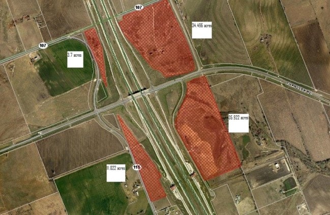
AW0370 AW0370 - KEITH, G. SUR., ACRES 23.027
Commercialnec
WILLIAMSON
B and X Area of moderate flood hazard, usually the area between the limits of the 100-year and 500-year floods.
Texas
2024
23.03 AC
2025
Georgetown
020813
Austin
25,934 SF
Austin-Round Rock-San Marcos, TX
NEARBY LISTINGS FOR SALE OR LEASE
DEMOGRAPHICS near 1550 Cr 107/301 Cr 107 Spur
1 mile
3 mile
5 mile
2025 Total Population
681
21,524
100,473
2030 Population
818
25,663
116,907
Pop Growth 2025-2030
+ 20.12%
+ 19.23%
+ 16.36%
Average Age
39
36
36
2025 Total Households
247
7,160
33,647
HH Growth 2025-2030
+ 20.65%
+ 19.59%
+ 16.83%
Median Household Inc
$113,749
$134,411
$124,162
Avg Household Size
2.70
2.90
2.90
2025 Avg HH Vehicles
2.00
2.00
2.00
Median Home Value
$482,812
$467,636
$439,953
Median Year Built
2011
2011
2010
Nearby Places
Map Layers
Map Styles
 Street
 Aerial
Layers
 Traffic
 Biking
Places
Listings with unknown addresses are not visible on the map
- Restaurants
- Banks
- Shops
- Fitness
- Groceries
PUBLIC TRANSPORTATION
AIRPORT
Austin-Bergstrom International
Drive
Walk
Distance
Austin-Bergstrom International
45 min
36.2 mi
Freight Ports
Calhoun Port
Drive
Walk
Distance
Calhoun Port
206 min
179.1 mi
Nearby Properties
Address
Land Use
TOTAL SIZE
Lot Size
Zoning
Address
Land Use
TOTAL SIZE
Lot Size
Zoning
533,782 SF
79.41 AC
Address
Land Use
TOTAL SIZE
Lot Size
Zoning
331,584 SF
21.09 AC
Address
Land Use
TOTAL SIZE
Lot Size
Zoning
29,616 SF
158.84 AC
Address
Land Use
TOTAL SIZE
Lot Size
Zoning
228,685 SF
10.32 AC
Address
Land Use
TOTAL SIZE
Lot Size
Zoning
266,428 SF
58.60 AC
Address
Land Use
TOTAL SIZE
Lot Size
Zoning
246,708 SF
11.56 AC
Address
Land Use
TOTAL SIZE
Lot Size
Zoning
160,070 SF
13.68 AC
Address
Land Use
TOTAL SIZE
Lot Size
Zoning
116,641 SF
5.93 AC
Address
Land Use
TOTAL SIZE
Lot Size
Zoning
141,718 SF
24.12 AC
Address
Land Use
TOTAL SIZE
Lot Size
Zoning
Address
Land Use
TOTAL SIZE
Lot Size
Zoning
49,841 SF
74.93 AC
Address
Land Use
TOTAL SIZE
Lot Size
Zoning
333,614 SF
11.32 AC
Address
Land Use
TOTAL SIZE
Lot Size
Zoning
63,508 SF
14.45 AC
Address
Land Use
TOTAL SIZE
Lot Size
Zoning
24.86 AC
Address
Land Use
TOTAL SIZE
Lot Size
Zoning
14,947 SF
15.03 AC
Address
Land Use
TOTAL SIZE
Lot Size
Zoning
105,890 SF
11.21 AC
Address
Land Use
TOTAL SIZE
Lot Size
Zoning
56,175 SF
5.22 AC
Address
Land Use
TOTAL SIZE
Lot Size
Zoning
74,140 SF
52.06 AC
Address
Land Use
TOTAL SIZE
Lot Size
Zoning
25.57 AC
Address
Land Use
TOTAL SIZE
Lot Size
Zoning
105,078 SF
25.97 AC
Address
Land Use
TOTAL SIZE
Lot Size
Zoning
3,489 SF
11.16 AC
Address
Land Use
TOTAL SIZE
Lot Size
Zoning
48,156 SF
5.95 AC
Address
Land Use
TOTAL SIZE
Lot Size
Zoning
57,450 SF
5.10 AC
Address
Land Use
TOTAL SIZE
Lot Size
Zoning
44,693 SF
5.15 AC
Address
Land Use
TOTAL SIZE
Lot Size
Zoning
57,380 SF
5.22 AC
Address
Land Use
TOTAL SIZE
Lot Size
Zoning
146.58 AC
Address
Land Use
TOTAL SIZE
Lot Size
Zoning
48,125 SF
4.69 AC
Address
Land Use
TOTAL SIZE
Lot Size
Zoning
32,526 SF
18.32 AC
Address
Land Use
TOTAL SIZE
Lot Size
Zoning
78,210 SF
9.67 AC
The World's #1 Commercial Real Estate Marketplace
Connect with us
© 2026 CoStar Group
The information above has been obtained from sources believed reliable. While we do not doubt its accuracy we have not verified it and make no guarantee, warranty or representation about it. It is your responsibility to independently confirm its accuracy and completeness. Any projections, opinions, assumptions, or estimates used are for example only and do not represent the current or future performance of the property. The value of this transaction to you depends on tax and other factors which should be evaluated by your tax, financial, and legal advisors. You and your advisors should conduct a careful, independent investigation of the property to determine to your satisfaction the suitability of the property for your needs.