Property Record
1550 John E Sullivan Rd, Byron, GA 31008


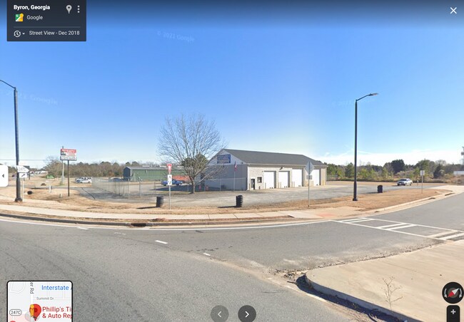
Property Detail
1550 John E Sullivan Rd
052A-059
LOT 1 JAMES EMORY INC S/D \ 1.363 AC LL16 LD5
Autorepair
Peach
C-3
Georgia
B and X Area of moderate flood hazard, usually the area between the limits of the 100-year and 500-year floods.
1
2025
1.36 AC
2025
Perry/Warner Robins
040101
Other Market Areas
4,500 SF
Warner Robins, GA
NEARBY LISTINGS FOR SALE OR LEASE
-
-
View all Byron listings for sale on LoopNet.com
DEMOGRAPHICS near 1550 John E Sullivan Rd
1 mile
3 mile
5 mile
2025 Total Population
1,306
11,594
49,450
2030 Population
1,361
12,064
51,695
Pop Growth 2025-2030
+ 4.21%
+ 4.05%
+ 4.54%
Average Age
44
41
40
2025 Total Households
534
4,624
19,125
HH Growth 2025-2030
+ 4.31%
+ 4.04%
+ 4.60%
Median Household Inc
$78,365
$87,393
$84,163
Avg Household Size
2.50
2.50
2.60
2025 Avg HH Vehicles
2.00
2.00
2.00
Median Home Value
$262,702
$244,787
$241,367
Median Year Built
2005
2001
2000
Nearby Places
Map Layers
Map Styles
 Street
 Aerial
Transit
 Traffic
 Biking
Places
Listings with unknown addresses are not visible on the map
- Restaurants
- Banks
- Shops
- Fitness
- Groceries
SALE & LEASE HISTORY
LISTING DATE
SALE/LEASE

Nov 30, 2021
For Sale
Dec 30, 2021
For Sale
Nearby Properties
Address
Land Use
TOTAL SIZE
Lot Size
Zoning
Address
Land Use
TOTAL SIZE
Lot Size
Zoning
503,585 SF
61.05 AC
C-2, WR
Address
Land Use
TOTAL SIZE
Lot Size
Zoning
18,954 SF
20 AC
C2
Address
Land Use
TOTAL SIZE
Lot Size
Zoning
9,600 SF
24.25 AC
C-H
Address
Land Use
TOTAL SIZE
Lot Size
Zoning
5,640 SF
28 AC
PDE
Address
Land Use
TOTAL SIZE
Lot Size
Zoning
338,708 SF
28.28 AC
M-2 WR
Address
Land Use
TOTAL SIZE
Lot Size
Zoning
68,545 SF
19.94 AC
MULTI
Address
Land Use
TOTAL SIZE
Lot Size
Zoning
225,751 SF
100 AC
M-1, WR
Address
Land Use
TOTAL SIZE
Lot Size
Zoning
63,274 SF
40.27 AC
C-2, WR
Address
Land Use
TOTAL SIZE
Lot Size
Zoning
62,173 SF
17.70 AC
C2
Address
Land Use
TOTAL SIZE
Lot Size
Zoning
5,320 SF
15.47 AC
R-4
Address
Land Use
TOTAL SIZE
Lot Size
Zoning
94,274 SF
28.34 AC
R-AG
Address
Land Use
TOTAL SIZE
Lot Size
Zoning
60,300 SF
6.99 AC
M-2, WR
Address
Land Use
TOTAL SIZE
Lot Size
Zoning
418,404 SF
17.99 AC
C-H
Address
Land Use
TOTAL SIZE
Lot Size
Zoning
8,640 SF
12.49 AC
R-AG
Address
Land Use
TOTAL SIZE
Lot Size
Zoning
23,100 SF
5.39 AC
C2
Address
Land Use
TOTAL SIZE
Lot Size
Zoning
106,830 SF
20.82 AC
C-H
Address
Land Use
TOTAL SIZE
Lot Size
Zoning
944 SF
294.54 AC
M-2 WR
Address
Land Use
TOTAL SIZE
Lot Size
Zoning
14,140 SF
16.59 AC
R1
Address
Land Use
TOTAL SIZE
Lot Size
Zoning
58,534 SF
7.82 AC
MULTI
Address
Land Use
TOTAL SIZE
Lot Size
Zoning
9,863 SF
11.85 AC
RR-1
Address
Land Use
TOTAL SIZE
Lot Size
Zoning
35,841 SF
38.62 AC
RMH
Address
Land Use
TOTAL SIZE
Lot Size
Zoning
1,690 SF
31.37 AC
C2
Address
Land Use
TOTAL SIZE
Lot Size
Zoning
54.81 AC
C-2, WR
Address
Land Use
TOTAL SIZE
Lot Size
Zoning
45,602 SF
6.03 AC
C2
Address
Land Use
TOTAL SIZE
Lot Size
Zoning
27.42 AC
C-H
Address
Land Use
TOTAL SIZE
Lot Size
Zoning
79.81 AC
PDE (WR)
Address
Land Use
TOTAL SIZE
Lot Size
Zoning
59.47 AC
R-AG
Address
Land Use
TOTAL SIZE
Lot Size
Zoning
5,154 SF
42.78 AC
R-AG
Address
Land Use
TOTAL SIZE
Lot Size
Zoning
5,460 SF
8.05 AC
C-2 , WR
Address
Land Use
TOTAL SIZE
Lot Size
Zoning
5,460 SF
8.05 AC
C-2 , WR
The World's #1 Commercial Real Estate Marketplace
Connect with us
© 2026 CoStar Group
The information above has been obtained from sources believed reliable. While we do not doubt its accuracy we have not verified it and make no guarantee, warranty or representation about it. It is your responsibility to independently confirm its accuracy and completeness. Any projections, opinions, assumptions, or estimates used are for example only and do not represent the current or future performance of the property. The value of this transaction to you depends on tax and other factors which should be evaluated by your tax, financial, and legal advisors. You and your advisors should conduct a careful, independent investigation of the property to determine to your satisfaction the suitability of the property for your needs.