Property Record
1550 Nc Highway 62 W, High Point, NC 27263
NEARBY LISTINGS FOR SALE OR LEASE
Property Detail
1550 Nc Highway 62 W
Greensboro-High Point, NC
Fairfield
0158575
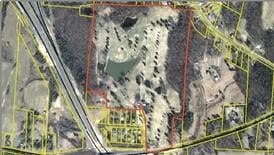
FAIRFIELD GOLF CLUB 9 HOLES PL:5-351
Cemetery
Guilford
X
North Carolina
3710772900K
36
2023
52.91 AC
2025
High Point/SW Guilford Cty
016600
Greensboro/Winston-Salem
1,092 SF
DEMOGRAPHICS near 1550 Nc Highway 62 W
1 Mile
3 Mile
5 Mile
2024 Total Population
800
12,363
49,886
2029 Population
806
12,575
50,596
Pop Growth 2024-2029
+ 0.75%
+ 1.71%
+ 1.42%
Average Age
44
42
40
2024 Total Households
331
4,962
19,802
HH Growth 2024-2029
+ 0.91%
+ 1.77%
+ 1.45%
Median Household Inc
$49,999
$60,699
$51,742
Avg Household Size
2.40
2.50
2.50
2024 Avg HH Vehicles
2.00
2.00
2.00
Median Home Value
$174,761
$162,727
$149,845
Median Year Built
1972
1978
1976
Nearby Places
Map Layers
Map Styles
 Street
 Aerial
- Restaurants
- Banks
- Shops
- Fitness
- Groceries
PUBLIC TRANSPORTATION
COMMUTER RAIL
High Point Station (Piedmont - North Carolina by Train (NC Train))
DRIVE
WALK
Distance
High Point Station (Piedmont - North Carolina by Train (NC Train))
13 min
6.8 mi
AIRPORT
Piedmont Triad International
DRIVE
WALK
Distance
Piedmont Triad International
31 min
19.6 mi
Freight Ports
Port of Wilmington
DRIVE
WALK
Distance
Port of Wilmington
246 min
208.1 mi
Nearby Properties
Address
Land Use
TOTAL SIZE
Lot Size
Zoning
Address
Land Use
TOTAL SIZE
Lot Size
Zoning
159,944 SF
13.95 AC
RS-40
Address
Land Use
TOTAL SIZE
Lot Size
Zoning
299,394 SF
8.60 AC
M-2
Address
Land Use
TOTAL SIZE
Lot Size
Zoning
90,000 SF
15.36 AC
M-2
Address
Land Use
TOTAL SIZE
Lot Size
Zoning
7,680 SF
9.95 AC
GRD
Address
Land Use
TOTAL SIZE
Lot Size
Zoning
69,094 SF
5.47 AC
M-2
Address
Land Use
TOTAL SIZE
Lot Size
Zoning
7,168 SF
7.51 AC
GRD
Address
Land Use
TOTAL SIZE
Lot Size
Zoning
73,658 SF
8.45 AC
B-1
Address
Land Use
TOTAL SIZE
Lot Size
Zoning
13,311 SF
162.92 AC
HI
Address
Land Use
TOTAL SIZE
Lot Size
Zoning
48,913 SF
2.25 AC
B-1
Address
Land Use
TOTAL SIZE
Lot Size
Zoning
35,620 SF
5.47 AC
M-2
Address
Land Use
TOTAL SIZE
Lot Size
Zoning
65,733 SF
124.36 AC
HI
Address
Land Use
TOTAL SIZE
Lot Size
Zoning
53,520 SF
5.48 AC
B-1
Address
Land Use
TOTAL SIZE
Lot Size
Zoning
8,927 SF
3.60 AC
OI
Address
Land Use
TOTAL SIZE
Lot Size
Zoning
40,275 SF
2.31 AC
B-1
Address
Land Use
TOTAL SIZE
Lot Size
Zoning
42,112 SF
6.41 AC
HB
Address
Land Use
TOTAL SIZE
Lot Size
Zoning
35,611 SF
8.92 AC
LI
Address
Land Use
TOTAL SIZE
Lot Size
Zoning
43,328 SF
2.11 AC
B-1
Address
Land Use
TOTAL SIZE
Lot Size
Zoning
37,680 SF
1.66 AC
CD HB
Address
Land Use
TOTAL SIZE
Lot Size
Zoning
18.23 AC
R-15
Address
Land Use
TOTAL SIZE
Lot Size
Zoning
27,601 SF
8.28 AC
SU R-10
Address
Land Use
TOTAL SIZE
Lot Size
Zoning
152,260 SF
20.59 AC
LI
Address
Land Use
TOTAL SIZE
Lot Size
Zoning
33,423 SF
4.48 AC
R-5
Address
Land Use
TOTAL SIZE
Lot Size
Zoning
41,876 SF
21 AC
R-5
Address
Land Use
TOTAL SIZE
Lot Size
Zoning
22,202 SF
2.30 AC
B-1
Address
Land Use
TOTAL SIZE
Lot Size
Zoning
2,817 SF
101.78 AC
HI
Address
Land Use
TOTAL SIZE
Lot Size
Zoning
112,900 SF
6.39 AC
M-2
Address
Land Use
TOTAL SIZE
Lot Size
Zoning
19,239 SF
18 AC
R-40
Address
Land Use
TOTAL SIZE
Lot Size
Zoning
22,880 SF
0.46 AC
R-5
Address
Land Use
TOTAL SIZE
Lot Size
Zoning
25,501 SF
4.51 AC
OI
Address
Land Use
TOTAL SIZE
Lot Size
Zoning
30,720 SF
5.57 AC
RM-16
The World's #1 Commercial Real Estate Marketplace
Connect with us
© 2025 CoStar Group
The information above has been obtained from sources believed reliable. While we do not doubt its accuracy we have not verified it and make no guarantee, warranty or representation about it. It is your responsibility to independently confirm its accuracy and completeness. Any projections, opinions, assumptions, or estimates used are for example only and do not represent the current or future performance of the property. The value of this transaction to you depends on tax and other factors which should be evaluated by your tax, financial, and legal advisors. You and your advisors should conduct a careful, independent investigation of the property to determine to your satisfaction the suitability of the property for your needs.