Property Record
1550 Ne 27Th St, Bend, OR 97701

Property Detail
1550 Ne 27Th St
118994
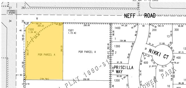
PP1990-61 LOT PT PARCEL A
Commercialnec
DESCHUTES
RM
Oregon
B and X Area of moderate flood hazard, usually the area between the limits of the 100-year and 500-year floods.
1.34 AC
2025
Deschutes County
2025
Portland
001903
Bend, OR
18,424 SF
NEARBY LISTINGS FOR SALE OR LEASE
DEMOGRAPHICS near 1550 Ne 27Th St
1 mile
3 mile
5 mile
2025 Total Population
13,271
56,562
101,289
2030 Population
13,548
57,602
103,670
Pop Growth 2025-2030
+ 2.09%
+ 1.84%
+ 2.35%
Average Age
40
40
41
2025 Total Households
5,983
23,459
41,286
HH Growth 2025-2030
+ 2.07%
+ 1.78%
+ 2.32%
Median Household Inc
$72,783
$90,808
$102,229
Avg Household Size
2.10
2.30
2.40
2025 Avg HH Vehicles
2.00
2.00
2.00
Median Home Value
$596,344
$686,968
$754,029
Median Year Built
1998
1996
1999
Nearby Places
Map Layers
Map Styles
 Street
 Aerial
Layers
 Traffic
 Biking
Places
Listings with unknown addresses are not visible on the map
- Restaurants
- Banks
- Shops
- Fitness
- Groceries
PUBLIC TRANSPORTATION
AIRPORT
Roberts Field
Drive
Walk
Distance
Roberts Field
26 min
17.4 mi
Freight Ports
Port of Portland
Drive
Walk
Distance
Port of Portland
235 min
179.0 mi
Nearby Properties
Address
Land Use
TOTAL SIZE
Lot Size
Zoning
Address
Land Use
TOTAL SIZE
Lot Size
Zoning
61,869 SF
35.14 AC
RH
Address
Land Use
TOTAL SIZE
Lot Size
Zoning
35.14 AC
Address
Land Use
TOTAL SIZE
Lot Size
Zoning
116,476 SF
35.14 AC
RH
Address
Land Use
TOTAL SIZE
Lot Size
Zoning
10,490 SF
35.14 AC
RH
Address
Land Use
TOTAL SIZE
Lot Size
Zoning
144,000 SF
35.14 AC
RH
Address
Land Use
TOTAL SIZE
Lot Size
Zoning
35.14 AC
RH
Address
Land Use
TOTAL SIZE
Lot Size
Zoning
144,000 SF
35.14 AC
RH
Address
Land Use
TOTAL SIZE
Lot Size
Zoning
35.14 AC
RH
Address
Land Use
TOTAL SIZE
Lot Size
Zoning
11,947 SF
35.14 AC
RH
Address
Land Use
TOTAL SIZE
Lot Size
Zoning
35.14 AC
RH
Address
Land Use
TOTAL SIZE
Lot Size
Zoning
35.14 AC
Address
Land Use
TOTAL SIZE
Lot Size
Zoning
35.14 AC
RH
Address
Land Use
TOTAL SIZE
Lot Size
Zoning
35.14 AC
RH
Address
Land Use
TOTAL SIZE
Lot Size
Zoning
35.14 AC
RH
Address
Land Use
TOTAL SIZE
Lot Size
Zoning
144,000 SF
35.14 AC
RH
Address
Land Use
TOTAL SIZE
Lot Size
Zoning
35.14 AC
RH
Address
Land Use
TOTAL SIZE
Lot Size
Zoning
35.14 AC
Address
Land Use
TOTAL SIZE
Lot Size
Zoning
12,000 SF
2.77 AC
IL
Address
Land Use
TOTAL SIZE
Lot Size
Zoning
2.77 AC
IL
Address
Land Use
TOTAL SIZE
Lot Size
Zoning
201,150 SF
3.75 AC
RH
Address
Land Use
TOTAL SIZE
Lot Size
Zoning
1,546 SF
6.41 AC
RH
Address
Land Use
TOTAL SIZE
Lot Size
Zoning
1.04 AC
CB
Address
Land Use
TOTAL SIZE
Lot Size
Zoning
201,575 SF
1.04 AC
CB
Address
Land Use
TOTAL SIZE
Lot Size
Zoning
165,048 SF
4.68 AC
RM
Address
Land Use
TOTAL SIZE
Lot Size
Zoning
1,248 SF
5.04 AC
RM
Address
Land Use
TOTAL SIZE
Lot Size
Zoning
229,286 SF
17.96 AC
CG
Address
Land Use
TOTAL SIZE
Lot Size
Zoning
70,294 SF
17.96 AC
CG
Address
Land Use
TOTAL SIZE
Lot Size
Zoning
24.36 AC
Address
Land Use
TOTAL SIZE
Lot Size
Zoning
24.36 AC
IG
Address
Land Use
TOTAL SIZE
Lot Size
Zoning
24.36 AC
IG
The World's #1 Commercial Real Estate Marketplace
Connect with us
© 2026 CoStar Group
The information above has been obtained from sources believed reliable. While we do not doubt its accuracy we have not verified it and make no guarantee, warranty or representation about it. It is your responsibility to independently confirm its accuracy and completeness. Any projections, opinions, assumptions, or estimates used are for example only and do not represent the current or future performance of the property. The value of this transaction to you depends on tax and other factors which should be evaluated by your tax, financial, and legal advisors. You and your advisors should conduct a careful, independent investigation of the property to determine to your satisfaction the suitability of the property for your needs.