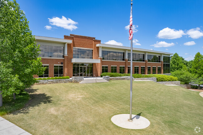
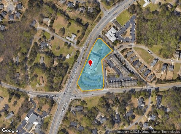
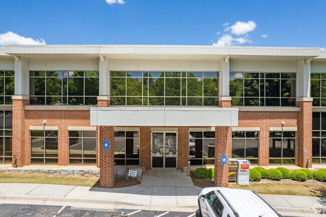
Property Record
1550 Timothy Rd, Athens, GA 30606
NEARBY LISTINGS FOR SALE OR LEASE
Property Detail
1550 Timothy Rd
Athens-Clarke County, GA
Com-St-066->00-03
074D-B-001
LOT 1 - 2.502 AC
Officebuilding
Clarke
X
Georgia
13059C0033F
1
2025
2.50 AC
2025
Epps Bridge
150300
Other Market Areas
32,320 SF
DEMOGRAPHICS near 1550 Timothy Rd
1 Mile
3 Mile
5 Mile
2024 Total Population
6,853
43,012
105,586
2029 Population
6,924
43,753
108,006
Pop Growth 2024-2029
+ 1.04%
+ 1.72%
+ 2.29%
Average Age
37
38
35
2024 Total Households
2,979
18,551
40,579
HH Growth 2024-2029
+ 0.87%
+ 1.50%
+ 2.11%
Median Household Inc
$63,320
$62,797
$55,947
Avg Household Size
2.20
2.20
2.30
2024 Avg HH Vehicles
2.00
2.00
2.00
Median Home Value
$326,807
$323,590
$300,579
Median Year Built
1994
1986
1988
Nearby Places
Map Layers
Map Styles
 Street
 Aerial
- Restaurants
- Banks
- Shops
- Fitness
- Groceries
SALE & LEASE HISTORY
LISTING DATE
SALE/LEASE

Jul 08, 2019
For Lease
Nearby Properties
Address
Land Use
TOTAL SIZE
Lot Size
Zoning
Address
Land Use
TOTAL SIZE
Lot Size
Zoning
11.36 AC
G
Address
Land Use
TOTAL SIZE
Lot Size
Zoning
85,608 SF
63.75 AC
RM-2
Address
Land Use
TOTAL SIZE
Lot Size
Zoning
87,066 SF
36.66 AC
RM-2
Address
Land Use
TOTAL SIZE
Lot Size
Zoning
212,919 SF
37.92 AC
RM-1
Address
Land Use
TOTAL SIZE
Lot Size
Zoning
81,792 SF
30.99 AC
RM-1
Address
Land Use
TOTAL SIZE
Lot Size
Zoning
56.15 AC
G
Address
Land Use
TOTAL SIZE
Lot Size
Zoning
20 AC
G
Address
Land Use
TOTAL SIZE
Lot Size
Zoning
97,317 SF
24.31 AC
C-G
Address
Land Use
TOTAL SIZE
Lot Size
Zoning
4,907 SF
28.35 AC
RM-2
Address
Land Use
TOTAL SIZE
Lot Size
Zoning
17,388 SF
21.49 AC
RM-1
Address
Land Use
TOTAL SIZE
Lot Size
Zoning
18.47 AC
C-G
Address
Land Use
TOTAL SIZE
Lot Size
Zoning
98,402 SF
8.11 AC
B-2
Address
Land Use
TOTAL SIZE
Lot Size
Zoning
108,668 SF
37.79 AC
001
Address
Land Use
TOTAL SIZE
Lot Size
Zoning
66,200 SF
13.35 AC
G
Address
Land Use
TOTAL SIZE
Lot Size
Zoning
2,505 SF
25.03 AC
RM-1
Address
Land Use
TOTAL SIZE
Lot Size
Zoning
36.74 AC
G
Address
Land Use
TOTAL SIZE
Lot Size
Zoning
113,787 SF
32.92 AC
C-G
Address
Land Use
TOTAL SIZE
Lot Size
Zoning
1,511 SF
17.01 AC
RM-1
Address
Land Use
TOTAL SIZE
Lot Size
Zoning
101,920 SF
18.01 AC
RM-2
Address
Land Use
TOTAL SIZE
Lot Size
Zoning
Address
Land Use
TOTAL SIZE
Lot Size
Zoning
1,956 SF
93.87 AC
RM-1
Address
Land Use
TOTAL SIZE
Lot Size
Zoning
4,373 SF
25.41 AC
RM-2
Address
Land Use
TOTAL SIZE
Lot Size
Zoning
1,672 SF
23.70 AC
RM-2
Address
Land Use
TOTAL SIZE
Lot Size
Zoning
38,928 SF
18.56 AC
RM-2
Address
Land Use
TOTAL SIZE
Lot Size
Zoning
154,270 SF
23.19 AC
Address
Land Use
TOTAL SIZE
Lot Size
Zoning
48,400 SF
12 AC
RM-2
Address
Land Use
TOTAL SIZE
Lot Size
Zoning
49.58 AC
G
Address
Land Use
TOTAL SIZE
Lot Size
Zoning
88,251 SF
8.16 AC
C-G
Address
Land Use
TOTAL SIZE
Lot Size
Zoning
10,490 SF
5.16 AC
C-G
Address
Land Use
TOTAL SIZE
Lot Size
Zoning
22,716 SF
66.62 AC
R-3
The World's #1 Commercial Real Estate Marketplace
Connect with us
© 2025 CoStar Group
The information above has been obtained from sources believed reliable. While we do not doubt its accuracy we have not verified it and make no guarantee, warranty or representation about it. It is your responsibility to independently confirm its accuracy and completeness. Any projections, opinions, assumptions, or estimates used are for example only and do not represent the current or future performance of the property. The value of this transaction to you depends on tax and other factors which should be evaluated by your tax, financial, and legal advisors. You and your advisors should conduct a careful, independent investigation of the property to determine to your satisfaction the suitability of the property for your needs.