Property Record
1550 Whiteford Rd, York, PA 17402

NEARBY LISTINGS FOR SALE OR LEASE
Property Detail
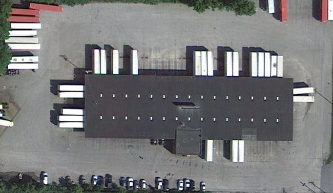
1550 Whiteford Rd
Realpropertynec
York
X
Pennsylvania
42133C0327F
5.96 AC
2025
York County
2025
Philadelphia
010210
York-Hanover, PA
10,890 SF
46-000-JI-0033.B0-00000
DEMOGRAPHICS near 1550 Whiteford Rd
1 Mile
3 Mile
5 Mile
2024 Total Population
7,350
85,523
149,917
2029 Population
7,562
87,882
153,763
Pop Growth 2024-2029
+ 2.88%
+ 2.76%
+ 2.57%
Average Age
40
39
40
2024 Total Households
2,987
33,216
57,775
HH Growth 2024-2029
+ 2.98%
+ 2.81%
+ 2.62%
Median Household Inc
$62,224
$55,204
$64,013
Avg Household Size
2.40
2.40
2.40
2024 Avg HH Vehicles
2.00
2.00
2.00
Median Home Value
$156,362
$165,356
$188,829
Median Year Built
1954
1956
1964
Nearby Places
Map Layers
Map Styles
 Street
 Aerial
- Restaurants
- Banks
- Shops
- Fitness
- Groceries
PUBLIC TRANSPORTATION
AIRPORT
Harrisburg International
DRIVE
WALK
Distance
Harrisburg International
41 min
30.5 mi
Freight Ports
Port of Baltimore
DRIVE
WALK
Distance
Port of Baltimore
72 min
54.4 mi
SALE & LEASE HISTORY
LISTING DATE
SALE/LEASE

Sep 21, 2022
For Sale
Dec 12, 2018
For Lease
Aug 31, 2020
For Lease
Nearby Properties
Address
Land Use
TOTAL SIZE
Lot Size
Zoning
Address
Land Use
TOTAL SIZE
Lot Size
Zoning
21 AC
I
Address
Land Use
TOTAL SIZE
Lot Size
Zoning
779,291 SF
95.61 AC
I
Address
Land Use
TOTAL SIZE
Lot Size
Zoning
1,068,680 SF
64.22 AC
I
Address
Land Use
TOTAL SIZE
Lot Size
Zoning
754,640 SF
54.36 AC
Address
Land Use
TOTAL SIZE
Lot Size
Zoning
123,796 SF
26.99 AC
CH
Address
Land Use
TOTAL SIZE
Lot Size
Zoning
398,644 SF
50.92 AC
CH
Address
Land Use
TOTAL SIZE
Lot Size
Zoning
271,039 SF
47.69 AC
CH
Address
Land Use
TOTAL SIZE
Lot Size
Zoning
174,841 SF
27.30 AC
RS
Address
Land Use
TOTAL SIZE
Lot Size
Zoning
286,411 SF
35.12 AC
CM
Address
Land Use
TOTAL SIZE
Lot Size
Zoning
12.15 AC
Address
Land Use
TOTAL SIZE
Lot Size
Zoning
150,082 SF
3.45 AC
Address
Land Use
TOTAL SIZE
Lot Size
Zoning
170,850 SF
27.83 AC
FD
Address
Land Use
TOTAL SIZE
Lot Size
Zoning
195,669 SF
22.25 AC
RS
Address
Land Use
TOTAL SIZE
Lot Size
Zoning
28.77 AC
I
Address
Land Use
TOTAL SIZE
Lot Size
Zoning
12,432 SF
27.56 AC
R1
Address
Land Use
TOTAL SIZE
Lot Size
Zoning
42,414 SF
25.52 AC
ID
Address
Land Use
TOTAL SIZE
Lot Size
Zoning
12.12 AC
Address
Land Use
TOTAL SIZE
Lot Size
Zoning
7.08 AC
FD
Address
Land Use
TOTAL SIZE
Lot Size
Zoning
373,298 SF
24.99 AC
GI
Address
Land Use
TOTAL SIZE
Lot Size
Zoning
40.04 AC
AG
Address
Land Use
TOTAL SIZE
Lot Size
Zoning
483,676 SF
165.85 AC
I
Address
Land Use
TOTAL SIZE
Lot Size
Zoning
47,648 SF
25.99 AC
MU
Address
Land Use
TOTAL SIZE
Lot Size
Zoning
11.22 AC
Address
Land Use
TOTAL SIZE
Lot Size
Zoning
340,000 SF
24.63 AC
I
Address
Land Use
TOTAL SIZE
Lot Size
Zoning
379,696 SF
20.09 AC
GI
Address
Land Use
TOTAL SIZE
Lot Size
Zoning
101,698 SF
5.88 AC
BI
Address
Land Use
TOTAL SIZE
Lot Size
Zoning
15.88 AC
AG
Address
Land Use
TOTAL SIZE
Lot Size
Zoning
408,240 SF
14.60 AC
FD
Address
Land Use
TOTAL SIZE
Lot Size
Zoning
57,358 SF
9 AC
NC
Address
Land Use
TOTAL SIZE
Lot Size
Zoning
111,200 SF
17.06 AC
R1
The World's #1 Commercial Real Estate Marketplace
Connect with us
© 2025 CoStar Group
The information above has been obtained from sources believed reliable. While we do not doubt its accuracy we have not verified it and make no guarantee, warranty or representation about it. It is your responsibility to independently confirm its accuracy and completeness. Any projections, opinions, assumptions, or estimates used are for example only and do not represent the current or future performance of the property. The value of this transaction to you depends on tax and other factors which should be evaluated by your tax, financial, and legal advisors. You and your advisors should conduct a careful, independent investigation of the property to determine to your satisfaction the suitability of the property for your needs.