Property Record
15500 Hanover Pike, Upperco, MD 21155

NEARBY LISTINGS FOR SALE OR LEASE
-
-
View all Upperco listings for sale on LoopNet.com
Property Detail
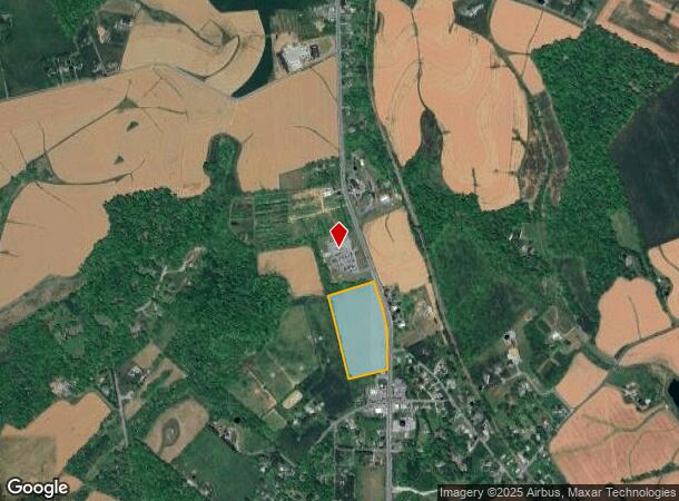
15500 Hanover Pike
Baltimore-Columbia-Towson, MD
Morfoot Prop
04-0418000386
11.93 AC.
Agriculturalland
Baltimore
X
Maryland
2400100090G
0418000
2024
11.98 AC
2025
Reisterstown Rd Corridor
404600
Baltimore
29,125 SF
DEMOGRAPHICS near 15500 Hanover Pike
1 Mile
3 Mile
5 Mile
2024 Total Population
633
4,539
21,596
2029 Population
625
4,549
21,968
Pop Growth 2024-2029
(1.26%)
+ 0.22%
+ 1.72%
Average Age
45
43
42
2024 Total Households
241
1,668
8,202
HH Growth 2024-2029
(1.24%)
+ 0.06%
+ 1.76%
Median Household Inc
$106,060
$108,466
$100,949
Avg Household Size
2.50
2.60
2.60
2024 Avg HH Vehicles
2.00
2.00
2.00
Median Home Value
$444,444
$438,153
$379,812
Median Year Built
1964
1976
1980
Nearby Places
Map Layers
Map Styles
 Street
 Aerial
- Restaurants
- Banks
- Shops
- Fitness
- Groceries
PUBLIC TRANSPORTATION
AIRPORT
Baltimore/Washington International Thurgood Marshall
DRIVE
WALK
Distance
Baltimore/Washington International Thurgood Marshall
46 min
30.4 mi
Freight Ports
Port of Baltimore
DRIVE
WALK
Distance
Port of Baltimore
46 min
30.2 mi
Nearby Properties
Address
Land Use
TOTAL SIZE
Lot Size
Zoning
Address
Land Use
TOTAL SIZE
Lot Size
Zoning
86,496 SF
52.58 AC
RC-2
Address
Land Use
TOTAL SIZE
Lot Size
Zoning
58,688 SF
23.36 AC
RC4
Address
Land Use
TOTAL SIZE
Lot Size
Zoning
210,288 SF
38.44 AC
RESTR
Address
Land Use
TOTAL SIZE
Lot Size
Zoning
20,705 SF
182.66 AC
RC2
Address
Land Use
TOTAL SIZE
Lot Size
Zoning
16,212 SF
6.29 AC
RC2
Address
Land Use
TOTAL SIZE
Lot Size
Zoning
3,864 SF
4.87 AC
C-2
Address
Land Use
TOTAL SIZE
Lot Size
Zoning
9.74 AC
AGRIC
Address
Land Use
TOTAL SIZE
Lot Size
Zoning
1,892 SF
36.10 AC
RESTR
Address
Land Use
TOTAL SIZE
Lot Size
Zoning
3,496 SF
2.95 AC
BL
Address
Land Use
TOTAL SIZE
Lot Size
Zoning
9,600 SF
16.71 AC
AGRIC
Address
Land Use
TOTAL SIZE
Lot Size
Zoning
6,948 SF
6.25 AC
AGRIC
Address
Land Use
TOTAL SIZE
Lot Size
Zoning
6,299 SF
140.50 AC
Address
Land Use
TOTAL SIZE
Lot Size
Zoning
9,540 SF
57.09 AC
Address
Land Use
TOTAL SIZE
Lot Size
Zoning
12.01 AC
RESTR
Address
Land Use
TOTAL SIZE
Lot Size
Zoning
43.66 AC
AGRIC
Address
Land Use
TOTAL SIZE
Lot Size
Zoning
8,937 SF
129.76 AC
Address
Land Use
TOTAL SIZE
Lot Size
Zoning
29,125 SF
4 AC
BM
Address
Land Use
TOTAL SIZE
Lot Size
Zoning
8,100 SF
2.71 AC
I-1
Address
Land Use
TOTAL SIZE
Lot Size
Zoning
45.92 AC
I-1
Address
Land Use
TOTAL SIZE
Lot Size
Zoning
2,940 SF
1.84 AC
C-2
Address
Land Use
TOTAL SIZE
Lot Size
Zoning
8,937 SF
52.45 AC
Address
Land Use
TOTAL SIZE
Lot Size
Zoning
2,356 SF
0.74 AC
C-2
Address
Land Use
TOTAL SIZE
Lot Size
Zoning
13,314 SF
2.60 AC
R-400
Address
Land Use
TOTAL SIZE
Lot Size
Zoning
9,635 SF
5.60 AC
Address
Land Use
TOTAL SIZE
Lot Size
Zoning
6,570 SF
26.50 AC
Address
Land Use
TOTAL SIZE
Lot Size
Zoning
10,488 SF
3.12 AC
Address
Land Use
TOTAL SIZE
Lot Size
Zoning
4,150 SF
63.70 AC
Address
Land Use
TOTAL SIZE
Lot Size
Zoning
6,880 SF
1.35 AC
Address
Land Use
TOTAL SIZE
Lot Size
Zoning
6,164 SF
6.03 AC
RC2
Address
Land Use
TOTAL SIZE
Lot Size
Zoning
4,851 SF
16.38 AC
The World's #1 Commercial Real Estate Marketplace
Connect with us
© 2026 CoStar Group
The information above has been obtained from sources believed reliable. While we do not doubt its accuracy we have not verified it and make no guarantee, warranty or representation about it. It is your responsibility to independently confirm its accuracy and completeness. Any projections, opinions, assumptions, or estimates used are for example only and do not represent the current or future performance of the property. The value of this transaction to you depends on tax and other factors which should be evaluated by your tax, financial, and legal advisors. You and your advisors should conduct a careful, independent investigation of the property to determine to your satisfaction the suitability of the property for your needs.