Property Record
15581 Burnt Store Rd, Punta Gorda, FL 33955
Current Lease Availabilities
NEARBY LISTINGS FOR SALE OR LEASE
Property Detail
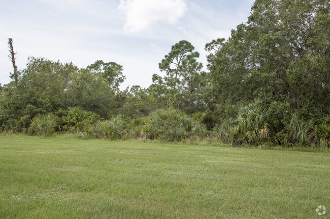
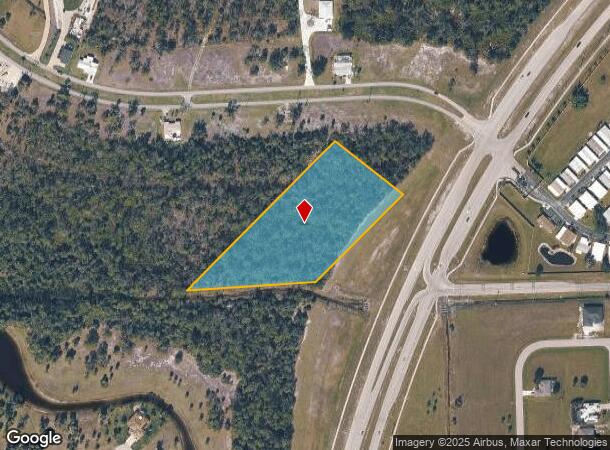
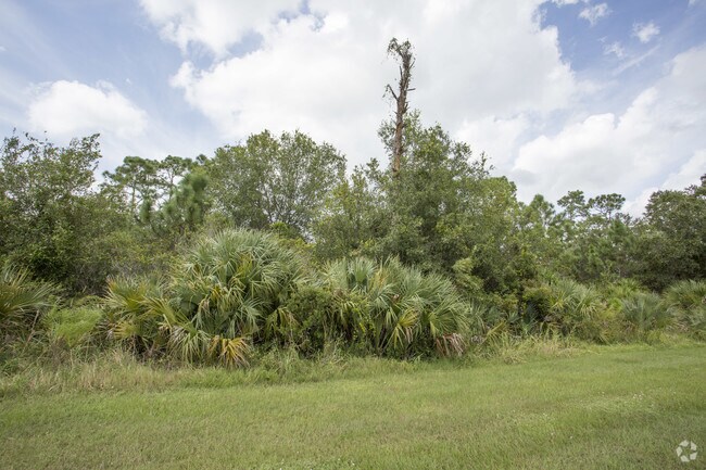
15581 Burnt Store Rd
Punta Gorda, FL
Pirate Harbor
422319480013
PIRATE HARBOR UN 2 A PORT OF TR B DESC AS BEG SW COR SEC20-42-23 TH E 9.72 FT TH NE ALG W R/W BURNT STORE RD 411.5 FT NW 300 FT TO W LN TR B 750.46 FT TO S LN TR B TH E 442.9 FT TO POB BEING 4 AC. M/L 1083/69 2414/487 2633/1746
Commercialacreage
Charlotte
AE
Florida
12015C0416G
tb
2024
4 AC
2025
Charlotte County
010505
Southwest Florida
DEMOGRAPHICS near 15581 Burnt Store Rd
1 Mile
3 Mile
5 Mile
2024 Total Population
1,905
6,842
9,958
2029 Population
2,350
8,458
12,227
Pop Growth 2024-2029
+ 23.36%
+ 23.62%
+ 22.79%
Average Age
59
64
60
2024 Total Households
932
3,520
4,881
HH Growth 2024-2029
+ 23.71%
+ 23.64%
+ 22.84%
Median Household Inc
$65,473
$73,283
$71,434
Avg Household Size
2.00
1.90
2.00
2024 Avg HH Vehicles
2.00
2.00
2.00
Median Home Value
$269,180
$315,013
$290,232
Median Year Built
2004
2001
2000
Nearby Places
Map Layers
Map Styles
 Street
 Aerial
- Restaurants
- Banks
- Shops
- Fitness
- Groceries
PUBLIC TRANSPORTATION
AIRPORT
Punta Gorda
DRIVE
WALK
Distance
Punta Gorda
18 min
10.8 mi
Southwest Florida International
DRIVE
WALK
Distance
Southwest Florida International
51 min
38.4 mi
Freight Ports
Port Manatee
DRIVE
WALK
Distance
Port Manatee
99 min
82.5 mi
Nearby Properties
Address
Land Use
TOTAL SIZE
Lot Size
Zoning
Address
Land Use
TOTAL SIZE
Lot Size
Zoning
39,997 SF
10.34 AC
RM-2
Address
Land Use
TOTAL SIZE
Lot Size
Zoning
16,364 SF
333.14 AC
PD
Address
Land Use
TOTAL SIZE
Lot Size
Zoning
12,820 SF
118.64 AC
II
Address
Land Use
TOTAL SIZE
Lot Size
Zoning
0.86 AC
RE1
Address
Land Use
TOTAL SIZE
Lot Size
Zoning
28,794 SF
3.95 AC
CG
Address
Land Use
TOTAL SIZE
Lot Size
Zoning
12.98 AC
CG
Address
Land Use
TOTAL SIZE
Lot Size
Zoning
8,217 SF
9.57 AC
RE1
Address
Land Use
TOTAL SIZE
Lot Size
Zoning
12.38 AC
CG
Address
Land Use
TOTAL SIZE
Lot Size
Zoning
11.52 AC
CG
Address
Land Use
TOTAL SIZE
Lot Size
Zoning
38.50 AC
MHP
Address
Land Use
TOTAL SIZE
Lot Size
Zoning
10,210 SF
65.43 AC
PD
Address
Land Use
TOTAL SIZE
Lot Size
Zoning
12,402 SF
105.60 AC
AG-2
Address
Land Use
TOTAL SIZE
Lot Size
Zoning
9,317 SF
1.42 AC
CC
Address
Land Use
TOTAL SIZE
Lot Size
Zoning
1.04 AC
PD
Address
Land Use
TOTAL SIZE
Lot Size
Zoning
996 SF
44.43 AC
PD
Address
Land Use
TOTAL SIZE
Lot Size
Zoning
22.26 AC
PD
Address
Land Use
TOTAL SIZE
Lot Size
Zoning
7,980 SF
54.01 AC
RE1
Address
Land Use
TOTAL SIZE
Lot Size
Zoning
19.21 AC
MHP
Address
Land Use
TOTAL SIZE
Lot Size
Zoning
38.49 AC
AG-2
Address
Land Use
TOTAL SIZE
Lot Size
Zoning
4,889 SF
34.24 AC
RE1
Address
Land Use
TOTAL SIZE
Lot Size
Zoning
8,247 SF
40.31 AC
RE1
Address
Land Use
TOTAL SIZE
Lot Size
Zoning
6.94 AC
RE1
Address
Land Use
TOTAL SIZE
Lot Size
Zoning
0.36 AC
RM-2
Address
Land Use
TOTAL SIZE
Lot Size
Zoning
6,991 SF
1.29 AC
RM-2
Address
Land Use
TOTAL SIZE
Lot Size
Zoning
3.98 AC
CG
Address
Land Use
TOTAL SIZE
Lot Size
Zoning
6,692 SF
2.40 AC
RE1
Address
Land Use
TOTAL SIZE
Lot Size
Zoning
3,712 SF
0.46 AC
CG
Address
Land Use
TOTAL SIZE
Lot Size
Zoning
27.50 AC
RE1
Address
Land Use
TOTAL SIZE
Lot Size
Zoning
40 AC
RE1
The World's #1 Commercial Real Estate Marketplace
Connect with us
© 2025 CoStar Group
The information above has been obtained from sources believed reliable. While we do not doubt its accuracy we have not verified it and make no guarantee, warranty or representation about it. It is your responsibility to independently confirm its accuracy and completeness. Any projections, opinions, assumptions, or estimates used are for example only and do not represent the current or future performance of the property. The value of this transaction to you depends on tax and other factors which should be evaluated by your tax, financial, and legal advisors. You and your advisors should conduct a careful, independent investigation of the property to determine to your satisfaction the suitability of the property for your needs.