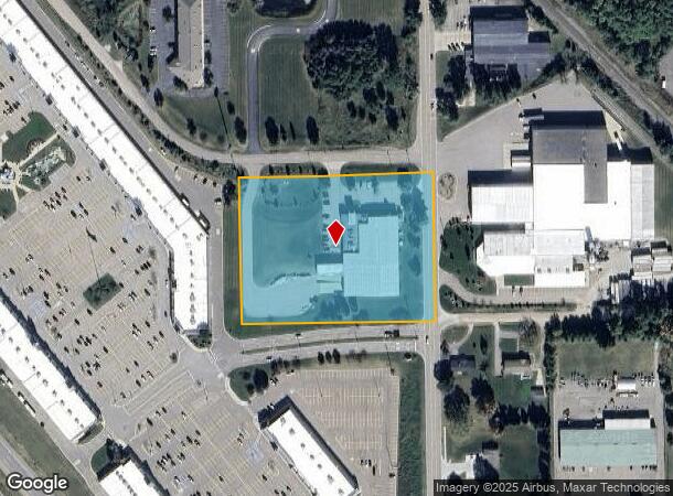
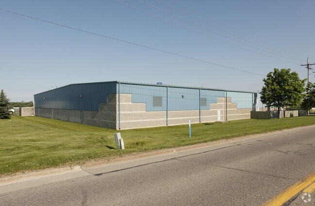
Property Record
1551 N Burkhart Rd, Howell, MI 48855


NEARBY LISTINGS FOR SALE OR LEASE
Property Detail
1551 N Burkhart Rd
06-29-200-031
SEC 29 T3N R4E BEG E 1/4 COR OF SEC TH ALG E-W 1/4 LINE TH N89*37'54"W 510 FT TH N 390.23 FT TH ALG S LINE OF LAMBERT DR TH N
Industrialgeneral
Livingston
X
Michigan
26093C0301D
4.59 AC
2025
Livingston County
2025
Detroit
724001
Detroit-Warren-Dearborn, MI
26,362 SF
DEMOGRAPHICS near 1551 N Burkhart Rd
1 Mile
3 Mile
5 Mile
2024 Total Population
957
10,660
36,791
2029 Population
965
10,941
37,794
Pop Growth 2024-2029
+ 0.84%
+ 2.64%
+ 2.73%
Average Age
43
42
41
2024 Total Households
389
4,258
14,549
HH Growth 2024-2029
+ 0.51%
+ 2.63%
+ 2.71%
Median Household Inc
$68,008
$75,715
$77,733
Avg Household Size
2.40
2.40
2.50
2024 Avg HH Vehicles
2.00
2.00
2.00
Median Home Value
$181,603
$247,137
$248,768
Median Year Built
1998
1993
1990
Nearby Places
Map Layers
Map Styles
 Street
 Aerial
- Restaurants
- Banks
- Shops
- Fitness
- Groceries
PUBLIC TRANSPORTATION
AIRPORT
Bishop International
DRIVE
WALK
Distance
Bishop International
60 min
38.7 mi
Freight Ports
Port of Toledo
DRIVE
WALK
Distance
Port of Toledo
112 min
92.5 mi
Nearby Properties
Address
Land Use
TOTAL SIZE
Lot Size
Zoning
Address
Land Use
TOTAL SIZE
Lot Size
Zoning
767,161 SF
127.33 AC
I-1
Address
Land Use
TOTAL SIZE
Lot Size
Zoning
331,100 SF
41.10 AC
RSC
Address
Land Use
TOTAL SIZE
Lot Size
Zoning
89,443 SF
10.45 AC
R-M
Address
Land Use
TOTAL SIZE
Lot Size
Zoning
102,971 SF
11.95 AC
I-1
Address
Land Use
TOTAL SIZE
Lot Size
Zoning
171,564 SF
30.98 AC
O-1
Address
Land Use
TOTAL SIZE
Lot Size
Zoning
321,167 SF
27.01 AC
IFZ
Address
Land Use
TOTAL SIZE
Lot Size
Zoning
145,366 SF
13.60 AC
R-M
Address
Land Use
TOTAL SIZE
Lot Size
Zoning
95,252 SF
11.56 AC
R-M
Address
Land Use
TOTAL SIZE
Lot Size
Zoning
37.65 AC
MFR
Address
Land Use
TOTAL SIZE
Lot Size
Zoning
80,330 SF
10 AC
MFR
Address
Land Use
TOTAL SIZE
Lot Size
Zoning
38.64 AC
R&D
Address
Land Use
TOTAL SIZE
Lot Size
Zoning
24,644 SF
160 AC
R&D
Address
Land Use
TOTAL SIZE
Lot Size
Zoning
6,837 SF
128.76 AC
MHP
Address
Land Use
TOTAL SIZE
Lot Size
Zoning
152,606 SF
16 AC
R-M
Address
Land Use
TOTAL SIZE
Lot Size
Zoning
16.65 AC
MFR
Address
Land Use
TOTAL SIZE
Lot Size
Zoning
106,170 SF
6.68 AC
I
Address
Land Use
TOTAL SIZE
Lot Size
Zoning
119,260 SF
7.10 AC
IFZ
Address
Land Use
TOTAL SIZE
Lot Size
Zoning
154,040 SF
13.70 AC
I
Address
Land Use
TOTAL SIZE
Lot Size
Zoning
112,419 SF
9.31 AC
I
Address
Land Use
TOTAL SIZE
Lot Size
Zoning
107,867 SF
26.53 AC
AR
Address
Land Use
TOTAL SIZE
Lot Size
Zoning
119,436 SF
12.20 AC
I-1
Address
Land Use
TOTAL SIZE
Lot Size
Zoning
37,892 SF
5.40 AC
R-M
Address
Land Use
TOTAL SIZE
Lot Size
Zoning
128,437 SF
8.55 AC
IFZ
Address
Land Use
TOTAL SIZE
Lot Size
Zoning
122,040 SF
9.81 AC
I
Address
Land Use
TOTAL SIZE
Lot Size
Zoning
39,654 SF
1.62 AC
PUD
Address
Land Use
TOTAL SIZE
Lot Size
Zoning
22,660 SF
4.80 AC
IFZ
Address
Land Use
TOTAL SIZE
Lot Size
Zoning
81.26 AC
MHP
Address
Land Use
TOTAL SIZE
Lot Size
Zoning
52,744 SF
4.10 AC
R-M
Address
Land Use
TOTAL SIZE
Lot Size
Zoning
55,100 SF
5 AC
NSC
Address
Land Use
TOTAL SIZE
Lot Size
Zoning
56,205 SF
3.68 AC
RSC
The World's #1 Commercial Real Estate Marketplace
Connect with us
© 2026 CoStar Group
The information above has been obtained from sources believed reliable. While we do not doubt its accuracy we have not verified it and make no guarantee, warranty or representation about it. It is your responsibility to independently confirm its accuracy and completeness. Any projections, opinions, assumptions, or estimates used are for example only and do not represent the current or future performance of the property. The value of this transaction to you depends on tax and other factors which should be evaluated by your tax, financial, and legal advisors. You and your advisors should conduct a careful, independent investigation of the property to determine to your satisfaction the suitability of the property for your needs.