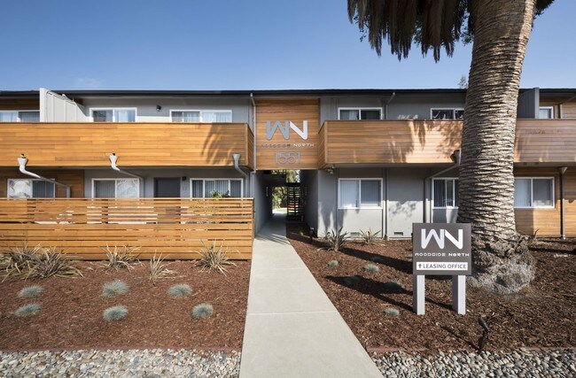
Property Record
1536 Oxford St, Redwood City, CA 94061


NEARBY LISTINGS FOR SALE OR LEASE
Property Detail
1536 Oxford St
San Francisco-San Mateo-Redwood City, CA
Woodside Acres
059-083-010
BEING NELY 221.10 FT OF LOT 5 BLOCK H WOODSIDE ACRES RSM 11/34 35
Multifamilydwelling
San Mateo
X
California
06081C0303E
5
2024
0.89 AC
2025
Palm Park
610800
San Francisco
23,819 SF
DEMOGRAPHICS near 1536 Oxford St
1 Mile
3 Mile
5 Mile
2024 Total Population
34,459
129,959
249,051
2029 Population
33,138
124,468
238,829
Pop Growth 2024-2029
(3.83%)
(4.23%)
(4.10%)
Average Age
39
41
40
2024 Total Households
12,039
46,298
87,272
HH Growth 2024-2029
(3.95%)
(4.29%)
(4.15%)
Median Household Inc
$111,582
$148,459
$147,403
Avg Household Size
2.70
2.70
2.60
2024 Avg HH Vehicles
2.00
2.00
2.00
Median Home Value
$1,128,023
$1,132,442
$1,132,549
Median Year Built
1964
1962
1966
Nearby Places
Map Layers
Map Styles
 Street
 Aerial
- Restaurants
- Banks
- Shops
- Fitness
- Groceries
PUBLIC TRANSPORTATION
COMMUTER RAIL
Redwood City (Caltrain - Caltrain (Caltrain))
DRIVE
WALK
Distance
Redwood City (Caltrain - Caltrain (Caltrain))
5 min
1.9 mi
Menlo Park (Caltrain - Caltrain (Caltrain))
DRIVE
WALK
Distance
Menlo Park (Caltrain - Caltrain (Caltrain))
8 min
3.4 mi
AIRPORT
San Francisco International
DRIVE
WALK
Distance
San Francisco International
24 min
16.4 mi
Norman Y Mineta San Jose International
DRIVE
WALK
Distance
Norman Y Mineta San Jose International
29 min
20.5 mi
Metro Oakland International
DRIVE
WALK
Distance
Metro Oakland International
43 min
32.1 mi
Freight Ports
Port of Redwood City
DRIVE
WALK
Distance
Port of Redwood City
8 min
3.2 mi
SALE & LEASE HISTORY
LISTING DATE
SALE/LEASE

Mar 01, 2019
For Sale
Nearby Properties
Address
Land Use
TOTAL SIZE
Lot Size
Zoning
Address
Land Use
TOTAL SIZE
Lot Size
Zoning
Address
Land Use
TOTAL SIZE
Lot Size
Zoning
520,988 SF
8.88 AC
Address
Land Use
TOTAL SIZE
Lot Size
Zoning
373,238 SF
7.94 AC
Address
Land Use
TOTAL SIZE
Lot Size
Zoning
Address
Land Use
TOTAL SIZE
Lot Size
Zoning
8.31 AC
EA00CA
Address
Land Use
TOTAL SIZE
Lot Size
Zoning
491,030 SF
2.74 AC
Address
Land Use
TOTAL SIZE
Lot Size
Zoning
528,437 SF
9.69 AC
Address
Land Use
TOTAL SIZE
Lot Size
Zoning
330,071 SF
1.64 AC
Address
Land Use
TOTAL SIZE
Lot Size
Zoning
Address
Land Use
TOTAL SIZE
Lot Size
Zoning
378,534 SF
2.24 AC
Address
Land Use
TOTAL SIZE
Lot Size
Zoning
247,567 SF
3.52 AC
Address
Land Use
TOTAL SIZE
Lot Size
Zoning
368,000 SF
11.32 AC
Address
Land Use
TOTAL SIZE
Lot Size
Zoning
40,000 SF
1.60 AC
Address
Land Use
TOTAL SIZE
Lot Size
Zoning
61.20 AC
R10000
Address
Land Use
TOTAL SIZE
Lot Size
Zoning
395,625 SF
5.08 AC
Address
Land Use
TOTAL SIZE
Lot Size
Zoning
458,111 SF
2.26 AC
Address
Land Use
TOTAL SIZE
Lot Size
Zoning
2.69 AC
ML001R
Address
Land Use
TOTAL SIZE
Lot Size
Zoning
Address
Land Use
TOTAL SIZE
Lot Size
Zoning
16.43 AC
Address
Land Use
TOTAL SIZE
Lot Size
Zoning
366,384 SF
3.63 AC
Address
Land Use
TOTAL SIZE
Lot Size
Zoning
249,198 SF
1.14 AC
Address
Land Use
TOTAL SIZE
Lot Size
Zoning
171,563 SF
3.57 AC
Address
Land Use
TOTAL SIZE
Lot Size
Zoning
2,023 SF
1.31 AC
Address
Land Use
TOTAL SIZE
Lot Size
Zoning
262,189 SF
1.16 AC
Address
Land Use
TOTAL SIZE
Lot Size
Zoning
170,495 SF
7.15 AC
Address
Land Use
TOTAL SIZE
Lot Size
Zoning
Address
Land Use
TOTAL SIZE
Lot Size
Zoning
221,200 SF
0.77 AC
Address
Land Use
TOTAL SIZE
Lot Size
Zoning
2.13 AC
Address
Land Use
TOTAL SIZE
Lot Size
Zoning
135,070 SF
5.27 AC
Address
Land Use
TOTAL SIZE
Lot Size
Zoning
11,760 SF
1.50 AC
The World's #1 Commercial Real Estate Marketplace
Connect with us
© 2026 CoStar Group
The information above has been obtained from sources believed reliable. While we do not doubt its accuracy we have not verified it and make no guarantee, warranty or representation about it. It is your responsibility to independently confirm its accuracy and completeness. Any projections, opinions, assumptions, or estimates used are for example only and do not represent the current or future performance of the property. The value of this transaction to you depends on tax and other factors which should be evaluated by your tax, financial, and legal advisors. You and your advisors should conduct a careful, independent investigation of the property to determine to your satisfaction the suitability of the property for your needs.