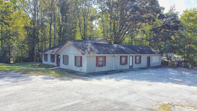
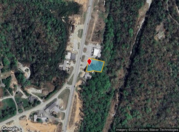
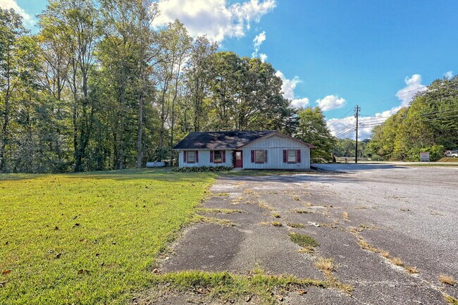
Property Record
1552 Highway 441 N, Clayton, GA 30525
NEARBY LISTINGS FOR SALE OR LEASE
-
-
View all Clayton listings for sale on LoopNet.com
Property Detail
1552 Highway 441 N
Commercialnec
LL 50 LD 2
X
Rabun
13241C0119D
Georgia
2025
0.59 AC
2025
Georgia Northeast
970103
Other Market Areas
2,598 SF
041E-018
DEMOGRAPHICS near 1552 Highway 441 N
1 Mile
3 Mile
5 Mile
2024 Total Population
619
5,030
8,494
2029 Population
614
4,989
8,526
Pop Growth 2024-2029
(0.81%)
(0.82%)
+ 0.38%
Average Age
47
44
44
2024 Total Households
279
2,181
3,629
HH Growth 2024-2029
(1.08%)
(1.10%)
0.00%
Median Household Inc
$46,500
$47,903
$48,021
Avg Household Size
2.20
2.30
2.30
2024 Avg HH Vehicles
2.00
2.00
2.00
Median Home Value
$206,098
$226,724
$233,009
Median Year Built
1979
1981
1983
Nearby Places
Map Layers
Map Styles
 Street
 Aerial
- Restaurants
- Banks
- Shops
- Fitness
- Groceries
SALE & LEASE HISTORY
LISTING DATE
SALE/LEASE

Oct 29, 2024
For Sale
Aug 19, 2024
For Sale
Nearby Properties
Address
Land Use
TOTAL SIZE
Lot Size
Zoning
Address
Land Use
TOTAL SIZE
Lot Size
Zoning
47,207 SF
9.84 AC
HB
Address
Land Use
TOTAL SIZE
Lot Size
Zoning
1,520 SF
1,083.77 AC
A
Address
Land Use
TOTAL SIZE
Lot Size
Zoning
157,489 SF
17.78 AC
HB
Address
Land Use
TOTAL SIZE
Lot Size
Zoning
84,341 SF
25.35 AC
HB
Address
Land Use
TOTAL SIZE
Lot Size
Zoning
38,022 SF
0.68 AC
CBD
Address
Land Use
TOTAL SIZE
Lot Size
Zoning
2,150 SF
76.67 AC
HB
Address
Land Use
TOTAL SIZE
Lot Size
Zoning
480 SF
10.33 AC
CBD
Address
Land Use
TOTAL SIZE
Lot Size
Zoning
5,000 SF
4.30 AC
R3
Address
Land Use
TOTAL SIZE
Lot Size
Zoning
5,369 SF
2.68 AC
Address
Land Use
TOTAL SIZE
Lot Size
Zoning
35,000 SF
4.04 AC
CBD
Address
Land Use
TOTAL SIZE
Lot Size
Zoning
38,628 SF
3.65 AC
HB
Address
Land Use
TOTAL SIZE
Lot Size
Zoning
24,025 SF
4.20 AC
R1
Address
Land Use
TOTAL SIZE
Lot Size
Zoning
18,864 SF
15 AC
A
Address
Land Use
TOTAL SIZE
Lot Size
Zoning
7,750 SF
11.10 AC
R3
Address
Land Use
TOTAL SIZE
Lot Size
Zoning
3,280 SF
117.59 AC
R1
Address
Land Use
TOTAL SIZE
Lot Size
Zoning
5,174 SF
10 AC
HB
Address
Land Use
TOTAL SIZE
Lot Size
Zoning
11,940 SF
4.50 AC
HB
Address
Land Use
TOTAL SIZE
Lot Size
Zoning
9,393 SF
1.34 AC
HB
Address
Land Use
TOTAL SIZE
Lot Size
Zoning
25,700 SF
4.80 AC
CBD
Address
Land Use
TOTAL SIZE
Lot Size
Zoning
12,064 SF
0.74 AC
CBD
Address
Land Use
TOTAL SIZE
Lot Size
Zoning
6,413 SF
1.70 AC
HB
Address
Land Use
TOTAL SIZE
Lot Size
Zoning
16,599 SF
0.14 AC
CBD
Address
Land Use
TOTAL SIZE
Lot Size
Zoning
12,322 SF
1.33 AC
HB
Address
Land Use
TOTAL SIZE
Lot Size
Zoning
23,630 SF
20.47 AC
R2
Address
Land Use
TOTAL SIZE
Lot Size
Zoning
7,854 SF
12.92 AC
HB
Address
Land Use
TOTAL SIZE
Lot Size
Zoning
8,585 SF
391.43 AC
VC
Address
Land Use
TOTAL SIZE
Lot Size
Zoning
10,336 SF
2.46 AC
HB
Address
Land Use
TOTAL SIZE
Lot Size
Zoning
1,680 SF
2.10 AC
R1
Address
Land Use
TOTAL SIZE
Lot Size
Zoning
10,370 SF
3.71 AC
HB
The World's #1 Commercial Real Estate Marketplace
Connect with us
© 2025 CoStar Group
The information above has been obtained from sources believed reliable. While we do not doubt its accuracy we have not verified it and make no guarantee, warranty or representation about it. It is your responsibility to independently confirm its accuracy and completeness. Any projections, opinions, assumptions, or estimates used are for example only and do not represent the current or future performance of the property. The value of this transaction to you depends on tax and other factors which should be evaluated by your tax, financial, and legal advisors. You and your advisors should conduct a careful, independent investigation of the property to determine to your satisfaction the suitability of the property for your needs.