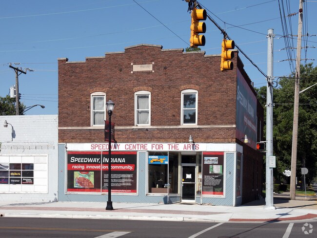
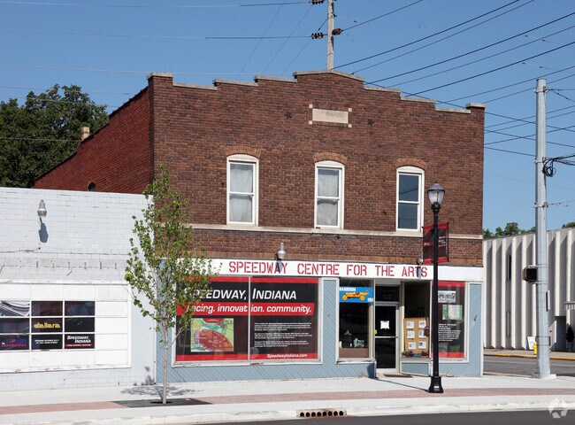
Property Record
1564 Main St, Indianapolis, IN 46224

NEARBY LISTINGS FOR SALE OR LEASE
Property Detail
1564 Main St
Indianapolis-Carmel-Anderson, IN
Speedway City
49-06-31-101-364.000-914
SPEEDWAY CITY L 1 THRU L 6
Storebuilding
Marion
X
Indiana
18097C0136G
1,6
2023
0.19 AC
2024
Speedway
341000
Indianapolis
17,910 SF
DEMOGRAPHICS near 1564 Main St
1 Mile
3 Mile
5 Mile
2024 Total Population
8,160
106,957
243,761
2029 Population
8,044
106,192
242,687
Pop Growth 2024-2029
(1.42%)
(0.72%)
(0.44%)
Average Age
39
35
36
2024 Total Households
3,648
41,081
100,273
HH Growth 2024-2029
(1.54%)
(0.78%)
(0.37%)
Median Household Inc
$48,246
$48,530
$52,716
Avg Household Size
2.20
2.50
2.30
2024 Avg HH Vehicles
2.00
2.00
2.00
Median Home Value
$165,852
$126,664
$149,639
Median Year Built
1956
1963
1971
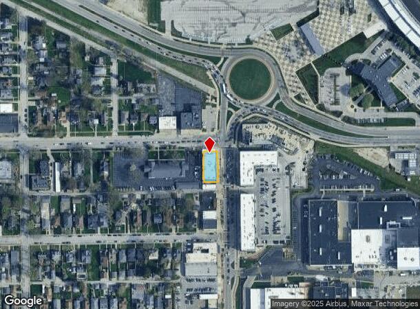
Nearby Places
Map Layers
Map Styles
 Street
 Aerial
- Restaurants
- Banks
- Shops
- Fitness
- Groceries
PUBLIC TRANSPORTATION
COMMUTER RAIL
DRIVE
WALK
Distance
14 min
7.5 mi
AIRPORT
Indianapolis International
DRIVE
WALK
Distance
Indianapolis International
25 min
12.4 mi
Nearby Properties
Address
Land Use
TOTAL SIZE
Lot Size
Zoning
Address
Land Use
TOTAL SIZE
Lot Size
Zoning
80,249 SF
71.96 AC
ZO01
Address
Land Use
TOTAL SIZE
Lot Size
Zoning
5,280 SF
97.87 AC
ZO01
Address
Land Use
TOTAL SIZE
Lot Size
Zoning
4,515 SF
23.95 AC
ZO01
Address
Land Use
TOTAL SIZE
Lot Size
Zoning
415,877 SF
55.83 AC
ZO01
Address
Land Use
TOTAL SIZE
Lot Size
Zoning
1,889,477 SF
89.82 AC
ZO01
Address
Land Use
TOTAL SIZE
Lot Size
Zoning
132 SF
3.26 AC
ZO01
Address
Land Use
TOTAL SIZE
Lot Size
Zoning
4,663 SF
7.98 AC
ZO01
Address
Land Use
TOTAL SIZE
Lot Size
Zoning
600,000 SF
41.64 AC
ZO01
Address
Land Use
TOTAL SIZE
Lot Size
Zoning
3,546 SF
25.09 AC
ZO01
Address
Land Use
TOTAL SIZE
Lot Size
Zoning
18,154 SF
9.40 AC
ZO01
Address
Land Use
TOTAL SIZE
Lot Size
Zoning
3,878 SF
17.76 AC
Address
Land Use
TOTAL SIZE
Lot Size
Zoning
438,643 SF
43.63 AC
ZO01
Address
Land Use
TOTAL SIZE
Lot Size
Zoning
70,717 SF
7.40 AC
ZO01
Address
Land Use
TOTAL SIZE
Lot Size
Zoning
7,364 SF
9.20 AC
Address
Land Use
TOTAL SIZE
Lot Size
Zoning
19,930 SF
3.92 AC
ZO01
Address
Land Use
TOTAL SIZE
Lot Size
Zoning
3,618 SF
31.13 AC
ZO01
Address
Land Use
TOTAL SIZE
Lot Size
Zoning
30,545 SF
3.41 AC
ZO01
Address
Land Use
TOTAL SIZE
Lot Size
Zoning
3,706 SF
30.57 AC
ZO01
Address
Land Use
TOTAL SIZE
Lot Size
Zoning
1.88 AC
ZO01
Address
Land Use
TOTAL SIZE
Lot Size
Zoning
1,868 SF
14.50 AC
ZO01
Address
Land Use
TOTAL SIZE
Lot Size
Zoning
28,400 SF
22.04 AC
ZO01
Address
Land Use
TOTAL SIZE
Lot Size
Zoning
73,528 SF
80 AC
ZO01
Address
Land Use
TOTAL SIZE
Lot Size
Zoning
101,718 SF
49.77 AC
ZO01
Address
Land Use
TOTAL SIZE
Lot Size
Zoning
2,000 SF
57.60 AC
ZO01
Address
Land Use
TOTAL SIZE
Lot Size
Zoning
1,700 SF
40.37 AC
ZO01
Address
Land Use
TOTAL SIZE
Lot Size
Zoning
5,616 SF
9.34 AC
Address
Land Use
TOTAL SIZE
Lot Size
Zoning
2,288 SF
21.42 AC
Address
Land Use
TOTAL SIZE
Lot Size
Zoning
3,802 SF
12.25 AC
Address
Land Use
TOTAL SIZE
Lot Size
Zoning
120,734 SF
21.48 AC
Address
Land Use
TOTAL SIZE
Lot Size
Zoning
9,094 SF
6.22 AC
ZO01
The World's #1 Commercial Real Estate Marketplace
Connect with us
© 2026 CoStar Group
The information above has been obtained from sources believed reliable. While we do not doubt its accuracy we have not verified it and make no guarantee, warranty or representation about it. It is your responsibility to independently confirm its accuracy and completeness. Any projections, opinions, assumptions, or estimates used are for example only and do not represent the current or future performance of the property. The value of this transaction to you depends on tax and other factors which should be evaluated by your tax, financial, and legal advisors. You and your advisors should conduct a careful, independent investigation of the property to determine to your satisfaction the suitability of the property for your needs.