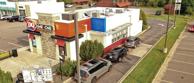
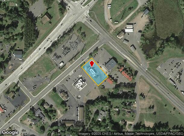
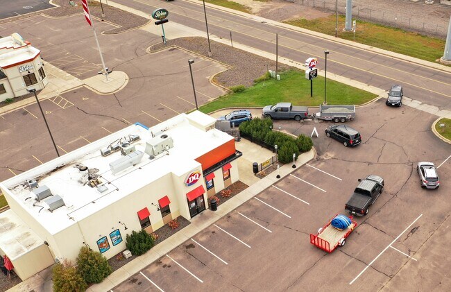
Property Record
15539 Railroad St, Hayward, WI 54843

NEARBY LISTINGS FOR SALE OR LEASE
Property Detail
15539 Railroad St
Other Market Areas
PRT NWSE, LOT 1 CSM 30/216 #7589
236-941-22-4236
Sawyer
Commercialnec
Wisconsin
2024
1
2024
0.62 AC
100502
Wisconsin North Area
DEMOGRAPHICS near 15539 Railroad St
1 Mile
3 Mile
5 Mile
2024 Total Population
1,553
3,505
4,779
2029 Population
1,550
3,519
4,857
Pop Growth 2024-2029
(0.19%)
+ 0.40%
+ 1.63%
Average Age
42
43
44
2024 Total Households
671
1,504
2,056
HH Growth 2024-2029
(0.60%)
+ 0.13%
+ 1.41%
Median Household Inc
$33,333
$48,914
$54,108
Avg Household Size
2.10
2.20
2.20
2024 Avg HH Vehicles
2.00
2.00
2.00
Median Home Value
$168,206
$178,435
$190,564
Median Year Built
1980
1977
1979
Nearby Places
Map Layers
Map Styles
 Street
 Aerial
- Restaurants
- Banks
- Shops
- Fitness
- Groceries
SALE & LEASE HISTORY
LISTING DATE
SALE/LEASE

Oct 12, 2021
For Sale
Nearby Properties
Address
Land Use
TOTAL SIZE
Lot Size
Zoning
Address
Land Use
TOTAL SIZE
Lot Size
Zoning
17.10 AC
CIT
Address
Land Use
TOTAL SIZE
Lot Size
Zoning
Address
Land Use
TOTAL SIZE
Lot Size
Zoning
40 AC
I-1
Address
Land Use
TOTAL SIZE
Lot Size
Zoning
8.48 AC
CIT
Address
Land Use
TOTAL SIZE
Lot Size
Zoning
8.28 AC
CIT
Address
Land Use
TOTAL SIZE
Lot Size
Zoning
18.68 AC
CIT
Address
Land Use
TOTAL SIZE
Lot Size
Zoning
389.02 AC
A-1;F-1
Address
Land Use
TOTAL SIZE
Lot Size
Zoning
5.98 AC
CIT
Address
Land Use
TOTAL SIZE
Lot Size
Zoning
2.85 AC
CIT
Address
Land Use
TOTAL SIZE
Lot Size
Zoning
5.25 AC
CIT
Address
Land Use
TOTAL SIZE
Lot Size
Zoning
2.59 AC
CIT
Address
Land Use
TOTAL SIZE
Lot Size
Zoning
2.07 AC
CIT
Address
Land Use
TOTAL SIZE
Lot Size
Zoning
2.23 AC
CIT
Address
Land Use
TOTAL SIZE
Lot Size
Zoning
1.43 AC
CIT
Address
Land Use
TOTAL SIZE
Lot Size
Zoning
1.81 AC
CIT
Address
Land Use
TOTAL SIZE
Lot Size
Zoning
0.85 AC
CIT
Address
Land Use
TOTAL SIZE
Lot Size
Zoning
1.98 AC
CIT
Address
Land Use
TOTAL SIZE
Lot Size
Zoning
2.68 AC
CIT
Address
Land Use
TOTAL SIZE
Lot Size
Zoning
4.34 AC
CIT
Address
Land Use
TOTAL SIZE
Lot Size
Zoning
4.76 AC
Address
Land Use
TOTAL SIZE
Lot Size
Zoning
11.60 AC
C-1
Address
Land Use
TOTAL SIZE
Lot Size
Zoning
1.41 AC
Address
Land Use
TOTAL SIZE
Lot Size
Zoning
24.08 AC
RR2
Address
Land Use
TOTAL SIZE
Lot Size
Zoning
Address
Land Use
TOTAL SIZE
Lot Size
Zoning
0.32 AC
CIT
Address
Land Use
TOTAL SIZE
Lot Size
Zoning
0.40 AC
CIT
Address
Land Use
TOTAL SIZE
Lot Size
Zoning
2.27 AC
CIT
Address
Land Use
TOTAL SIZE
Lot Size
Zoning
0.86 AC
CIT
Address
Land Use
TOTAL SIZE
Lot Size
Zoning
1.58 AC
Address
Land Use
TOTAL SIZE
Lot Size
Zoning
The World's #1 Commercial Real Estate Marketplace
Connect with us
© 2025 CoStar Group
The information above has been obtained from sources believed reliable. While we do not doubt its accuracy we have not verified it and make no guarantee, warranty or representation about it. It is your responsibility to independently confirm its accuracy and completeness. Any projections, opinions, assumptions, or estimates used are for example only and do not represent the current or future performance of the property. The value of this transaction to you depends on tax and other factors which should be evaluated by your tax, financial, and legal advisors. You and your advisors should conduct a careful, independent investigation of the property to determine to your satisfaction the suitability of the property for your needs.