Property Record
15543 Interstate 45 S, Conroe, TX 77385
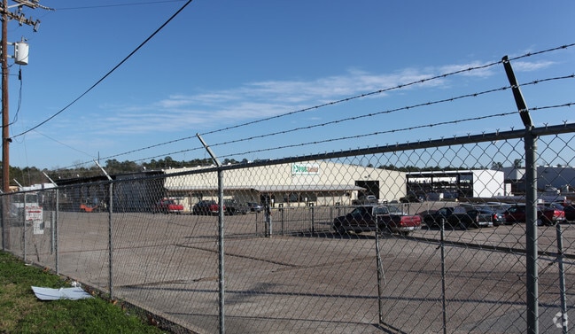

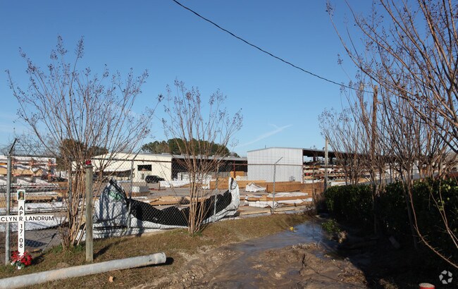
Property Detail
15543 Interstate 45 S
0576-00-03000
A0576 - TOBY THOMAS, TRACT 30, ACRES 10.992
Commercialnec
Montgomery
6
Texas
AE The base floodplain where base flood elevations are provided. AE Zones are now used on new format FIRMs instead of A1-A30 Zones.
10.99 AC
2024
The Woodlands/Conroe
2025
Houston
692101
Houston-Pasadena-The Woodlands, TX
35,200 SF
NEARBY LISTINGS FOR SALE OR LEASE
DEMOGRAPHICS near 15543 Interstate 45 S
1 mile
3 mile
5 mile
2024 Total Population
8,288
49,064
126,016
2029 Population
9,662
57,387
147,735
Pop Growth 2024-2029
+ 16.58%
+ 16.96%
+ 17.24%
Average Age
40
38
40
2024 Total Households
3,493
18,796
48,217
HH Growth 2024-2029
+ 17.29%
+ 17.56%
+ 17.86%
Median Household Inc
$87,281
$105,515
$104,657
Avg Household Size
2.30
2.60
2.60
2024 Avg HH Vehicles
2.00
2.00
2.00
Median Home Value
$389,579
$378,232
$396,441
Median Year Built
2010
2010
2006
Nearby Places
Map Layers
Map Styles
 Street
 Aerial
Transit
 Traffic
 Biking
Places
Listings with unknown addresses are not visible on the map
- Restaurants
- Banks
- Shops
- Fitness
- Groceries
PUBLIC TRANSPORTATION
AIRPORT
George Bush Intcntl/Houston
Drive
Walk
Distance
George Bush Intcntl/Houston
34 min
26.9 mi
Freight Ports
Port of Houston
Drive
Walk
Distance
Port of Houston
57 min
42.7 mi
Nearby Properties
Address
Land Use
TOTAL SIZE
Lot Size
Zoning
Address
Land Use
TOTAL SIZE
Lot Size
Zoning
743,246 SF
40.65 AC
Address
Land Use
TOTAL SIZE
Lot Size
Zoning
465,986 SF
21.55 AC
Address
Land Use
TOTAL SIZE
Lot Size
Zoning
813,318 SF
20.95 AC
Address
Land Use
TOTAL SIZE
Lot Size
Zoning
508,985 SF
29.47 AC
6
Address
Land Use
TOTAL SIZE
Lot Size
Zoning
502,255 SF
15.42 AC
6
Address
Land Use
TOTAL SIZE
Lot Size
Zoning
535,690 SF
15.89 AC
Address
Land Use
TOTAL SIZE
Lot Size
Zoning
109,842 SF
25.58 AC
Address
Land Use
TOTAL SIZE
Lot Size
Zoning
579,596 SF
1.32 AC
Address
Land Use
TOTAL SIZE
Lot Size
Zoning
494,633 SF
17.70 AC
Address
Land Use
TOTAL SIZE
Lot Size
Zoning
880,985 SF
99.32 AC
6
Address
Land Use
TOTAL SIZE
Lot Size
Zoning
189,537 SF
13.52 AC
Address
Land Use
TOTAL SIZE
Lot Size
Zoning
315,885 SF
17.41 AC
Address
Land Use
TOTAL SIZE
Lot Size
Zoning
344,233 SF
15.24 AC
Address
Land Use
TOTAL SIZE
Lot Size
Zoning
292,274 SF
7.55 AC
Address
Land Use
TOTAL SIZE
Lot Size
Zoning
477,509 SF
41.53 AC
Address
Land Use
TOTAL SIZE
Lot Size
Zoning
441,092 SF
29.09 AC
Address
Land Use
TOTAL SIZE
Lot Size
Zoning
269,565 SF
14.58 AC
Address
Land Use
TOTAL SIZE
Lot Size
Zoning
427,151 SF
17.98 AC
Address
Land Use
TOTAL SIZE
Lot Size
Zoning
44,672 SF
13.08 AC
Address
Land Use
TOTAL SIZE
Lot Size
Zoning
222,721 SF
10.28 AC
Address
Land Use
TOTAL SIZE
Lot Size
Zoning
291,173 SF
17.77 AC
6
Address
Land Use
TOTAL SIZE
Lot Size
Zoning
221,485 SF
12.36 AC
Address
Land Use
TOTAL SIZE
Lot Size
Zoning
221,955 SF
7.71 AC
Address
Land Use
TOTAL SIZE
Lot Size
Zoning
261,490 SF
125.16 AC
6
Address
Land Use
TOTAL SIZE
Lot Size
Zoning
217,654 SF
9.81 AC
Address
Land Use
TOTAL SIZE
Lot Size
Zoning
270,204 SF
9.85 AC
Address
Land Use
TOTAL SIZE
Lot Size
Zoning
158,093 SF
13.88 AC
Address
Land Use
TOTAL SIZE
Lot Size
Zoning
85,560 SF
8.55 AC
Address
Land Use
TOTAL SIZE
Lot Size
Zoning
181,860 SF
22.85 AC
6
The World's #1 Commercial Real Estate Marketplace
Connect with us
© 2026 CoStar Group
The information above has been obtained from sources believed reliable. While we do not doubt its accuracy we have not verified it and make no guarantee, warranty or representation about it. It is your responsibility to independently confirm its accuracy and completeness. Any projections, opinions, assumptions, or estimates used are for example only and do not represent the current or future performance of the property. The value of this transaction to you depends on tax and other factors which should be evaluated by your tax, financial, and legal advisors. You and your advisors should conduct a careful, independent investigation of the property to determine to your satisfaction the suitability of the property for your needs.