Property Record
1555 E Telegraph Rd, Fillmore, CA 93015

Property Detail
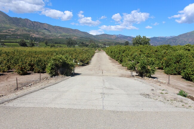
1555 E Telegraph Rd
Orchard
VENTURA
AE-40
California
AE The base floodplain where base flood elevations are provided. AE Zones are now used on new format FIRMs instead of A1-A30 Zones.
47.19 AC
2024
Fillmore/NE County
2025
Los Angeles
000302
Oxnard-Thousand Oaks-Ventura, CA
1,432 SF
046-0-010-125
NEARBY LISTINGS FOR SALE OR LEASE
DEMOGRAPHICS near 1555 E Telegraph Rd
1 mile
3 mile
5 mile
2025 Total Population
1,045
17,494
18,039
2030 Population
1,028
17,386
17,938
Pop Growth 2025-2030
(1.63%)
(0.62%)
(0.56%)
Average Age
38
38
38
2025 Total Households
295
4,952
5,130
HH Growth 2025-2030
(2.03%)
(0.63%)
(0.57%)
Median Household Inc
$120,613
$88,447
$88,328
Avg Household Size
3.50
3.50
3.40
2025 Avg HH Vehicles
3.00
2.00
2.00
Median Home Value
$756,622
$684,354
$684,744
Median Year Built
1982
1974
1974
Nearby Places
Map Layers
Map Styles
 Street
 Aerial
Transit
 Traffic
 Biking
Places
Listings with unknown addresses are not visible on the map
- Restaurants
- Banks
- Shops
- Fitness
- Groceries
SALE & LEASE HISTORY
LISTING DATE
SALE/LEASE

Apr 06, 2020
For Sale
Nearby Properties
Address
Land Use
TOTAL SIZE
Lot Size
Zoning
Address
Land Use
TOTAL SIZE
Lot Size
Zoning
2.13 AC
Address
Land Use
TOTAL SIZE
Lot Size
Zoning
10.52 AC
AE
Address
Land Use
TOTAL SIZE
Lot Size
Zoning
1.43 AC
RO
Address
Land Use
TOTAL SIZE
Lot Size
Zoning
43,521 SF
0.95 AC
A1
Address
Land Use
TOTAL SIZE
Lot Size
Zoning
399.50 AC
AE
Address
Land Use
TOTAL SIZE
Lot Size
Zoning
1.60 AC
Address
Land Use
TOTAL SIZE
Lot Size
Zoning
293.48 AC
Address
Land Use
TOTAL SIZE
Lot Size
Zoning
2.58 AC
A1
Address
Land Use
TOTAL SIZE
Lot Size
Zoning
7,380 SF
2.85 AC
M1
Address
Land Use
TOTAL SIZE
Lot Size
Zoning
39,532 SF
0.37 AC
7
Address
Land Use
TOTAL SIZE
Lot Size
Zoning
1.70 AC
Address
Land Use
TOTAL SIZE
Lot Size
Zoning
25,390 SF
3.32 AC
A1
Address
Land Use
TOTAL SIZE
Lot Size
Zoning
25,476 SF
3.86 AC
R2PD
Address
Land Use
TOTAL SIZE
Lot Size
Zoning
88,620 SF
10.94 AC
M2
Address
Land Use
TOTAL SIZE
Lot Size
Zoning
172.70 AC
AE-40
Address
Land Use
TOTAL SIZE
Lot Size
Zoning
27,736 SF
1.73 AC
Address
Land Use
TOTAL SIZE
Lot Size
Zoning
152.03 AC
AE
Address
Land Use
TOTAL SIZE
Lot Size
Zoning
293.48 AC
Address
Land Use
TOTAL SIZE
Lot Size
Zoning
71.14 AC
AE/MRP
Address
Land Use
TOTAL SIZE
Lot Size
Zoning
70.89 AC
AE
Address
Land Use
TOTAL SIZE
Lot Size
Zoning
8,680 SF
2.78 AC
Address
Land Use
TOTAL SIZE
Lot Size
Zoning
16,730 SF
0.60 AC
R3
Address
Land Use
TOTAL SIZE
Lot Size
Zoning
136.19 AC
AE
Address
Land Use
TOTAL SIZE
Lot Size
Zoning
1,836 SF
0.39 AC
C3
Address
Land Use
TOTAL SIZE
Lot Size
Zoning
13,703 SF
1.37 AC
RE
Address
Land Use
TOTAL SIZE
Lot Size
Zoning
27.05 AC
AE
Address
Land Use
TOTAL SIZE
Lot Size
Zoning
20,904 SF
1.72 AC
C3
Address
Land Use
TOTAL SIZE
Lot Size
Zoning
0.46 AC
A1
Address
Land Use
TOTAL SIZE
Lot Size
Zoning
78.10 AC
AE
Address
Land Use
TOTAL SIZE
Lot Size
Zoning
11,573 SF
0.16 AC
C3
The World's #1 Commercial Real Estate Marketplace
Connect with us
© 2026 CoStar Group
The information above has been obtained from sources believed reliable. While we do not doubt its accuracy we have not verified it and make no guarantee, warranty or representation about it. It is your responsibility to independently confirm its accuracy and completeness. Any projections, opinions, assumptions, or estimates used are for example only and do not represent the current or future performance of the property. The value of this transaction to you depends on tax and other factors which should be evaluated by your tax, financial, and legal advisors. You and your advisors should conduct a careful, independent investigation of the property to determine to your satisfaction the suitability of the property for your needs.