Property Record
1555 Westgreen Blvd, Katy, TX 77450
NEARBY LISTINGS FOR SALE OR LEASE
-
-
View all Katy listings for sale on LoopNet.com
Property Detail
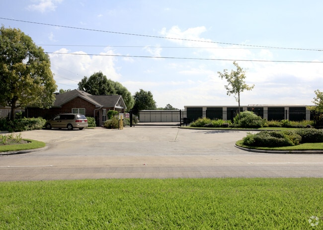
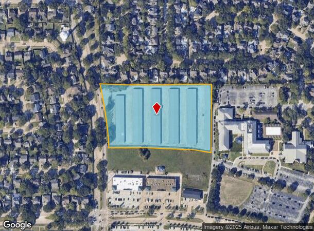
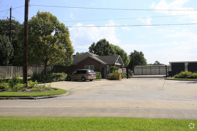
1555 Westgreen Blvd
1153910090021
Nottingham Country Sec 10
Shipyard
RES D BLK 9 NOTTINGHAM COUNTRY SEC 10
X
Harris
48201C0615M
Texas
2024
6.82 AC
2025
Katy/Grand Parkway West
454700
Houston
119,760 SF
Houston-The Woodlands-Sugar Land, TX
DEMOGRAPHICS near 1555 Westgreen Blvd
1 Mile
3 Mile
5 Mile
2024 Total Population
18,830
98,976
268,274
2029 Population
19,101
103,611
290,561
Pop Growth 2024-2029
+ 1.44%
+ 4.68%
+ 8.31%
Average Age
39
38
37
2024 Total Households
6,422
34,783
90,083
HH Growth 2024-2029
+ 1.39%
+ 4.72%
+ 8.26%
Median Household Inc
$101,286
$90,176
$91,141
Avg Household Size
2.90
2.80
2.90
2024 Avg HH Vehicles
2.00
2.00
2.00
Median Home Value
$285,021
$303,022
$277,277
Median Year Built
1988
1995
2002
Nearby Places
Map Layers
Map Styles
 Street
 Aerial
- Restaurants
- Banks
- Shops
- Fitness
- Groceries
PUBLIC TRANSPORTATION
AIRPORT
William P Hobby
DRIVE
WALK
Distance
William P Hobby
55 min
37.7 mi
George Bush Intcntl/Houston
DRIVE
WALK
Distance
George Bush Intcntl/Houston
50 min
39.0 mi
Freight Ports
Port of Houston
DRIVE
WALK
Distance
Port of Houston
49 min
34.4 mi
Nearby Properties
Address
Land Use
TOTAL SIZE
Lot Size
Zoning
Address
Land Use
TOTAL SIZE
Lot Size
Zoning
614,847 SF
42 AC
Address
Land Use
TOTAL SIZE
Lot Size
Zoning
523,641 SF
17.31 AC
X
Address
Land Use
TOTAL SIZE
Lot Size
Zoning
481,055 SF
4.56 AC
Address
Land Use
TOTAL SIZE
Lot Size
Zoning
451,973 SF
19.47 AC
Address
Land Use
TOTAL SIZE
Lot Size
Zoning
439,347 SF
13.50 AC
Address
Land Use
TOTAL SIZE
Lot Size
Zoning
417,092 SF
17.58 AC
Address
Land Use
TOTAL SIZE
Lot Size
Zoning
891,129 SF
44.39 AC
Address
Land Use
TOTAL SIZE
Lot Size
Zoning
346,736 SF
14.28 AC
Address
Land Use
TOTAL SIZE
Lot Size
Zoning
352,733 SF
13.66 AC
Address
Land Use
TOTAL SIZE
Lot Size
Zoning
455,592 SF
27.53 AC
Address
Land Use
TOTAL SIZE
Lot Size
Zoning
455,592 SF
20.95 AC
Address
Land Use
TOTAL SIZE
Lot Size
Zoning
375,486 SF
12.36 AC
Address
Land Use
TOTAL SIZE
Lot Size
Zoning
343,605 SF
11.90 AC
Address
Land Use
TOTAL SIZE
Lot Size
Zoning
168,051 SF
12.68 AC
Address
Land Use
TOTAL SIZE
Lot Size
Zoning
319,717 SF
10.45 AC
Address
Land Use
TOTAL SIZE
Lot Size
Zoning
492,836 SF
30.20 AC
Address
Land Use
TOTAL SIZE
Lot Size
Zoning
272,033 SF
12.74 AC
Address
Land Use
TOTAL SIZE
Lot Size
Zoning
278,684 SF
13 AC
Address
Land Use
TOTAL SIZE
Lot Size
Zoning
384,260 SF
18 AC
Address
Land Use
TOTAL SIZE
Lot Size
Zoning
317,277 SF
16.16 AC
Address
Land Use
TOTAL SIZE
Lot Size
Zoning
235,837 SF
7.99 AC
Address
Land Use
TOTAL SIZE
Lot Size
Zoning
326,912 SF
13.78 AC
Address
Land Use
TOTAL SIZE
Lot Size
Zoning
284,321 SF
10.54 AC
Address
Land Use
TOTAL SIZE
Lot Size
Zoning
351,505 SF
13.38 AC
Address
Land Use
TOTAL SIZE
Lot Size
Zoning
307,596 SF
9.62 AC
Address
Land Use
TOTAL SIZE
Lot Size
Zoning
214,347 SF
30.70 AC
Address
Land Use
TOTAL SIZE
Lot Size
Zoning
312,053 SF
14.11 AC
Address
Land Use
TOTAL SIZE
Lot Size
Zoning
313,705 SF
14.11 AC
Address
Land Use
TOTAL SIZE
Lot Size
Zoning
420,671 SF
23.29 AC
Address
Land Use
TOTAL SIZE
Lot Size
Zoning
183,216 SF
10.84 AC
The World's #1 Commercial Real Estate Marketplace
Connect with us
© 2025 CoStar Group
The information above has been obtained from sources believed reliable. While we do not doubt its accuracy we have not verified it and make no guarantee, warranty or representation about it. It is your responsibility to independently confirm its accuracy and completeness. Any projections, opinions, assumptions, or estimates used are for example only and do not represent the current or future performance of the property. The value of this transaction to you depends on tax and other factors which should be evaluated by your tax, financial, and legal advisors. You and your advisors should conduct a careful, independent investigation of the property to determine to your satisfaction the suitability of the property for your needs.