Property Record
1562 Telegraph Dr, Pontiac, MI 48340

NEARBY LISTINGS FOR SALE OR LEASE
Property Detail
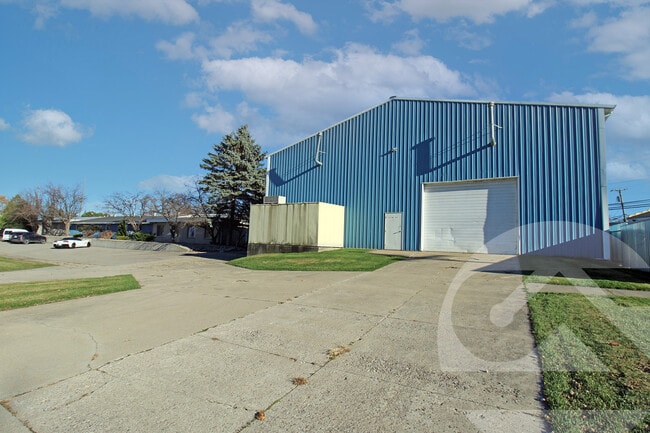
1562 Telegraph Dr
Detroit-Warren-Dearborn, MI
C Haines Wilsons Pontiac-Telegraph Road
14-07-479-004
T3N, R10E, SEC 7 C HAINES WILSON'S PONTIAC-TELEGRAPH ROAD SUB LOTS 322 TO 325 INCL, ALSO 1/2 OF VAC ALLEY ADJ TO SAME
Officebuilding
Oakland
X
Michigan
26125C0362F
322-325
2024
0.20 AC
2025
Auburn Hills, Pontiac & Rochester
141200
Detroit
4,081 SF
DEMOGRAPHICS near 1562 Telegraph Dr
1 Mile
3 Mile
5 Mile
2024 Total Population
10,223
61,169
149,500
2029 Population
10,135
60,983
148,828
Pop Growth 2024-2029
(0.86%)
(0.30%)
(0.45%)
Average Age
37
39
40
2024 Total Households
4,216
24,706
62,331
HH Growth 2024-2029
(0.90%)
(0.37%)
(0.54%)
Median Household Inc
$37,377
$52,436
$56,425
Avg Household Size
2.30
2.30
2.30
2024 Avg HH Vehicles
1.00
2.00
2.00
Median Home Value
$95,985
$151,779
$187,530
Median Year Built
1965
1966
1969
Nearby Places
Map Layers
Map Styles
 Street
 Aerial
- Restaurants
- Banks
- Shops
- Fitness
- Groceries
PUBLIC TRANSPORTATION
AIRPORT
Detroit City
DRIVE
WALK
Distance
Detroit City
43 min
32.3 mi
Bishop International
DRIVE
WALK
Distance
Bishop International
42 min
35.6 mi
Detroit Metro Wayne County
DRIVE
WALK
Distance
Detroit Metro Wayne County
57 min
43.3 mi
SALE & LEASE HISTORY
LISTING DATE
SALE/LEASE

Sep 25, 2016
For Lease
Nov 15, 2024
For Sale
Nov 15, 2024
For Lease
Nov 13, 2024
For Sale
Nov 13, 2024
For Lease
Dec 21, 2023
For Lease
Nearby Properties
Address
Land Use
TOTAL SIZE
Lot Size
Zoning
Address
Land Use
TOTAL SIZE
Lot Size
Zoning
1,421,000 SF
170.30 AC
B2
Address
Land Use
TOTAL SIZE
Lot Size
Zoning
527,000 SF
36.03 AC
Address
Land Use
TOTAL SIZE
Lot Size
Zoning
420,858 SF
65.07 AC
Address
Land Use
TOTAL SIZE
Lot Size
Zoning
430,338 SF
46.09 AC
Address
Land Use
TOTAL SIZE
Lot Size
Zoning
1,771,589 SF
96.73 AC
Address
Land Use
TOTAL SIZE
Lot Size
Zoning
247,500 SF
Address
Land Use
TOTAL SIZE
Lot Size
Zoning
430,338 SF
43.22 AC
Address
Land Use
TOTAL SIZE
Lot Size
Zoning
426,034 SF
24.99 AC
AI
Address
Land Use
TOTAL SIZE
Lot Size
Zoning
280,000 SF
Address
Land Use
TOTAL SIZE
Lot Size
Zoning
213,112 SF
12.17 AC
I1
Address
Land Use
TOTAL SIZE
Lot Size
Zoning
327,435 SF
39.93 AC
R2
Address
Land Use
TOTAL SIZE
Lot Size
Zoning
455,045 SF
23.47 AC
I1
Address
Land Use
TOTAL SIZE
Lot Size
Zoning
232,860 SF
28.30 AC
I1
Address
Land Use
TOTAL SIZE
Lot Size
Zoning
148,825 SF
Address
Land Use
TOTAL SIZE
Lot Size
Zoning
171,242 SF
11.86 AC
Address
Land Use
TOTAL SIZE
Lot Size
Zoning
137,086 SF
9.29 AC
I1
Address
Land Use
TOTAL SIZE
Lot Size
Zoning
102,379 SF
28.20 AC
Address
Land Use
TOTAL SIZE
Lot Size
Zoning
218,870 SF
23.21 AC
Address
Land Use
TOTAL SIZE
Lot Size
Zoning
124,104 SF
Address
Land Use
TOTAL SIZE
Lot Size
Zoning
79,263 SF
22.27 AC
Address
Land Use
TOTAL SIZE
Lot Size
Zoning
174,265 SF
13.50 AC
TR
Address
Land Use
TOTAL SIZE
Lot Size
Zoning
65,432 SF
16.57 AC
Address
Land Use
TOTAL SIZE
Lot Size
Zoning
137,086 SF
Address
Land Use
TOTAL SIZE
Lot Size
Zoning
124,104 SF
7.98 AC
I1
Address
Land Use
TOTAL SIZE
Lot Size
Zoning
125,108 SF
27.93 AC
I1
Address
Land Use
TOTAL SIZE
Lot Size
Zoning
110,521 SF
3.23 AC
B2
Address
Land Use
TOTAL SIZE
Lot Size
Zoning
177,394 SF
10.08 AC
I1
Address
Land Use
TOTAL SIZE
Lot Size
Zoning
71,140 SF
Address
Land Use
TOTAL SIZE
Lot Size
Zoning
1,870,974 SF
61.73 AC
Address
Land Use
TOTAL SIZE
Lot Size
Zoning
144,889 SF
8.09 AC
The World's #1 Commercial Real Estate Marketplace
Connect with us
© 2026 CoStar Group
The information above has been obtained from sources believed reliable. While we do not doubt its accuracy we have not verified it and make no guarantee, warranty or representation about it. It is your responsibility to independently confirm its accuracy and completeness. Any projections, opinions, assumptions, or estimates used are for example only and do not represent the current or future performance of the property. The value of this transaction to you depends on tax and other factors which should be evaluated by your tax, financial, and legal advisors. You and your advisors should conduct a careful, independent investigation of the property to determine to your satisfaction the suitability of the property for your needs.