Property Record
1556 W State Highway 71 W, Cedar Creek, TX 78612
NEARBY LISTINGS FOR SALE OR LEASE
-
-
View all Cedar Creek listings for sale on LoopNet.com
Property Detail
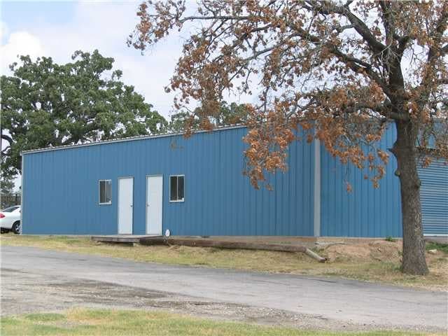
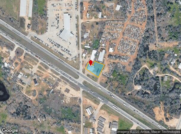
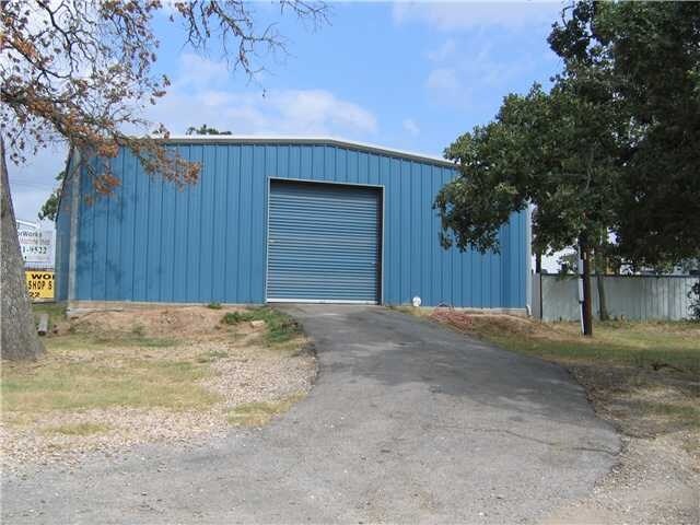
1556 W State Highway 71 W
60534
Bangs, J. Manuel
Commercialnec
ABS A5 BANGS, J. MANUEL,0.4770 ACRES
X
Bastrop
48021C0335F
Texas
2024
0.48 AC
2025
Bastrop County
950300
Austin
4,600 SF
Austin-Round Rock, TX
DEMOGRAPHICS near 1556 W State Highway 71 W
1 Mile
3 Mile
5 Mile
2024 Total Population
1,617
7,089
16,038
2029 Population
2,018
8,803
20,004
Pop Growth 2024-2029
+ 24.80%
+ 24.18%
+ 24.73%
Average Age
41
40
40
2024 Total Households
595
2,572
5,864
HH Growth 2024-2029
+ 25.88%
+ 25.39%
+ 25.82%
Median Household Inc
$105,523
$107,949
$102,812
Avg Household Size
2.70
2.70
2.70
2024 Avg HH Vehicles
2.00
2.00
2.00
Median Home Value
$363,157
$291,066
$281,588
Median Year Built
1992
1999
2002
Nearby Places
Map Layers
Map Styles
 Street
 Aerial
- Restaurants
- Banks
- Shops
- Fitness
- Groceries
PUBLIC TRANSPORTATION
AIRPORT
Austin-Bergstrom International
DRIVE
WALK
Distance
Austin-Bergstrom International
29 min
18.9 mi
Freight Ports
Calhoun Port
DRIVE
WALK
Distance
Calhoun Port
173 min
146.7 mi
Nearby Properties
Address
Land Use
TOTAL SIZE
Lot Size
Zoning
Address
Land Use
TOTAL SIZE
Lot Size
Zoning
546,512 SF
389.26 AC
Address
Land Use
TOTAL SIZE
Lot Size
Zoning
64.93 AC
Address
Land Use
TOTAL SIZE
Lot Size
Zoning
11,085 SF
992.03 AC
Address
Land Use
TOTAL SIZE
Lot Size
Zoning
35,983 SF
20 AC
Address
Land Use
TOTAL SIZE
Lot Size
Zoning
20 AC
Address
Land Use
TOTAL SIZE
Lot Size
Zoning
72,496 SF
42.01 AC
Address
Land Use
TOTAL SIZE
Lot Size
Zoning
33,105 SF
21.89 AC
Address
Land Use
TOTAL SIZE
Lot Size
Zoning
37.88 AC
Address
Land Use
TOTAL SIZE
Lot Size
Zoning
37,058 SF
4.14 AC
Address
Land Use
TOTAL SIZE
Lot Size
Zoning
43,956 SF
6.29 AC
Address
Land Use
TOTAL SIZE
Lot Size
Zoning
33,183 SF
33.48 AC
Address
Land Use
TOTAL SIZE
Lot Size
Zoning
10,464 SF
108.47 AC
Address
Land Use
TOTAL SIZE
Lot Size
Zoning
1,999 SF
15.66 AC
Address
Land Use
TOTAL SIZE
Lot Size
Zoning
156,609 SF
9.62 AC
Address
Land Use
TOTAL SIZE
Lot Size
Zoning
55,344 SF
4 AC
Address
Land Use
TOTAL SIZE
Lot Size
Zoning
25,220 SF
17.65 AC
Address
Land Use
TOTAL SIZE
Lot Size
Zoning
14,257 SF
19.67 AC
Address
Land Use
TOTAL SIZE
Lot Size
Zoning
19,040 SF
104.34 AC
Address
Land Use
TOTAL SIZE
Lot Size
Zoning
54 SF
8.98 AC
Address
Land Use
TOTAL SIZE
Lot Size
Zoning
1,884 SF
11.61 AC
Address
Land Use
TOTAL SIZE
Lot Size
Zoning
11,642 SF
7.51 AC
Address
Land Use
TOTAL SIZE
Lot Size
Zoning
42,115 SF
8.17 AC
Address
Land Use
TOTAL SIZE
Lot Size
Zoning
3,630 SF
5.05 AC
Address
Land Use
TOTAL SIZE
Lot Size
Zoning
11,540 SF
4.74 AC
Address
Land Use
TOTAL SIZE
Lot Size
Zoning
30,759 SF
8.43 AC
Address
Land Use
TOTAL SIZE
Lot Size
Zoning
31,528 SF
7.67 AC
Address
Land Use
TOTAL SIZE
Lot Size
Zoning
11,568 SF
1.48 AC
Address
Land Use
TOTAL SIZE
Lot Size
Zoning
25,367 SF
10.22 AC
Address
Land Use
TOTAL SIZE
Lot Size
Zoning
15,729 SF
18.65 AC
The World's #1 Commercial Real Estate Marketplace
Connect with us
© 2025 CoStar Group
The information above has been obtained from sources believed reliable. While we do not doubt its accuracy we have not verified it and make no guarantee, warranty or representation about it. It is your responsibility to independently confirm its accuracy and completeness. Any projections, opinions, assumptions, or estimates used are for example only and do not represent the current or future performance of the property. The value of this transaction to you depends on tax and other factors which should be evaluated by your tax, financial, and legal advisors. You and your advisors should conduct a careful, independent investigation of the property to determine to your satisfaction the suitability of the property for your needs.