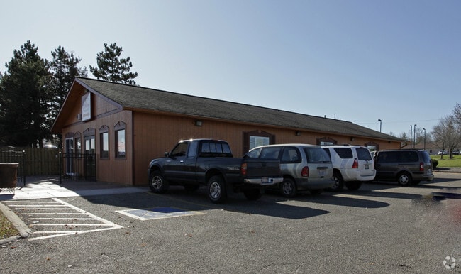
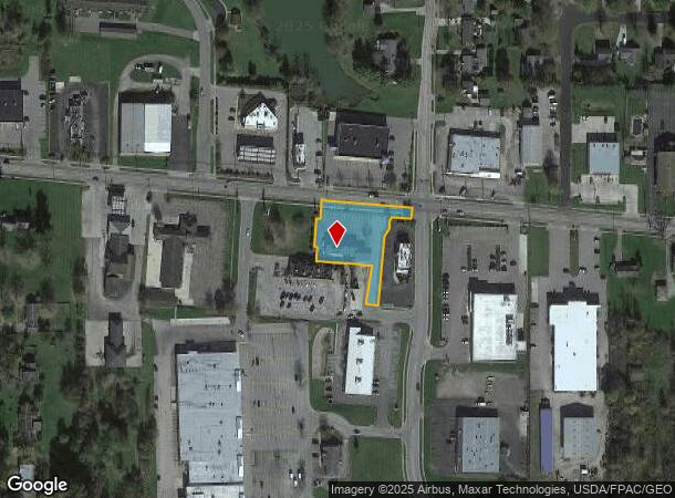
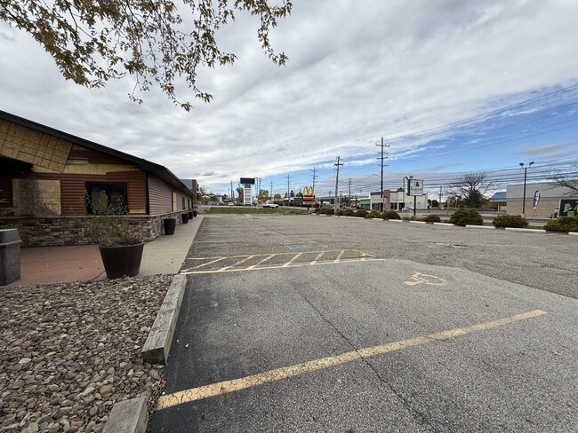
Property Record
15585 W High St, Middlefield, OH 44062
NEARBY LISTINGS FOR SALE OR LEASE
-
-
View all Middlefield listings for lease on LoopNet.com
Property Detail
15585 W High St
19-072853
PARCEL C1 MCDONALDS REAL ESTATE COMPANY LOT SPLIT
Restaurantbuilding
Geauga
X
Ohio
39155C0100D
0.79 AC
2024
Geauga County
2024
Cleveland
312300
Cleveland-Elyria, OH
2,880 SF
DEMOGRAPHICS near 15585 W High St
1 Mile
3 Mile
5 Mile
2024 Total Population
2,789
7,407
14,342
2029 Population
2,779
7,348
14,105
Pop Growth 2024-2029
(0.36%)
(0.80%)
(1.65%)
Average Age
40
38
37
2024 Total Households
1,093
2,631
4,726
HH Growth 2024-2029
(0.46%)
(0.84%)
(1.63%)
Median Household Inc
$57,640
$59,161
$65,723
Avg Household Size
2.50
2.70
2.90
2024 Avg HH Vehicles
1.00
1.00
2.00
Median Home Value
$185,676
$188,785
$202,527
Median Year Built
1976
1975
1972
Nearby Places
- Restaurants
- Banks
- Shops
- Fitness
- Groceries
SALE & LEASE HISTORY
LISTING DATE
SALE/LEASE

Nov 06, 2025
For Lease
Nearby Properties
Address
Land Use
TOTAL SIZE
Lot Size
Zoning
Address
Land Use
TOTAL SIZE
Lot Size
Zoning
69,844 SF
7.88 AC
Address
Land Use
TOTAL SIZE
Lot Size
Zoning
74,620 SF
28 AC
R1
Address
Land Use
TOTAL SIZE
Lot Size
Zoning
196,414 SF
10.93 AC
I
Address
Land Use
TOTAL SIZE
Lot Size
Zoning
1,274 SF
4.48 AC
GC
Address
Land Use
TOTAL SIZE
Lot Size
Zoning
317,183 SF
19.75 AC
I
Address
Land Use
TOTAL SIZE
Lot Size
Zoning
156,678 SF
17.23 AC
GC
Address
Land Use
TOTAL SIZE
Lot Size
Zoning
111,000 SF
12.38 AC
Address
Land Use
TOTAL SIZE
Lot Size
Zoning
35,600 SF
11.06 AC
IPUD
Address
Land Use
TOTAL SIZE
Lot Size
Zoning
4,664 SF
13.24 AC
Address
Land Use
TOTAL SIZE
Lot Size
Zoning
36,908 SF
15 AC
Address
Land Use
TOTAL SIZE
Lot Size
Zoning
1,978 SF
19.31 AC
Address
Land Use
TOTAL SIZE
Lot Size
Zoning
116,416 SF
6.11 AC
IPUD
Address
Land Use
TOTAL SIZE
Lot Size
Zoning
57,300 SF
18.18 AC
IC
Address
Land Use
TOTAL SIZE
Lot Size
Zoning
99,421 SF
6.01 AC
IPUD
Address
Land Use
TOTAL SIZE
Lot Size
Zoning
172,802 SF
10.09 AC
I
Address
Land Use
TOTAL SIZE
Lot Size
Zoning
105,640 SF
6.57 AC
IPUD
Address
Land Use
TOTAL SIZE
Lot Size
Zoning
9,636 SF
14 AC
IC
Address
Land Use
TOTAL SIZE
Lot Size
Zoning
107,541 SF
7.24 AC
Address
Land Use
TOTAL SIZE
Lot Size
Zoning
8,286 SF
13.12 AC
I
Address
Land Use
TOTAL SIZE
Lot Size
Zoning
3,696 SF
12.51 AC
R3
Address
Land Use
TOTAL SIZE
Lot Size
Zoning
84,808 SF
24 AC
R2
Address
Land Use
TOTAL SIZE
Lot Size
Zoning
38,445 SF
3.26 AC
R1
Address
Land Use
TOTAL SIZE
Lot Size
Zoning
21,093 SF
9.56 AC
R3
Address
Land Use
TOTAL SIZE
Lot Size
Zoning
2,872 SF
41.16 AC
Address
Land Use
TOTAL SIZE
Lot Size
Zoning
20,400 SF
23.03 AC
Address
Land Use
TOTAL SIZE
Lot Size
Zoning
92,640 SF
8.17 AC
I
Address
Land Use
TOTAL SIZE
Lot Size
Zoning
109,620 SF
7.45 AC
Address
Land Use
TOTAL SIZE
Lot Size
Zoning
107,244 SF
7 AC
I
Address
Land Use
TOTAL SIZE
Lot Size
Zoning
67,752 SF
9.44 AC
GC
Address
Land Use
TOTAL SIZE
Lot Size
Zoning
23,927 SF
1.14 AC
GC
The World's #1 Commercial Real Estate Marketplace
Connect with us
© 2025 CoStar Group
The information above has been obtained from sources believed reliable. While we do not doubt its accuracy we have not verified it and make no guarantee, warranty or representation about it. It is your responsibility to independently confirm its accuracy and completeness. Any projections, opinions, assumptions, or estimates used are for example only and do not represent the current or future performance of the property. The value of this transaction to you depends on tax and other factors which should be evaluated by your tax, financial, and legal advisors. You and your advisors should conduct a careful, independent investigation of the property to determine to your satisfaction the suitability of the property for your needs.