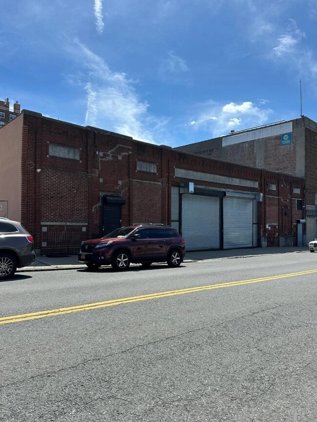
Property Record
158 Ludlow St, Yonkers, NY 10705


Current Lease Availabilities
NEARBY LISTINGS FOR SALE OR LEASE
Property Detail
158 Ludlow St
1800-001-000-00165-000-0004
Westchester
Distributionwarehouseregional
New York
X
4.000
34003C0220H
0.21 AC
2025
Southwest
2024
Westchester/So Connecticut
000202
New York-Jersey City-White Plains, NY-NJ
9,300 SF
DEMOGRAPHICS near 158 Ludlow St
1 Mile
3 Mile
5 Mile
2024 Total Population
60,032
239,086
970,821
2029 Population
59,110
230,956
919,872
Pop Growth 2024-2029
(1.54%)
(3.40%)
(5.25%)
Average Age
37
40
40
2024 Total Households
20,954
90,580
355,200
HH Growth 2024-2029
(1.66%)
(3.81%)
(5.63%)
Median Household Inc
$45,823
$71,808
$60,757
Avg Household Size
2.70
2.50
2.60
2024 Avg HH Vehicles
1.00
1.00
1.00
Median Home Value
$429,469
$478,877
$511,005
Median Year Built
1958
1956
1950
Nearby Places
Map Layers
Map Styles
 Street
 Aerial
- Restaurants
- Banks
- Shops
- Fitness
- Groceries
PUBLIC TRANSPORTATION
COMMUTER RAIL
Ludlow Station (Hudson Line - Metro-North Commuter Railroad Company (Metro-North))
DRIVE
WALK
Distance
Ludlow Station (Hudson Line - Metro-North Commuter Railroad Company (Metro-North))
1 min
4 min
0.2 mi
Yonkers Station (Hudson Line - Metro-North Commuter Railroad Company (Metro-North))
DRIVE
WALK
Distance
Yonkers Station (Hudson Line - Metro-North Commuter Railroad Company (Metro-North))
5 min
20 min
1.0 mi
AIRPORT
LaGuardia
DRIVE
WALK
Distance
LaGuardia
27 min
16.3 mi
Westchester County
DRIVE
WALK
Distance
Westchester County
32 min
20.9 mi
Newark Liberty International
DRIVE
WALK
Distance
Newark Liberty International
37 min
27.1 mi
Nearby Properties
Address
Land Use
TOTAL SIZE
Lot Size
Zoning
Address
Land Use
TOTAL SIZE
Lot Size
Zoning
111.37 AC
P1
Address
Land Use
TOTAL SIZE
Lot Size
Zoning
185.35 AC
P
Address
Land Use
TOTAL SIZE
Lot Size
Zoning
219.71 AC
O
Address
Land Use
TOTAL SIZE
Lot Size
Zoning
100,151 SF
22.13 AC
B2
Address
Land Use
TOTAL SIZE
Lot Size
Zoning
135.51 AC
RR
Address
Land Use
TOTAL SIZE
Lot Size
Zoning
94.42 AC
P
Address
Land Use
TOTAL SIZE
Lot Size
Zoning
87,000 SF
455.70 AC
PARK
Address
Land Use
TOTAL SIZE
Lot Size
Zoning
225.36 AC
O
Address
Land Use
TOTAL SIZE
Lot Size
Zoning
450,784 SF
42.36 AC
R4
Address
Land Use
TOTAL SIZE
Lot Size
Zoning
18,445 SF
510.83 AC
PARK
Address
Land Use
TOTAL SIZE
Lot Size
Zoning
614,887 SF
14.77 AC
R4
Address
Land Use
TOTAL SIZE
Lot Size
Zoning
Address
Land Use
TOTAL SIZE
Lot Size
Zoning
61,055 SF
343.42 AC
R6
Address
Land Use
TOTAL SIZE
Lot Size
Zoning
285,373 SF
2.66 AC
R4
Address
Land Use
TOTAL SIZE
Lot Size
Zoning
478 SF
10.45 AC
Address
Land Use
TOTAL SIZE
Lot Size
Zoning
203,837 SF
1.92 AC
R6
Address
Land Use
TOTAL SIZE
Lot Size
Zoning
202,062 SF
29 AC
O
Address
Land Use
TOTAL SIZE
Lot Size
Zoning
58.78 AC
P
Address
Land Use
TOTAL SIZE
Lot Size
Zoning
193,520 SF
4.32 AC
R4
Address
Land Use
TOTAL SIZE
Lot Size
Zoning
Address
Land Use
TOTAL SIZE
Lot Size
Zoning
174,896 SF
8.69 AC
R4
Address
Land Use
TOTAL SIZE
Lot Size
Zoning
15,828 SF
17.71 AC
Address
Land Use
TOTAL SIZE
Lot Size
Zoning
5.98 AC
RA
Address
Land Use
TOTAL SIZE
Lot Size
Zoning
360,483 SF
7.44 AC
R4
Address
Land Use
TOTAL SIZE
Lot Size
Zoning
193,856 SF
1.25 AC
R7-1
Address
Land Use
TOTAL SIZE
Lot Size
Zoning
159,260 SF
12.19 AC
R4
Address
Land Use
TOTAL SIZE
Lot Size
Zoning
192,939 SF
12.57 AC
R4
Address
Land Use
TOTAL SIZE
Lot Size
Zoning
144,307 SF
1.65 AC
R4
Address
Land Use
TOTAL SIZE
Lot Size
Zoning
118,423 SF
3.35 AC
M1-2
Address
Land Use
TOTAL SIZE
Lot Size
Zoning
9,854 SF
110.48 AC
R6
The World's #1 Commercial Real Estate Marketplace
Connect with us
© 2026 CoStar Group
The information above has been obtained from sources believed reliable. While we do not doubt its accuracy we have not verified it and make no guarantee, warranty or representation about it. It is your responsibility to independently confirm its accuracy and completeness. Any projections, opinions, assumptions, or estimates used are for example only and do not represent the current or future performance of the property. The value of this transaction to you depends on tax and other factors which should be evaluated by your tax, financial, and legal advisors. You and your advisors should conduct a careful, independent investigation of the property to determine to your satisfaction the suitability of the property for your needs.